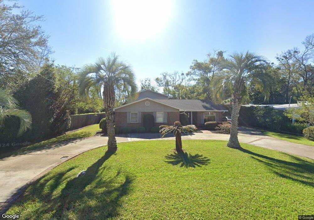
528 Timmons St Saint Simons Island, GA 31522
Estimated Value: $1,100,000 - $1,511,000
3
Beds
3
Baths
2,646
Sq Ft
$482/Sq Ft
Est. Value
About This Home
This home is located at 528 Timmons St, Saint Simons Island, GA 31522 and is currently estimated at $1,274,082, approximately $481 per square foot. 528 Timmons St is a home located in Glynn County with nearby schools including St. Simons Elementary School, Glynn Middle School, and Glynn Academy.
Ownership History
Date
Name
Owned For
Owner Type
Purchase Details
Closed on
Jan 28, 2014
Sold by
Deutsche Bank Trust Co Ame
Bought by
Saunders Kathryn
Current Estimated Value
Purchase Details
Closed on
Jul 2, 2013
Sold by
Bowman Rebecca
Bought by
Deutsche Bank Trust Co America
Create a Home Valuation Report for This Property
The Home Valuation Report is an in-depth analysis detailing your home's value as well as a comparison with similar homes in the area
Home Values in the Area
Average Home Value in this Area
Purchase History
| Date | Buyer | Sale Price | Title Company |
|---|---|---|---|
| Saunders Kathryn | $245,874 | -- | |
| Deutsche Bank Trust Co America | -- | -- |
Source: Public Records
Tax History Compared to Growth
Tax History
| Year | Tax Paid | Tax Assessment Tax Assessment Total Assessment is a certain percentage of the fair market value that is determined by local assessors to be the total taxable value of land and additions on the property. | Land | Improvement |
|---|---|---|---|---|
| 2025 | $7,418 | $295,800 | $159,360 | $136,440 |
| 2024 | $7,420 | $295,880 | $159,360 | $136,520 |
| 2023 | $1,511 | $295,880 | $159,360 | $136,520 |
| 2022 | $1,659 | $244,000 | $133,880 | $110,120 |
| 2021 | $1,703 | $195,000 | $133,880 | $61,120 |
| 2020 | $1,744 | $195,000 | $133,880 | $61,120 |
| 2019 | $1,744 | $180,640 | $119,520 | $61,120 |
| 2018 | $4,842 | $180,640 | $119,520 | $61,120 |
| 2017 | $4,842 | $180,640 | $119,520 | $61,120 |
| 2016 | $2,893 | $115,320 | $54,200 | $61,120 |
| 2015 | $2,849 | $96,920 | $54,200 | $42,720 |
| 2014 | $2,849 | $113,040 | $55,480 | $57,560 |
Source: Public Records
Map
Nearby Homes
- 533 Timmons St
- 536 Delegal St
- 805 Mallery St Unit E
- 800 Mallery St Unit 52
- 800 Mallery St Unit 90
- 800 Mallery St Unit C-30
- 800 Mallery St Unit J-89
- 213 Magnolia Ave
- 30 Admirals Cove
- 425 Magnolia Ave Unit C
- 413 Ashantilly Ave
- 125 Tiffany Ln
- 1044 Village Oaks Ln
- 850 Mallery St Unit 8K
- 850 Mallery St Unit 6A
- 850 Mallery St Unit 4W
- 850 Mallery St Unit S 3
- 850 Mallery St Unit 4O
- 850 Mallery St Unit 13Q
- 850 Mallery St Unit 9W