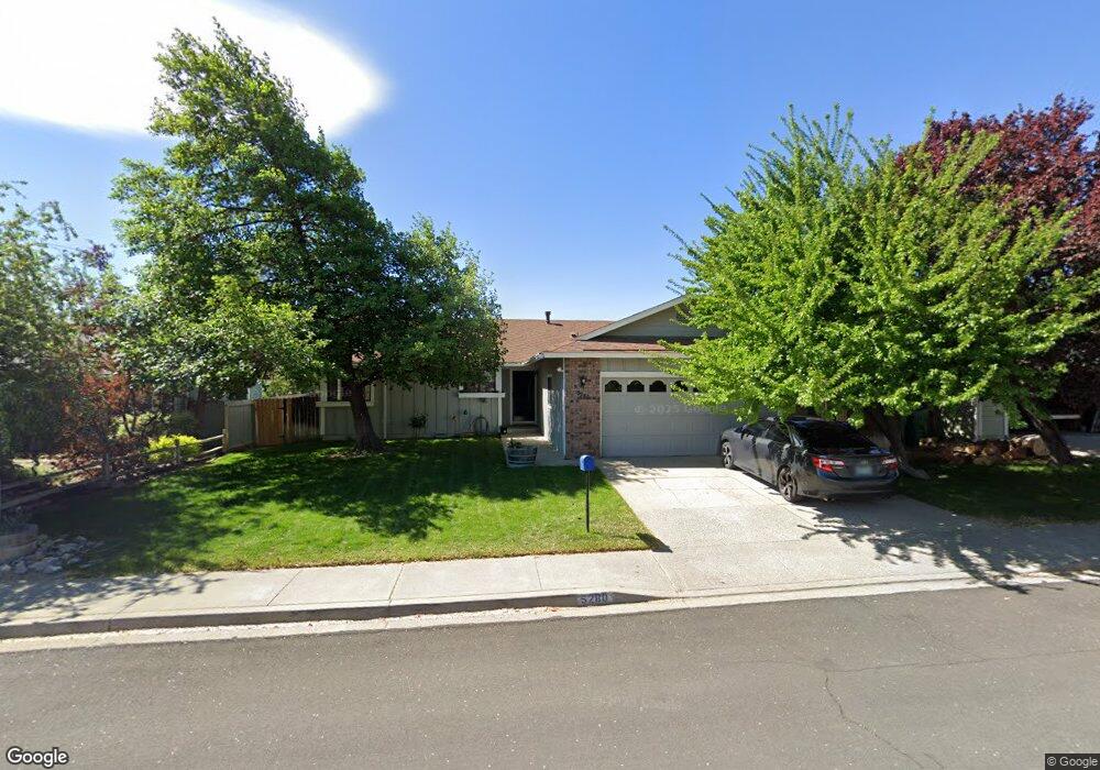
5280 Coit Dr Unit 3 Reno, NV 89523
Mae Anne Avenue NeighborhoodEstimated Value: $520,900 - $559,000
3
Beds
2
Baths
1,439
Sq Ft
$379/Sq Ft
Est. Value
About This Home
This home is located at 5280 Coit Dr Unit 3, Reno, NV 89523 and is currently estimated at $545,475, approximately $379 per square foot. 5280 Coit Dr Unit 3 is a home located in Washoe County with nearby schools including Sarah Winnemucca Elementary School, B D Billinghurst Middle School, and Robert McQueen High School.
Ownership History
Date
Name
Owned For
Owner Type
Purchase Details
Closed on
Jun 22, 2011
Sold by
Williams Cathy D
Bought by
Cypress Investments Nevada Llc
Current Estimated Value
Purchase Details
Closed on
Aug 8, 2002
Sold by
Barker Jeffrey F and Barker Debra A
Bought by
Williams Cathy D
Home Financials for this Owner
Home Financials are based on the most recent Mortgage that was taken out on this home.
Original Mortgage
$195,100
Interest Rate
6.52%
Create a Home Valuation Report for This Property
The Home Valuation Report is an in-depth analysis detailing your home's value as well as a comparison with similar homes in the area
Home Values in the Area
Average Home Value in this Area
Purchase History
| Date | Buyer | Sale Price | Title Company |
|---|---|---|---|
| Cypress Investments Nevada Llc | $123,100 | None Available | |
| Williams Cathy D | $190,000 | Stewart Title Northern Nevad |
Source: Public Records
Mortgage History
| Date | Status | Borrower | Loan Amount |
|---|---|---|---|
| Previous Owner | Williams Cathy D | $195,100 |
Source: Public Records
Tax History
| Year | Tax Paid | Tax Assessment Tax Assessment Total Assessment is a certain percentage of the fair market value that is determined by local assessors to be the total taxable value of land and additions on the property. | Land | Improvement |
|---|---|---|---|---|
| 2026 | -- | $84,287 | $44,123 | $40,165 |
| 2025 | $2,164 | $83,355 | $42,028 | $41,327 |
| 2024 | $2,102 | $81,273 | $39,235 | $42,038 |
| 2023 | $2,102 | $81,853 | $41,662 | $40,191 |
| 2022 | $2,139 | $68,106 | $34,314 | $33,793 |
| 2021 | $1,981 | $57,367 | $23,441 | $33,926 |
| 2020 | $1,922 | $58,778 | $24,505 | $34,273 |
| 2019 | $1,830 | $55,580 | $22,411 | $33,169 |
| 2018 | $1,747 | $49,090 | $16,359 | $32,731 |
| 2017 | $1,677 | $48,269 | $15,262 | $33,007 |
| 2016 | $1,633 | $48,847 | $14,896 | $33,951 |
| 2015 | $1,630 | $47,123 | $13,001 | $34,122 |
| 2014 | $1,580 | $43,983 | $10,507 | $33,476 |
| 2013 | -- | $41,765 | $8,612 | $33,153 |
Source: Public Records
Map
Nearby Homes
- 5294 Tappan Ct
- 2150 Altamira Dr
- 5420 Brittania Dr
- 5490 Twin Creeks Dr
- 2769 Newburgh Way
- 4034 Royal Sage Dr
- 4985 W 7th St Unit 13
- 5421 Daybreak Dr
- 5722 Golden Eagle Dr
- 3848 Bexley Square
- 5850 Blue Canyon Dr
- 3630 Bryan St
- 5764 Golden Eagle Dr
- 3815 Kings Row
- 3015 Fairlands Dr
- 5941 Sapphire Ridge Ct
- 1215 Conway Ln
- 1820 Terrace Heights Ln
- 5712 Royal Vista Way
- 3325 Kings Row
- 5270 Coit Dr
- 5290 Coit Dr
- 5291 Challis Cir
- 5260 Coit Dr
- 5281 Coit Dr
- 5311 Challis Cir
- 5281 Challis Cir
- 5331 Challis Cir
- 5271 Coit Dr
- 5291 Coit Dr
- 5261 Coit Dr
- 5250 Coit Dr
- 5301 Coit Dr
- 5271 Challis Cir
- 5251 Coit Dr
- 5311 Coit Dr
- 5221 Challis Cir
- 5211 Challis Cir
- 5201 Challis Cir Unit 3
- 5264 Tappan Ct
Your Personal Tour Guide
Ask me questions while you tour the home.