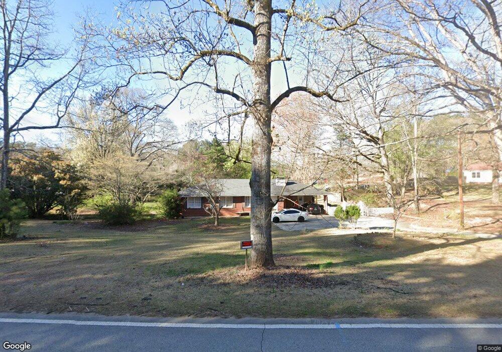
5281 Koweta Rd Atlanta, GA 30349
Estimated Value: $183,000 - $269,000
3
Beds
2
Baths
1,492
Sq Ft
$158/Sq Ft
Est. Value
About This Home
This home is located at 5281 Koweta Rd, Atlanta, GA 30349 and is currently estimated at $236,245, approximately $158 per square foot. 5281 Koweta Rd is a home located in Fulton County with nearby schools including Liberty Point Elementary School, Renaissance Middle School, and Langston Hughes High School.
Ownership History
Date
Name
Owned For
Owner Type
Purchase Details
Closed on
Jun 6, 2007
Sold by
Delgado Arturo A
Bought by
Desantos Jaime and Alba Rosa
Current Estimated Value
Home Financials for this Owner
Home Financials are based on the most recent Mortgage that was taken out on this home.
Original Mortgage
$90,000
Interest Rate
6.57%
Mortgage Type
New Conventional
Purchase Details
Closed on
Apr 7, 1999
Sold by
Guthrie Robert H and Guthrie Betty A
Bought by
Delgado Arturo A
Home Financials for this Owner
Home Financials are based on the most recent Mortgage that was taken out on this home.
Original Mortgage
$79,050
Interest Rate
6.85%
Mortgage Type
New Conventional
Create a Home Valuation Report for This Property
The Home Valuation Report is an in-depth analysis detailing your home's value as well as a comparison with similar homes in the area
Home Values in the Area
Average Home Value in this Area
Purchase History
| Date | Buyer | Sale Price | Title Company |
|---|---|---|---|
| Desantos Jaime | -- | -- | |
| Delgado Arturo A | $81,500 | -- |
Source: Public Records
Mortgage History
| Date | Status | Borrower | Loan Amount |
|---|---|---|---|
| Previous Owner | Desantos Jaime | $90,000 | |
| Previous Owner | Delgado Arturo A | $79,050 |
Source: Public Records
Tax History Compared to Growth
Tax History
| Year | Tax Paid | Tax Assessment Tax Assessment Total Assessment is a certain percentage of the fair market value that is determined by local assessors to be the total taxable value of land and additions on the property. | Land | Improvement |
|---|---|---|---|---|
| 2025 | $592 | $69,800 | $15,160 | $54,640 |
| 2023 | $2,048 | $72,560 | $13,880 | $58,680 |
| 2022 | $537 | $44,120 | $6,320 | $37,800 |
| 2021 | $525 | $42,840 | $6,120 | $36,720 |
| 2020 | $522 | $39,320 | $3,440 | $35,880 |
| 2019 | $608 | $38,680 | $3,400 | $35,280 |
| 2018 | $779 | $37,760 | $3,320 | $34,440 |
| 2017 | $453 | $26,080 | $7,440 | $18,640 |
| 2016 | $452 | $26,080 | $7,440 | $18,640 |
| 2015 | $453 | $26,080 | $7,440 | $18,640 |
| 2014 | $367 | $21,440 | $7,840 | $13,600 |
Source: Public Records
Map
Nearby Homes
- 4820 Station Dr Unit 6
- 4824 Station Dr Unit 8
- 4815 Station Dr Unit 33
- 4835 Station Dr Unit 27
- 4816 Station Dr Unit 4
- 4812 Station Dr Unit 2
- 4811 Station Dr Unit 35
- 8273 Eastshore Dr
- 8273 Eastshore Dr Unit 2
- 4838 Station Lane-Lot 15
- 3320 Stonewall Ln
- 3318 Stonewall Ln
- Nelson Plan at The Enclave at Stonewall Station
- Cecil Plan at The Enclave at Stonewall Station
- 5250 Forest Downs Ln
- 4811 Station Ln
- 4813 Station Ln
- 5435 Forest Downs Cir
- 4814 Station Ln
- 4817 Station Ln Unit 32
- 5261 Koweta Rd
- 5291 Koweta Rd
- 5290 Koweta Rd
- 5245 Koweta Rd
- 5300 Koweta Rd
- 5295 Koweta Rd
- 8924 Crestview Cir
- 5225 Koweta Rd
- 5225 Koweta Rd Unit 5225
- 5345 Koweta Rd
- 8926 Crestview Cir
- 8922 Crestview Cir
- 8928 Crestview Cir
- 8299 Eastshore Dr Unit 2
- 8297 Eastshore Dr
- 8930 Crestview Cir
- 8932 Crestview Cir
- 8298 Eastshore Dr
- 5356 Koweta Rd
- 5356 Koweta Rd Unit 99