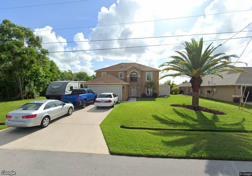
5281 NW Mayfield Ln Port Saint Lucie, FL 34983
Saint Lucie North NeighborhoodEstimated Value: $448,991 - $505,000
3
Beds
3
Baths
1,176
Sq Ft
$415/Sq Ft
Est. Value
About This Home
This home is located at 5281 NW Mayfield Ln, Port Saint Lucie, FL 34983 and is currently estimated at $487,748, approximately $414 per square foot. 5281 NW Mayfield Ln is a home located in St. Lucie County with nearby schools including Parkway Elementary School, Northport K-8 School, and Floresta Elementary School.
Ownership History
Date
Name
Owned For
Owner Type
Purchase Details
Closed on
Mar 5, 2004
Sold by
Harvey Kevin L and Harvey Dorothy A
Bought by
Smaldone Christopher and Smaldone Suzanne
Current Estimated Value
Home Financials for this Owner
Home Financials are based on the most recent Mortgage that was taken out on this home.
Original Mortgage
$109,000
Outstanding Balance
$50,977
Interest Rate
5.68%
Estimated Equity
$436,771
Purchase Details
Closed on
Dec 12, 2001
Sold by
Maronda Homes Inc Fl
Bought by
Harvey Kevin I and Harvey Dorothy A
Home Financials for this Owner
Home Financials are based on the most recent Mortgage that was taken out on this home.
Original Mortgage
$91,850
Interest Rate
6.42%
Purchase Details
Closed on
Apr 3, 2001
Sold by
Victores Sergio D and Victores Sergio I
Bought by
Maronda Homes Inc
Create a Home Valuation Report for This Property
The Home Valuation Report is an in-depth analysis detailing your home's value as well as a comparison with similar homes in the area
Home Values in the Area
Average Home Value in this Area
Purchase History
| Date | Buyer | Sale Price | Title Company |
|---|---|---|---|
| Smaldone Christopher | $234,000 | -- | |
| Harvey Kevin I | $114,900 | -- | |
| Maronda Homes Inc | $6,000 | -- |
Source: Public Records
Mortgage History
| Date | Status | Borrower | Loan Amount |
|---|---|---|---|
| Open | Smaldone Christopher | $109,000 | |
| Previous Owner | Harvey Kevin I | $91,850 |
Source: Public Records
Tax History Compared to Growth
Tax History
| Year | Tax Paid | Tax Assessment Tax Assessment Total Assessment is a certain percentage of the fair market value that is determined by local assessors to be the total taxable value of land and additions on the property. | Land | Improvement |
|---|---|---|---|---|
| 2024 | $2,863 | $146,252 | -- | -- |
| 2023 | $2,863 | $141,993 | $0 | $0 |
| 2022 | $2,730 | $137,858 | $0 | $0 |
| 2021 | $2,638 | $133,843 | $0 | $0 |
| 2020 | $2,647 | $131,996 | $0 | $0 |
| 2019 | $2,615 | $129,029 | $0 | $0 |
| 2018 | $2,480 | $126,624 | $0 | $0 |
| 2017 | $2,448 | $163,400 | $28,100 | $135,300 |
| 2016 | $2,410 | $170,400 | $26,100 | $144,300 |
| 2015 | $2,431 | $142,000 | $18,100 | $123,900 |
| 2014 | $2,311 | $119,669 | $0 | $0 |
Source: Public Records
Map
Nearby Homes
- 5270 NW Mayfield Ln
- 6579 NW Omega Rd
- 5364 NW Rugby Dr
- 6640 NW Omega Rd
- 6690 NW Pinson Ct
- 6625 NW Rodin Ct
- 5323 NW Perez Ct
- 5501 W Midway Rd
- 5199 NW Rugby Dr
- 5109 NW Rugby Dr
- 2550 W Midway Rd
- 6575 NW Pomona Ct
- 6482 NW Regal Cir
- 5423 NW Milner Dr
- 6413 NW Regal Cir
- 424 NW Sheffield Cir
- 5178 NW Primm St
- 430 NW Dover Ct
- 436 NW Dover Ct
- 422 NW Dover Ct
- 5271 NW Mayfield Ln
- 5291 NW Mayfield Ln
- 6560 NW Omega Rd
- 5261 NW Mayfield Ln
- 5301 NW Mayfield Ln
- 5240 NW Mayfield Ln
- 6540 NW Omega Rd
- 5250 NW Mayfield Ln
- 6580 NW Omega Rd
- 5205 NW Bengal St
- 5251 NW Mayfield Ln
- 6570 NW Omega Rd
- 6550 NW Omega Rd
- 5260 NW Mayfield Ln
- 6530 NW Omega Rd
- 6460 NW Omega Rd
- 5200 NW Bengal St
- 6590 NW Omega Rd
- 6735 NW Rasp Ct
- 5241 NW Mayfield Ln