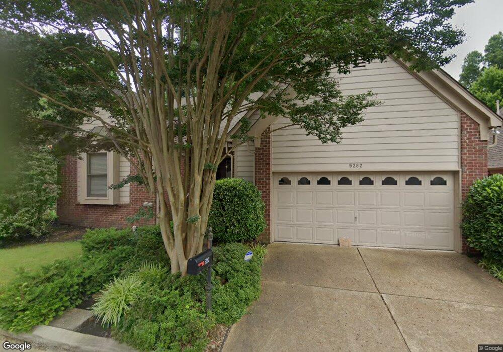
5282 Bears Paw Cir Memphis, TN 38120
East Memphis NeighborhoodEstimated Value: $372,697 - $419,000
4
Beds
3
Baths
3,640
Sq Ft
$111/Sq Ft
Est. Value
About This Home
This home is located at 5282 Bears Paw Cir, Memphis, TN 38120 and is currently estimated at $403,924, approximately $110 per square foot. 5282 Bears Paw Cir is a home located in Shelby County with nearby schools including Richland Elementary School, White Station Middle, and White Station High.
Ownership History
Date
Name
Owned For
Owner Type
Purchase Details
Closed on
Jan 15, 2004
Sold by
Grimes George M and Grimes Lillian
Bought by
Greene Toni L
Current Estimated Value
Home Financials for this Owner
Home Financials are based on the most recent Mortgage that was taken out on this home.
Original Mortgage
$235,500
Interest Rate
5.81%
Mortgage Type
Purchase Money Mortgage
Purchase Details
Closed on
Feb 29, 1996
Bought by
Hately James W and Hately June C
Create a Home Valuation Report for This Property
The Home Valuation Report is an in-depth analysis detailing your home's value as well as a comparison with similar homes in the area
Home Values in the Area
Average Home Value in this Area
Purchase History
| Date | Buyer | Sale Price | Title Company |
|---|---|---|---|
| Greene Toni L | $235,500 | -- | |
| Hately James W | $170,000 | -- |
Source: Public Records
Mortgage History
| Date | Status | Borrower | Loan Amount |
|---|---|---|---|
| Closed | Greene Toni L | $235,500 |
Source: Public Records
Tax History
| Year | Tax Paid | Tax Assessment Tax Assessment Total Assessment is a certain percentage of the fair market value that is determined by local assessors to be the total taxable value of land and additions on the property. | Land | Improvement |
|---|---|---|---|---|
| 2025 | $2,733 | $98,775 | $13,375 | $85,400 |
| 2024 | -- | $80,625 | $13,375 | $67,250 |
| 2023 | $4,911 | $80,625 | $13,375 | $67,250 |
| 2022 | $4,911 | $80,625 | $13,375 | $67,250 |
| 2021 | $4,969 | $80,625 | $13,375 | $67,250 |
| 2020 | $4,447 | $61,375 | $13,375 | $48,000 |
| 2019 | $4,447 | $61,375 | $13,375 | $48,000 |
| 2018 | $4,447 | $61,375 | $13,375 | $48,000 |
| 2017 | $2,523 | $61,375 | $13,375 | $48,000 |
| 2016 | $2,617 | $59,875 | $0 | $0 |
| 2014 | $2,617 | $59,875 | $0 | $0 |
Source: Public Records
Map
Nearby Homes
- 416 Rosser Rd
- 5364 Wheaton Park Ct
- 5250 Sequoia Rd
- 536 Wheaton Park Cove N
- 443 N White Station Rd
- 451 Mineral Rd
- 5167 Tarrytown Dr
- 5249 Boswell Ave
- 5255 Boswell Ave
- 5382 Bentley Place
- 5159 Tarrytown Dr
- 5219 Sequoia Rd
- 5170 Verosa Ave
- 5151 Tarrytown Dr
- 5194 Warfield Dr
- 506 Mcdermitt Rd
- 5124 Princeton Rd
- 5126 Verosa Ave
- 5368 Boswell Ave
- 5126 Sequoia Rd
- 5288 Bears Paw Cir
- 5278 Bears Paw Cir
- 5275 Bears Paw Cir
- 5287 Bears Paw Cir
- 488 Chalmers Rd
- 5298 Abbie Woods Cove
- 5295 Bears Paw Cir
- 504 Chalmers Rd
- 480 Chalmers Rd
- 5296 Bears Paw Cir
- 5307 Bears Paw Cir
- 5273 Bears Paw Cir
- 5269 Bears Paw Cir
- 512 Chalmers Rd
- 5310 Abbie Woods Cove
- 5289 Abbie Woods Cove
- 5293 Abbie Woods Cove
- 5263 Bears Paw Cir
- 5300 Bears Paw Cir
- 5301 Abbie Woods Cove
Your Personal Tour Guide
Ask me questions while you tour the home.