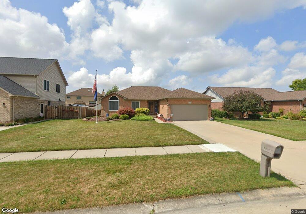
52829 Muirfield Dr Chesterfield, MI 48051
Estimated Value: $318,290 - $381,000
3
Beds
2
Baths
1,418
Sq Ft
$251/Sq Ft
Est. Value
About This Home
This home is located at 52829 Muirfield Dr, Chesterfield, MI 48051 and is currently estimated at $355,823, approximately $250 per square foot. 52829 Muirfield Dr is a home located in Macomb County with nearby schools including Joseph M. Carkenord Elementary School, L'Anse Creuse High School - North, and Merritt Academy.
Ownership History
Date
Name
Owned For
Owner Type
Purchase Details
Closed on
Oct 8, 2004
Sold by
Landa Joseph M and Landa Jennifer M
Bought by
Licavoli William and Licavoli Anne Marie
Current Estimated Value
Purchase Details
Closed on
Apr 12, 2002
Sold by
National Development Co
Bought by
Landa Joseph M
Home Financials for this Owner
Home Financials are based on the most recent Mortgage that was taken out on this home.
Original Mortgage
$167,950
Interest Rate
7.13%
Create a Home Valuation Report for This Property
The Home Valuation Report is an in-depth analysis detailing your home's value as well as a comparison with similar homes in the area
Home Values in the Area
Average Home Value in this Area
Purchase History
| Date | Buyer | Sale Price | Title Company |
|---|---|---|---|
| Licavoli William | $217,000 | Greco | |
| Landa Joseph M | $176,800 | -- |
Source: Public Records
Mortgage History
| Date | Status | Borrower | Loan Amount |
|---|---|---|---|
| Previous Owner | Landa Joseph M | $167,950 |
Source: Public Records
Tax History Compared to Growth
Tax History
| Year | Tax Paid | Tax Assessment Tax Assessment Total Assessment is a certain percentage of the fair market value that is determined by local assessors to be the total taxable value of land and additions on the property. | Land | Improvement |
|---|---|---|---|---|
| 2025 | $2,778 | $141,100 | $0 | $0 |
| 2024 | $1,900 | $137,900 | $0 | $0 |
| 2023 | $1,802 | $126,100 | $0 | $0 |
| 2022 | $2,513 | $111,300 | $0 | $0 |
| 2021 | $2,482 | $106,900 | $0 | $0 |
| 2020 | $1,654 | $101,100 | $0 | $0 |
| 2019 | $2,556 | $93,000 | $0 | $0 |
| 2018 | $2,546 | $90,200 | $13,000 | $77,200 |
| 2017 | $2,417 | $83,600 | $13,000 | $70,600 |
| 2016 | $2,399 | $83,600 | $0 | $0 |
| 2015 | $984 | $78,500 | $0 | $0 |
| 2014 | $984 | $66,000 | $9,150 | $56,850 |
| 2012 | -- | $0 | $0 | $0 |
Source: Public Records
Map
Nearby Homes
- 52823 Muirfield Dr
- 29008 Pinehurst Dr
- 29402 Georgetown Dr
- 51817 Lionel Ln Unit 12
- 29310 Jamestown Dr
- 51857 Adler Park Dr E Unit 44
- 0 Gratiot Ave
- 53064 Barberry Cir
- 51768 Adler Park Dr W Unit 23
- N W Corner 24 Mile & Gratiot Ave
- 51848 Adler Park Dr E Unit 75
- 29636 Cambridge Ct
- 51719 Adler Park Dr W Unit 77
- 53153 Gratiot Ave
- 28338 Adler Park Dr S
- 28372 Adler Park Dr S
- 51592 Stern Ln
- 52104 Worthington Ln
- 51630 Hale Ln Unit 86
- 29321 Debbie Dr Unit 43
- 52835 Muirfield Dr
- 52826 Turnberry Dr
- 52817 Muirfield Dr
- 52841 Muirfield Dr
- 52832 Turnberry Dr
- 52820 Turnberry Dr
- 52814 Turnberry Dr
- 52838 Turnberry Dr
- 52830 Muirfield Dr
- 52824 Muirfield Dr
- 52836 Muirfield Dr
- 52847 Muirfield Dr
- 52811 Muirfield Dr
- 52842 Muirfield Dr
- 52818 Muirfield Dr
- 52844 Turnberry Dr
- 52808 Turnberry Dr
- 52853 Muirfield Dr
- 52805 Muirfield Dr
- 52848 Muirfield Dr