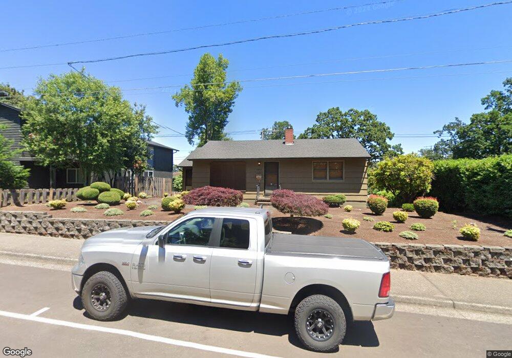
5285 W A St West Linn, OR 97068
Bolton NeighborhoodEstimated Value: $560,041 - $651,000
4
Beds
1
Bath
2,447
Sq Ft
$249/Sq Ft
Est. Value
About This Home
This home is located at 5285 W A St, West Linn, OR 97068 and is currently estimated at $609,010, approximately $248 per square foot. 5285 W A St is a home located in Clackamas County with nearby schools including Bolton Primary School, West Linn High School, and Clackamas Academy of Industrial Sciences (CAIS).
Ownership History
Date
Name
Owned For
Owner Type
Purchase Details
Closed on
May 11, 2007
Sold by
Baker Julie
Bought by
Romine Guy
Current Estimated Value
Home Financials for this Owner
Home Financials are based on the most recent Mortgage that was taken out on this home.
Original Mortgage
$31,800
Outstanding Balance
$19,217
Interest Rate
6.14%
Mortgage Type
Credit Line Revolving
Estimated Equity
$589,793
Purchase Details
Closed on
Jun 10, 2004
Sold by
Steinberg Margaret E
Bought by
Baker Julie
Home Financials for this Owner
Home Financials are based on the most recent Mortgage that was taken out on this home.
Original Mortgage
$223,250
Interest Rate
5.37%
Mortgage Type
Purchase Money Mortgage
Create a Home Valuation Report for This Property
The Home Valuation Report is an in-depth analysis detailing your home's value as well as a comparison with similar homes in the area
Home Values in the Area
Average Home Value in this Area
Purchase History
| Date | Buyer | Sale Price | Title Company |
|---|---|---|---|
| Romine Guy | $318,500 | Fidelity Natl Title Co Of Or | |
| Baker Julie | $235,000 | Lawyers Title Ins |
Source: Public Records
Mortgage History
| Date | Status | Borrower | Loan Amount |
|---|---|---|---|
| Open | Romine Guy | $31,800 | |
| Open | Romine Guy | $254,800 | |
| Previous Owner | Baker Julie | $223,250 |
Source: Public Records
Tax History Compared to Growth
Tax History
| Year | Tax Paid | Tax Assessment Tax Assessment Total Assessment is a certain percentage of the fair market value that is determined by local assessors to be the total taxable value of land and additions on the property. | Land | Improvement |
|---|---|---|---|---|
| 2025 | $4,339 | $225,124 | -- | -- |
| 2024 | $4,176 | $218,567 | -- | -- |
| 2023 | $4,176 | $212,201 | $0 | $0 |
| 2022 | $3,942 | $206,021 | $0 | $0 |
| 2021 | $3,742 | $200,021 | $0 | $0 |
| 2020 | $3,767 | $194,196 | $0 | $0 |
| 2019 | $3,592 | $188,540 | $0 | $0 |
| 2018 | $3,432 | $183,049 | $0 | $0 |
| 2017 | $3,299 | $177,717 | $0 | $0 |
| 2016 | $3,214 | $172,541 | $0 | $0 |
| 2015 | $3,122 | $167,516 | $0 | $0 |
| 2014 | $3,006 | $162,637 | $0 | $0 |
Source: Public Records
Map
Nearby Homes
- 5089 Territorial Dr
- 5390 Grove St
- 4711 Alder St
- 4645 Pine St
- 1870 Hemlock St
- 909 Center St
- 5687 River St
- 22881 Oregon City Loop
- 5910 W A St
- 824 Center St
- 22691 Oregon City Loop
- 401 4th St
- 411 4th St
- 312 High St
- 709 10th St
- 4405 Grant St
- 812 Jefferson St
- 2530 Cambridge St
- 4578 Norfolk St
- 5062 Prospect St
- 5321 W A St
- 5275 West A St
- 5288 Broadway St
- 5280 Broadway St
- 5263 W A St
- 5270 Broadway St
- 5330 Broadway St
- 5260 Broadway St
- 5250 Broadway St
- 5253 W A St
- 1987 King St
- 1985 Buse St Unit C
- 1931 Buse St
- 5283 Broadway St
- 1921 Buse St
- 5345 Broadway St
- 5271 Broadway St
- 5261 Broadway St
- 5375 Broadway St Unit C
- 5395 Broadway St