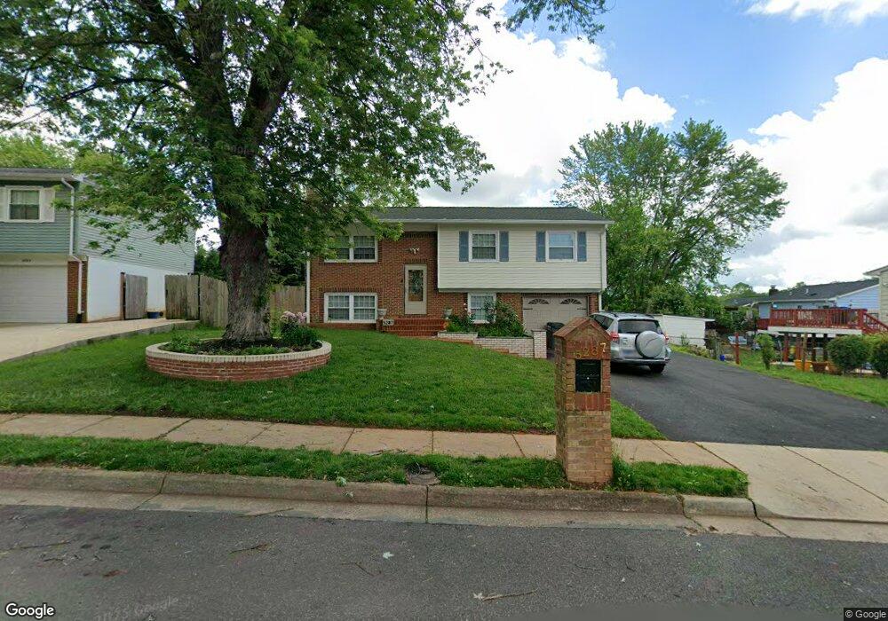
5287 Mantle Ct Woodbridge, VA 22193
Mapledale NeighborhoodEstimated Value: $493,000 - $504,000
4
Beds
2
Baths
1,084
Sq Ft
$459/Sq Ft
Est. Value
About This Home
This home is located at 5287 Mantle Ct, Woodbridge, VA 22193 and is currently estimated at $497,337, approximately $458 per square foot. 5287 Mantle Ct is a home located in Prince William County with nearby schools including Rosa Parks Elementary School, C.D. Hylton High School, and Stuart M. Beville Middle School.
Ownership History
Date
Name
Owned For
Owner Type
Purchase Details
Closed on
Jun 29, 1998
Sold by
Tew+ John D and Tew+ Martha G
Bought by
Scroggins Michael J and Scroggins Angela
Current Estimated Value
Home Financials for this Owner
Home Financials are based on the most recent Mortgage that was taken out on this home.
Original Mortgage
$122,802
Outstanding Balance
$25,327
Interest Rate
7.09%
Mortgage Type
FHA
Estimated Equity
$472,010
Create a Home Valuation Report for This Property
The Home Valuation Report is an in-depth analysis detailing your home's value as well as a comparison with similar homes in the area
Home Values in the Area
Average Home Value in this Area
Purchase History
| Date | Buyer | Sale Price | Title Company |
|---|---|---|---|
| Scroggins Michael J | $123,000 | -- |
Source: Public Records
Mortgage History
| Date | Status | Borrower | Loan Amount |
|---|---|---|---|
| Open | Scroggins Michael J | $122,802 |
Source: Public Records
Tax History Compared to Growth
Tax History
| Year | Tax Paid | Tax Assessment Tax Assessment Total Assessment is a certain percentage of the fair market value that is determined by local assessors to be the total taxable value of land and additions on the property. | Land | Improvement |
|---|---|---|---|---|
| 2025 | $4,124 | $451,000 | $145,500 | $305,500 |
| 2024 | $4,124 | $414,700 | $135,500 | $279,200 |
| 2023 | $4,177 | $401,400 | $132,700 | $268,700 |
| 2022 | $4,246 | $383,400 | $122,800 | $260,600 |
| 2021 | $4,311 | $350,900 | $110,700 | $240,200 |
| 2020 | $4,700 | $303,200 | $104,400 | $198,800 |
| 2019 | $4,644 | $299,600 | $100,400 | $199,200 |
| 2018 | $3,444 | $285,200 | $97,500 | $187,700 |
| 2017 | $3,322 | $266,200 | $92,000 | $174,200 |
| 2016 | $3,190 | $257,800 | $89,400 | $168,400 |
| 2015 | $2,929 | $245,600 | $86,400 | $159,200 |
| 2014 | $2,929 | $231,000 | $84,000 | $147,000 |
Source: Public Records
Map
Nearby Homes
- 13732 Moccasin Ct
- 5308 Macwood Dr
- 14010 Mapledale Ave
- 13737 Moccasin Ct
- 5655 Roundtree Dr
- 13871 Langstone Dr
- 5678 Roundtree Dr
- 13918 Lynhurst Dr
- 5611 Roundtree Dr
- 5710 Rhode Island Dr
- 14160 Landon Ln
- 14072 Oxbridge Inn Ct
- 5207 Quiet Place
- 14288 Lindendale Rd
- 13441 Kerr Ct
- 13501 Photo Dr
- 14371 Salsbury Ct
- 13454 Princedale Dr
- 4690 Pearson Dr
- 14368 Springbrook Ct
- 5285 Mantle Ct
- 5289 Mantle Ct
- 13813 Mapledale Ave
- 5292 Mansfield Ct
- 5283 Mantle Ct
- 13815 Mapledale Ave
- 5294 Mansfield Ct
- 5290 Mansfield Ct
- 13807 Mapledale Ave
- 5284 Mantle Ct
- 5288 Mansfield Ct
- 5296 Mansfield Ct
- 5281 Mantle Ct
- 5282 Mantle Ct
- 13805 Mapledale Ave
- 5286 Mansfield Ct
- 5279 Mantle Ct
- 13806 Mapledale Ave
- 13808 Mapledale Ave
- 5280 Mantle Ct