Estimated Value: $254,335 - $314,000
3
Beds
2
Baths
1,713
Sq Ft
$169/Sq Ft
Est. Value
About This Home
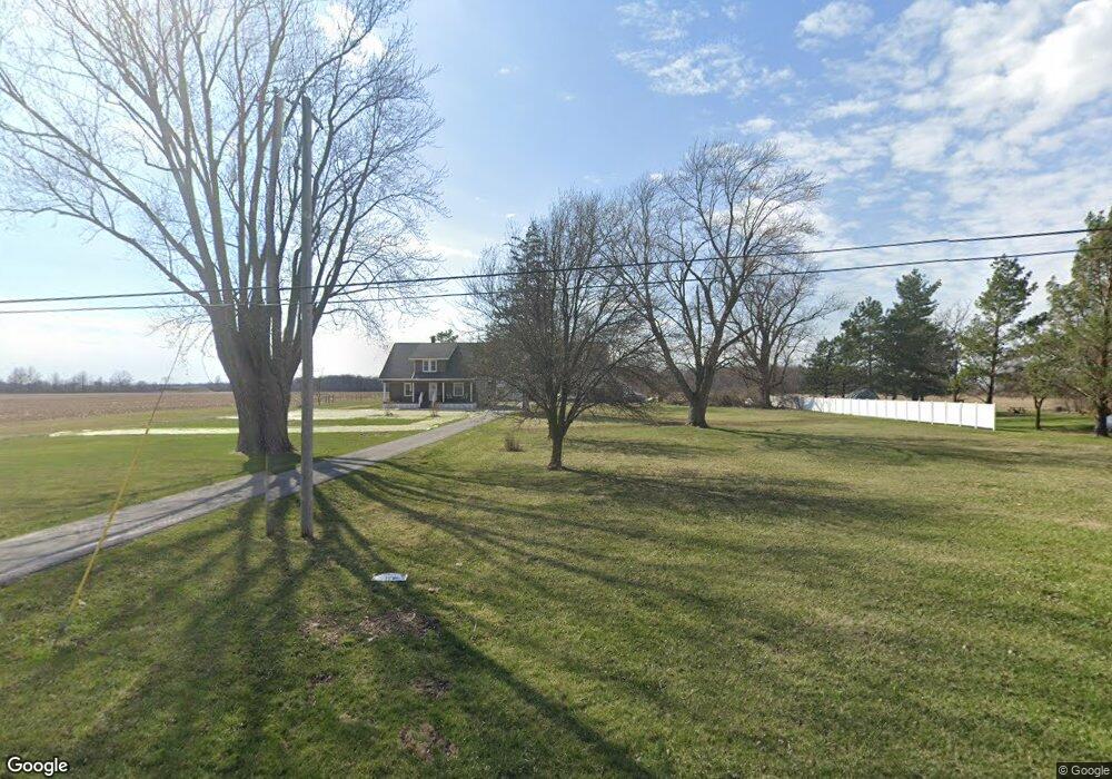
This home is located at 5287 Slabtown Rd, Lima, OH 45807 and is currently estimated at $288,834, approximately $168 per square foot. 5287 Slabtown Rd is a home located in Allen County with nearby schools including Bath Elementary School, Bath Middle School, and Bath High School.
Ownership History
Date
Name
Owned For
Owner Type
Purchase Details
Closed on
May 5, 2011
Sold by
Mcdorman Scott D and Mcdorman Michelle L
Bought by
Parker Matthew and Parker Lori
Current Estimated Value
Home Financials for this Owner
Home Financials are based on the most recent Mortgage that was taken out on this home.
Original Mortgage
$134,400
Outstanding Balance
$91,979
Interest Rate
4.86%
Mortgage Type
Purchase Money Mortgage
Estimated Equity
$196,855
Purchase Details
Closed on
May 16, 2005
Sold by
Mauk Jeffrey T and Mauk Amy V
Bought by
Mcdorman Scott D and Mcdorman Michelle L
Home Financials for this Owner
Home Financials are based on the most recent Mortgage that was taken out on this home.
Original Mortgage
$142,000
Interest Rate
6.13%
Mortgage Type
New Conventional
Purchase Details
Closed on
Sep 20, 1990
Bought by
Rudolph James Edson
Create a Home Valuation Report for This Property
The Home Valuation Report is an in-depth analysis detailing your home's value as well as a comparison with similar homes in the area
Purchase History
| Date | Buyer | Sale Price | Title Company |
|---|---|---|---|
| Parker Matthew | $141,500 | Attorney | |
| Mcdorman Scott D | $177,500 | None Available | |
| Rudolph James Edson | $60,000 | -- |
Source: Public Records
Mortgage History
| Date | Status | Borrower | Loan Amount |
|---|---|---|---|
| Open | Parker Matthew | $134,400 | |
| Closed | Mcdorman Scott D | $142,000 |
Source: Public Records
Tax History
| Year | Tax Paid | Tax Assessment Tax Assessment Total Assessment is a certain percentage of the fair market value that is determined by local assessors to be the total taxable value of land and additions on the property. | Land | Improvement |
|---|---|---|---|---|
| 2024 | $2,919 | $66,750 | $11,520 | $55,230 |
| 2023 | $2,544 | $56,570 | $9,770 | $46,800 |
| 2022 | $2,569 | $56,570 | $9,770 | $46,800 |
| 2021 | $2,584 | $56,570 | $9,770 | $46,800 |
| 2020 | $2,450 | $48,650 | $10,360 | $38,290 |
| 2019 | $2,450 | $48,650 | $10,360 | $38,290 |
| 2018 | $2,273 | $48,650 | $10,360 | $38,290 |
| 2017 | $2,159 | $43,650 | $10,360 | $33,290 |
| 2016 | $2,125 | $43,650 | $10,360 | $33,290 |
| 2015 | $2,057 | $43,650 | $10,360 | $33,290 |
| 2014 | $2,057 | $40,530 | $10,360 | $30,170 |
| 2013 | $2,058 | $40,530 | $10,360 | $30,170 |
Source: Public Records
Map
Nearby Homes
- 1085 Lutz Rd
- 201 Wall St
- 102 W Main St
- 3263 Shiloh Dr
- 513 W Main St
- 0 N Dixie Hwy Unit 300253
- 634 W Main St
- 2878 Autumn Lake Dr
- 5025 N Cool Rd
- 4387 N West St
- 2230 N Dixie Hwy
- 2145 N Dixie Hwy Unit 80
- 2145 N Dixie Hwy Unit 11
- 2145 N Dixie Hwy Unit 101
- 2145 N Dixie Hwy Unit 30
- 6431 Couples Ln
- 6477 Woods Dr Unit 220
- 6476 Mickelson Ln
- 5817 N Dixie Hwy
- 1656 Stewart Rd
Your Personal Tour Guide
Ask me questions while you tour the home.