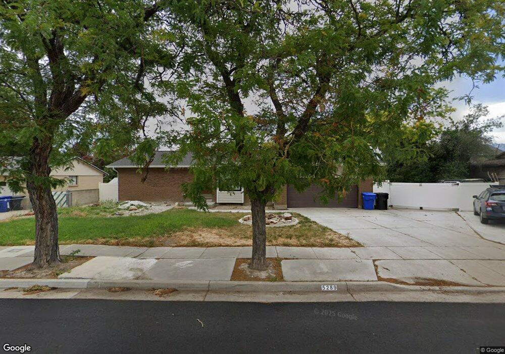
5289 S Samuel Dr Salt Lake City, UT 84118
Estimated Value: $458,000 - $491,000
4
Beds
3
Baths
1,996
Sq Ft
$239/Sq Ft
Est. Value
About This Home
This home is located at 5289 S Samuel Dr, Salt Lake City, UT 84118 and is currently estimated at $476,499, approximately $238 per square foot. 5289 S Samuel Dr is a home located in Salt Lake County with nearby schools including Vista Elementary School, Eisenhower Jr High School, and Taylorsville High School.
Ownership History
Date
Name
Owned For
Owner Type
Purchase Details
Closed on
Sep 11, 2023
Sold by
Woodall Dylan Cole
Bought by
Woodall Dylan C
Current Estimated Value
Home Financials for this Owner
Home Financials are based on the most recent Mortgage that was taken out on this home.
Original Mortgage
$106,000
Outstanding Balance
$103,688
Interest Rate
6.81%
Mortgage Type
New Conventional
Estimated Equity
$372,811
Purchase Details
Closed on
Jul 14, 2023
Sold by
Woodall Anne Marie Conlon
Bought by
Woodall Dylan Cole
Home Financials for this Owner
Home Financials are based on the most recent Mortgage that was taken out on this home.
Original Mortgage
$106,000
Outstanding Balance
$103,688
Interest Rate
6.81%
Mortgage Type
New Conventional
Estimated Equity
$372,811
Purchase Details
Closed on
May 17, 2004
Sold by
Woodall Anne M
Bought by
Woodall Anne M
Home Financials for this Owner
Home Financials are based on the most recent Mortgage that was taken out on this home.
Original Mortgage
$29,000
Interest Rate
5.12%
Mortgage Type
New Conventional
Purchase Details
Closed on
Jun 21, 2002
Sold by
England Kaye
Bought by
Woodall Anne M
Home Financials for this Owner
Home Financials are based on the most recent Mortgage that was taken out on this home.
Original Mortgage
$134,250
Interest Rate
6.74%
Purchase Details
Closed on
Mar 16, 1999
Sold by
Burns Joel G and Burns Pamela R
Bought by
Woodall Roger M and Woodall Anne M
Purchase Details
Closed on
Jul 29, 1996
Sold by
Barney Melvin Lee and Barney Vickie Sue
Bought by
Burns Joel G and Burns Pamela R
Home Financials for this Owner
Home Financials are based on the most recent Mortgage that was taken out on this home.
Original Mortgage
$96,000
Interest Rate
8.32%
Purchase Details
Closed on
Aug 11, 1994
Sold by
Barney Melvin Lee
Bought by
Barney Melvin Lee and Barney Vickie Sue
Home Financials for this Owner
Home Financials are based on the most recent Mortgage that was taken out on this home.
Original Mortgage
$86,200
Interest Rate
8.65%
Create a Home Valuation Report for This Property
The Home Valuation Report is an in-depth analysis detailing your home's value as well as a comparison with similar homes in the area
Home Values in the Area
Average Home Value in this Area
Purchase History
| Date | Buyer | Sale Price | Title Company |
|---|---|---|---|
| Woodall Dylan C | -- | Advanced Title | |
| Woodall Dylan Cole | -- | -- | |
| Woodall Anne M | -- | Meridian Title | |
| Woodall Anne M | -- | Meridian Title | |
| Woodall Roger M | -- | Associated Title | |
| Burns Joel G | -- | -- | |
| Barney Melvin Lee | -- | -- |
Source: Public Records
Mortgage History
| Date | Status | Borrower | Loan Amount |
|---|---|---|---|
| Open | Woodall Dylan C | $106,000 | |
| Previous Owner | Woodall Anne M | $29,000 | |
| Previous Owner | Woodall Anne M | $134,250 | |
| Previous Owner | Burns Joel G | $96,000 | |
| Previous Owner | Barney Melvin Lee | $86,200 |
Source: Public Records
Tax History Compared to Growth
Tax History
| Year | Tax Paid | Tax Assessment Tax Assessment Total Assessment is a certain percentage of the fair market value that is determined by local assessors to be the total taxable value of land and additions on the property. | Land | Improvement |
|---|---|---|---|---|
| 2025 | $2,456 | $426,700 | $143,500 | $283,200 |
| 2024 | $2,456 | $402,800 | $122,900 | $279,900 |
| 2023 | $2,377 | $375,000 | $118,100 | $256,900 |
| 2022 | $2,377 | $376,700 | $115,800 | $260,900 |
| 2021 | $2,163 | $305,700 | $89,100 | $216,600 |
| 2020 | $2,069 | $276,700 | $89,100 | $187,600 |
| 2019 | $2,034 | $265,600 | $79,400 | $186,200 |
| 2018 | $2,057 | $259,000 | $79,400 | $179,600 |
| 2017 | $1,804 | $238,700 | $79,400 | $159,300 |
| 2016 | $1,549 | $204,800 | $79,400 | $125,400 |
| 2015 | $1,486 | $183,700 | $76,300 | $107,400 |
| 2014 | $1,459 | $177,100 | $73,900 | $103,200 |
Source: Public Records
Map
Nearby Homes
- 2320 W 5400 S
- 2104 W Champagne Cir
- 2266 W Arches Dr
- 2063 W Chateau Ave
- 2503 5520 S
- 1891 S Jordan Canal Rd
- 2016 W Hew Wood Ct
- 5557 S 2200 W
- 2604 W West Central Park Way
- 2127 Cedar Breaks Dr
- 2658 W Scarsdale Ct Unit 49
- 5574 Easton St
- 1886 W Champagne Ave
- 2794 W Harker Ridge Cove
- 2001 W 5540 S
- 5552 Hew Wood Dr
- 5668 Lolene Way
- 5600 S Ralph Dr
- 5725 S 2665 W
- 2306 Bonniebrook Cir
- 5289 Samuel Dr
- 5309 Samuel Dr
- 5275 Samuel Dr
- 5284 Samuel Cir
- 2336 W 5320 S
- 5274 Samuel Cir
- 5292 Samuel Dr
- 2322 W 5320 S
- 5308 Samuel Dr
- 5280 Samuel Dr
- 5318 Samuel Dr
- 5331 Samuel Dr Unit S
- 5268 S Samuel Dr
- 5268 Samuel Dr
- 2306 W 5320 S
- 5283 Samuel Cir
- 5330 Royal Autumn Cir
- 5330 S Royal Autumn Cir
- 2342 Samuel Dr
- 2354 Samuel Dr