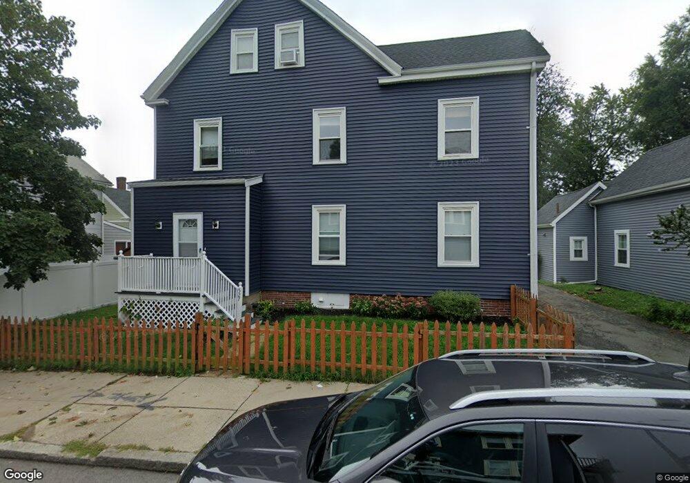
529 Ashmont St Unit 2 Dorchester, MA 02122
Neponset-Port Norfolk NeighborhoodEstimated Value: $401,000 - $468,000
2
Beds
1
Bath
684
Sq Ft
$632/Sq Ft
Est. Value
About This Home
This home is located at 529 Ashmont St Unit 2, Dorchester, MA 02122 and is currently estimated at $432,071, approximately $631 per square foot. 529 Ashmont St Unit 2 is a home located in Suffolk County with nearby schools including Neighborhood House Charter School and Epiphany School.
Ownership History
Date
Name
Owned For
Owner Type
Purchase Details
Closed on
Jul 6, 2007
Sold by
Otoole Rose M and Otoole John K
Bought by
Doherty Andrew S and Brady Sarah H
Current Estimated Value
Home Financials for this Owner
Home Financials are based on the most recent Mortgage that was taken out on this home.
Original Mortgage
$168,000
Outstanding Balance
$104,401
Interest Rate
6.39%
Mortgage Type
Purchase Money Mortgage
Estimated Equity
$327,670
Create a Home Valuation Report for This Property
The Home Valuation Report is an in-depth analysis detailing your home's value as well as a comparison with similar homes in the area
Home Values in the Area
Average Home Value in this Area
Purchase History
| Date | Buyer | Sale Price | Title Company |
|---|---|---|---|
| Doherty Andrew S | $210,000 | -- | |
| Doherty Andrew S | $210,000 | -- |
Source: Public Records
Mortgage History
| Date | Status | Borrower | Loan Amount |
|---|---|---|---|
| Open | Doherty Andrew S | $168,000 | |
| Closed | Doherty Andrew S | $168,000 |
Source: Public Records
Tax History Compared to Growth
Tax History
| Year | Tax Paid | Tax Assessment Tax Assessment Total Assessment is a certain percentage of the fair market value that is determined by local assessors to be the total taxable value of land and additions on the property. | Land | Improvement |
|---|---|---|---|---|
| 2025 | $5,132 | $443,200 | $0 | $443,200 |
| 2024 | $4,356 | $399,600 | $0 | $399,600 |
| 2023 | $4,166 | $387,900 | $0 | $387,900 |
| 2022 | $3,981 | $365,900 | $0 | $365,900 |
| 2021 | $3,790 | $355,200 | $0 | $355,200 |
| 2020 | $3,337 | $316,000 | $0 | $316,000 |
| 2019 | $3,141 | $298,000 | $0 | $298,000 |
| 2018 | $2,892 | $276,000 | $0 | $276,000 |
| 2017 | $2,681 | $253,200 | $0 | $253,200 |
| 2016 | $2,604 | $236,700 | $0 | $236,700 |
| 2015 | $2,417 | $199,600 | $0 | $199,600 |
| 2014 | $2,305 | $183,200 | $0 | $183,200 |
Source: Public Records
Map
Nearby Homes
- 33 Pierce Ave
- 97 Oakton Ave Unit two
- 48 Coffey St Unit PH:10D
- 56 Coffey St Unit 7
- 51 Coffey St Unit 51C
- 45 Coffey St Unit 45-1
- 667 Adams St
- 223 Neponset Ave Unit 2
- 217 Neponset Ave Unit 33
- 45 Chickatawbut St Unit 1
- 45 Chickatawbut St Unit 2
- 43 Chickatawbut St
- 8 Mckone St
- 45 S Munroe Terrace Unit 2
- 107 Minot St
- 36 Mckone St Unit 2
- 36 Mckone St Unit 1
- 36 Mckone St
- 103 Minot St
- 22 Chickatawbut St Unit 2
- 529 Ashmont St Unit 1
- 533 Ashmont St
- 527 Ashmont St
- 527 Ashmont St Unit 1
- 3 Newhall St
- 531 Ashmont St
- 531 Ashmont St
- 5 Newhall St
- 178-180 Train St Unit 180
- 178 Train St Unit 180
- 11 Newhall St
- 523 Ashmont St
- 540 Ashmont St
- 544 Ashmont St Unit 3
- 544 Ashmont St Unit 2
- 544 Ashmont St Unit 1
- 544 Ashmont St Unit 3,544
- 521 Ashmont St
- 13 Newhall St
- 176 Train St