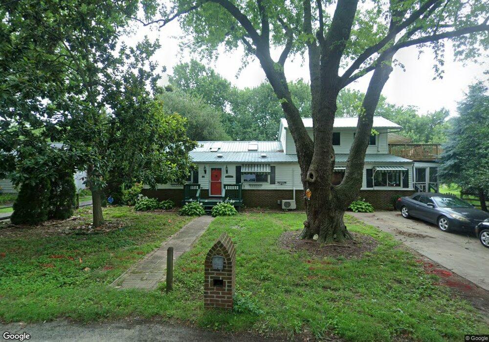
529 Chesapeake Ave Stevensville, MD 21666
Estimated Value: $517,000 - $640,000
--
Bed
2
Baths
2,547
Sq Ft
$233/Sq Ft
Est. Value
About This Home
This home is located at 529 Chesapeake Ave, Stevensville, MD 21666 and is currently estimated at $592,534, approximately $232 per square foot. 529 Chesapeake Ave is a home located in Queen Anne's County with nearby schools including Matapeake Elementary School, Matapeake Middle School, and Kent Island High School.
Ownership History
Date
Name
Owned For
Owner Type
Purchase Details
Closed on
Jul 7, 2006
Sold by
Lavelle Thomas J
Bought by
Lavelle Connie Lee Kratovil
Current Estimated Value
Purchase Details
Closed on
Apr 18, 2006
Sold by
Lavelle Thomas J
Bought by
Lavelle Connie Lee Kratovil
Purchase Details
Closed on
Apr 25, 2001
Sold by
Schaefer Elizabeth
Bought by
Lavelle Thomas J
Purchase Details
Closed on
Aug 21, 1998
Sold by
Butler David M
Bought by
Schaefer Elizabeth
Create a Home Valuation Report for This Property
The Home Valuation Report is an in-depth analysis detailing your home's value as well as a comparison with similar homes in the area
Home Values in the Area
Average Home Value in this Area
Purchase History
| Date | Buyer | Sale Price | Title Company |
|---|---|---|---|
| Lavelle Connie Lee Kratovil | -- | -- | |
| Lavelle Connie Lee Kratovil | -- | -- | |
| Lavelle Thomas J | $188,000 | -- | |
| Schaefer Elizabeth | $136,000 | -- |
Source: Public Records
Mortgage History
| Date | Status | Borrower | Loan Amount |
|---|---|---|---|
| Closed | Schaefer Elizabeth | -- |
Source: Public Records
Tax History Compared to Growth
Tax History
| Year | Tax Paid | Tax Assessment Tax Assessment Total Assessment is a certain percentage of the fair market value that is determined by local assessors to be the total taxable value of land and additions on the property. | Land | Improvement |
|---|---|---|---|---|
| 2025 | $4,004 | $442,033 | $0 | $0 |
| 2024 | $3,865 | $412,767 | $0 | $0 |
| 2023 | $3,613 | $383,500 | $189,100 | $194,400 |
| 2022 | $3,673 | $383,500 | $189,100 | $194,400 |
| 2021 | $3,485 | $383,500 | $189,100 | $194,400 |
| 2020 | $3,485 | $385,100 | $184,200 | $200,900 |
| 2019 | $3,314 | $359,667 | $0 | $0 |
| 2018 | $3,150 | $334,233 | $0 | $0 |
| 2017 | $2,992 | $308,800 | $0 | $0 |
| 2016 | -- | $308,800 | $0 | $0 |
| 2015 | $1,158 | $308,800 | $0 | $0 |
| 2014 | $1,158 | $312,600 | $0 | $0 |
Source: Public Records
Map
Nearby Homes
- 511 Chesapeake Ave
- 312 Queens Colony High Rd
- 0 Allen Ave
- 206 Columbia Ln
- 303 Queens Colony High Rd
- 0 Reynolds Ave
- 114 Queens Colony High Rd
- 227 Queen Anne Club Dr
- 410 5 Farms Dr
- 303 Queen Anne Club Dr
- 312 Columbia Ln
- 412 Five Farms Dr
- 116 Mallard Dr
- 122 Mallard Dr
- Lot 7 Maple Rd
- 0 Chesapeake Estates Dr
- 103 Chesapeake Estates Dr
- 321 Oregon Rd
- 101 Oak St
- 122 S Carolina Rd
- 525 Chesapeake Ave
- 0 Chesapeake Ave Unit QA10000834
- 0 Chesapeake Ave Unit MDQA2000604
- LOT #36 Chesapeake Ave
- 523 Chesapeake Ave
- 1202 Kentmorr Rd
- 1108 Kentmorr Rd
- 517 Chesapeake Ave
- 404 Queens Colony High Rd
- 1101 Kentmorr Rd
- 1106 Kentmorr Rd
- 1204 Kentmorr Rd
- 402 Queens Colony High Rd
- 514 Chesapeake Ave
- 1112 Kentmorr Rd
- 196 Queen Anne Club Dr
- 400 Queens Colony High Rd
- 515 Chesapeake Ave
- 1100 Kentmorr Rd
- 510 Chesapeake Ave