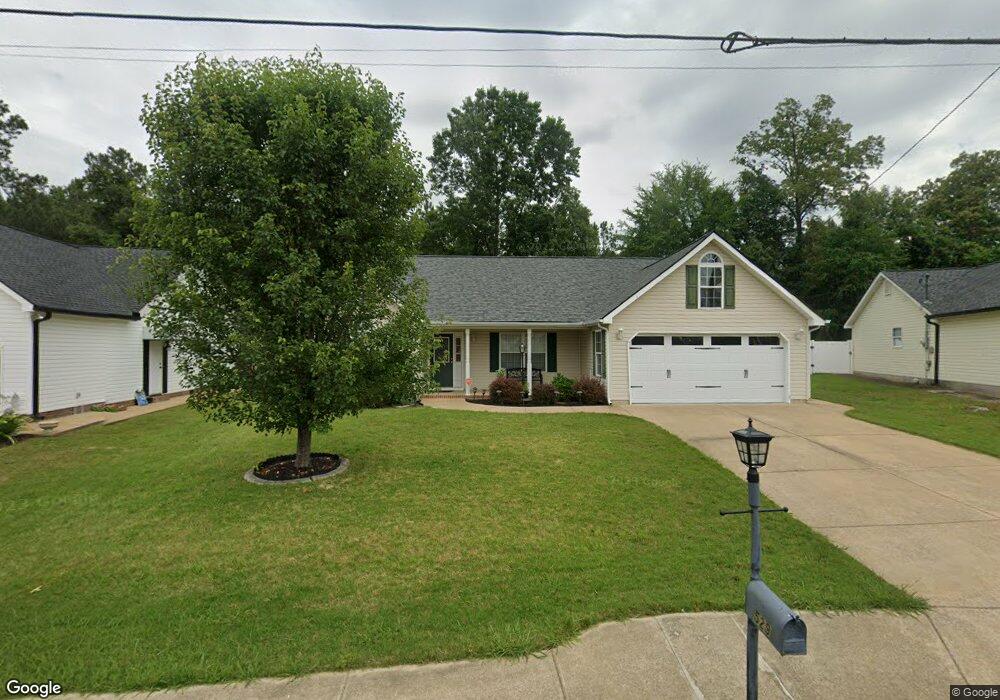
529 Colony Cir Fort Oglethorpe, GA 30742
Estimated Value: $269,161 - $287,000
3
Beds
2
Baths
1,374
Sq Ft
$201/Sq Ft
Est. Value
About This Home
This home is located at 529 Colony Cir, Fort Oglethorpe, GA 30742 and is currently estimated at $276,720, approximately $201 per square foot. 529 Colony Cir is a home located in Catoosa County with nearby schools including West Side Elementary School, Lakeview Middle School, and Lakeview-Fort Oglethorpe High School.
Ownership History
Date
Name
Owned For
Owner Type
Purchase Details
Closed on
Dec 21, 2009
Sold by
Best Land Investments
Bought by
Lawson Philip D and Baugh Andrea Y
Current Estimated Value
Purchase Details
Closed on
Apr 3, 2007
Sold by
Not Provided
Bought by
Lawson Philip D and Baugh Andrea Y
Purchase Details
Closed on
Jun 29, 1999
Bought by
Whitmire John C
Create a Home Valuation Report for This Property
The Home Valuation Report is an in-depth analysis detailing your home's value as well as a comparison with similar homes in the area
Home Values in the Area
Average Home Value in this Area
Purchase History
| Date | Buyer | Sale Price | Title Company |
|---|---|---|---|
| Lawson Philip D | $117,900 | -- | |
| Lawson Philip D | $545,500 | -- | |
| Whitmire John C | $16,000 | -- |
Source: Public Records
Tax History Compared to Growth
Tax History
| Year | Tax Paid | Tax Assessment Tax Assessment Total Assessment is a certain percentage of the fair market value that is determined by local assessors to be the total taxable value of land and additions on the property. | Land | Improvement |
|---|---|---|---|---|
| 2024 | $2,600 | $98,833 | $11,000 | $87,833 |
| 2023 | $2,008 | $76,338 | $11,000 | $65,338 |
| 2022 | $1,756 | $62,506 | $11,000 | $51,506 |
| 2021 | $1,664 | $62,506 | $11,000 | $51,506 |
| 2020 | $1,651 | $55,927 | $11,000 | $44,927 |
| 2019 | $1,609 | $53,927 | $9,000 | $44,927 |
| 2018 | $1,690 | $53,927 | $9,000 | $44,927 |
| 2017 | $1,596 | $50,916 | $7,200 | $43,716 |
| 2016 | $1,563 | $47,754 | $7,200 | $40,554 |
| 2015 | -- | $47,754 | $7,200 | $40,554 |
| 2014 | -- | $47,754 | $7,200 | $40,554 |
| 2013 | -- | $45,843 | $6,912 | $38,931 |
Source: Public Records
Map
Nearby Homes
- 180 Gem Dr
- 351 Franklin Cir
- 124 Colony Cir
- 1002 Cedar Creek Dr
- 17 Southshore Dr
- 183 McDonald Dr
- 66 Yellow Brick Rd
- 64 Yellow Brick Rd
- 239 Flagstone Dr
- 17 Evergreen Cir
- 344 Flagstone Dr
- 18 Evergreen Cir
- 6 Rocky Ford Rd
- 14 Evergreen Cir
- 72 Anchor Dr
- 69 Anchor Dr
- Robie Plan at Evergreen Landing
- Darwin Plan at Evergreen Landing
- Edmon Plan at Evergreen Landing
- Sullivan Plan at Evergreen Landing
- 517 Colony Cir
- 539 Colony Cir
- 503 Colony Cir
- 547 Colony Cir
- 546 Colony Cir
- 518 Colony Cir
- 504 Colony Cir
- 489 Colony Cir
- 557 Colony Cir
- 490 Colony Cir
- 574 Colony Cir
- 567 Colony Cir
- 478 Colony Cir
- 38 Stone Edge Ct
- 588 Colony Cir
- 28 Stone Edge Ct
- 579 Colony Cir
- 464 Colony Cir
- 48 Stone Edge Ct
- 602 Colony Cir