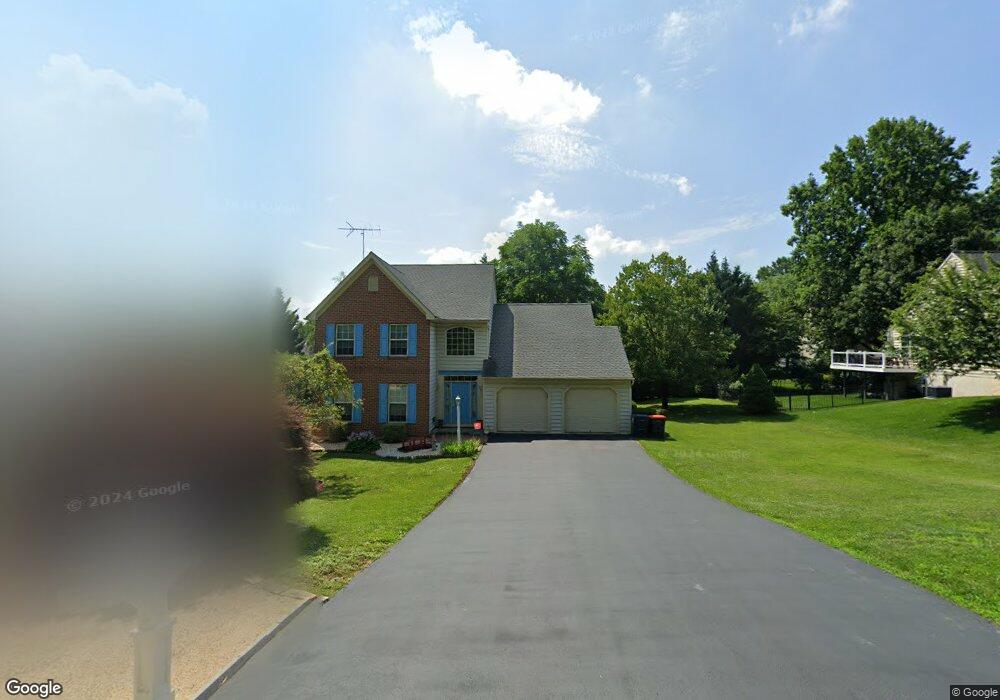
529 Hawthorne Ln Kennett Square, PA 19348
Estimated Value: $517,252 - $622,000
3
Beds
2
Baths
2,144
Sq Ft
$269/Sq Ft
Est. Value
About This Home
This home is located at 529 Hawthorne Ln, Kennett Square, PA 19348 and is currently estimated at $575,813, approximately $268 per square foot. 529 Hawthorne Ln is a home located in Chester County with nearby schools including Kennett Middle School, Kennett High School, and Avon Grove Charter School.
Ownership History
Date
Name
Owned For
Owner Type
Purchase Details
Closed on
Aug 18, 2023
Sold by
Theilacker Janet
Bought by
Donegan Janet and Donegan James
Current Estimated Value
Purchase Details
Closed on
May 30, 1995
Sold by
Bancroft Woods Company
Bought by
Theilacker Janet
Home Financials for this Owner
Home Financials are based on the most recent Mortgage that was taken out on this home.
Original Mortgage
$78,000
Interest Rate
8.24%
Create a Home Valuation Report for This Property
The Home Valuation Report is an in-depth analysis detailing your home's value as well as a comparison with similar homes in the area
Home Values in the Area
Average Home Value in this Area
Purchase History
| Date | Buyer | Sale Price | Title Company |
|---|---|---|---|
| Donegan Janet | -- | None Listed On Document | |
| Donegan Janet | -- | None Listed On Document | |
| Theilacker Janet | $161,900 | T A Title Insurance Company |
Source: Public Records
Mortgage History
| Date | Status | Borrower | Loan Amount |
|---|---|---|---|
| Previous Owner | Theilacker Janet | $78,000 |
Source: Public Records
Tax History
| Year | Tax Paid | Tax Assessment Tax Assessment Total Assessment is a certain percentage of the fair market value that is determined by local assessors to be the total taxable value of land and additions on the property. | Land | Improvement |
|---|---|---|---|---|
| 2025 | $6,397 | $159,740 | $40,510 | $119,230 |
| 2024 | $6,397 | $159,740 | $40,510 | $119,230 |
| 2023 | $6,183 | $159,740 | $40,510 | $119,230 |
| 2022 | $6,093 | $159,740 | $40,510 | $119,230 |
| 2021 | $6,031 | $159,740 | $40,510 | $119,230 |
| 2020 | $5,917 | $159,740 | $40,510 | $119,230 |
| 2019 | $5,836 | $159,740 | $40,510 | $119,230 |
| 2018 | $5,746 | $159,740 | $40,510 | $119,230 |
| 2017 | $5,628 | $159,740 | $40,510 | $119,230 |
| 2016 | $633 | $159,740 | $40,510 | $119,230 |
| 2015 | $633 | $159,740 | $40,510 | $119,230 |
| 2014 | $633 | $159,740 | $40,510 | $119,230 |
Source: Public Records
Map
Nearby Homes
- 131 Foragers Ln
- 103 Foragers Ln
- 130 Foragers Ln
- 13 Tullow Hill Dr
- 138 Foragers Ln
- 140 Foragers Ln
- 128 Foragers Ln
- 11 Tullow Hill Dr
- 15 Tullow Hill Dr
- 9 Tullow Hill Dr
- 156 Bancroft Rd Unit CARLTON
- 156 Bancroft Rd Unit SUTTON
- 156 Bancroft Rd Unit SGR
- 156 Bancroft Rd Unit CARLTON GRND
- 5 Tullow Hill Dr
- 225 Kestrel Ct
- 235 Kestrel Ct
- 273 Kestrel Ct
- 406 Columbine Dr
- 100 Declan Unit HAWTHORNE
- 533 Hawthorne Ln
- 525 Hawthorne Ln
- 304 Hillside Ln
- 308 Hillside Ln
- 300 Hillside Ln
- 521 Hawthorne Ln
- 537 Hawthorne Ln
- 312 Hillside Ln
- 505 Oakland Ct
- 501 Oakland Ct
- 201 Crestview Dr
- 208 Hillside Ln
- 507 Oakland Ct
- 215 Crestview Dr
- 305 Hillside Ln
- 211 Hillside Ln
- 517 Hawthorne Ln
- 326 Hillside Ln
- 209 Hillside Ln
- 202 Hillside Ln
Your Personal Tour Guide
Ask me questions while you tour the home.