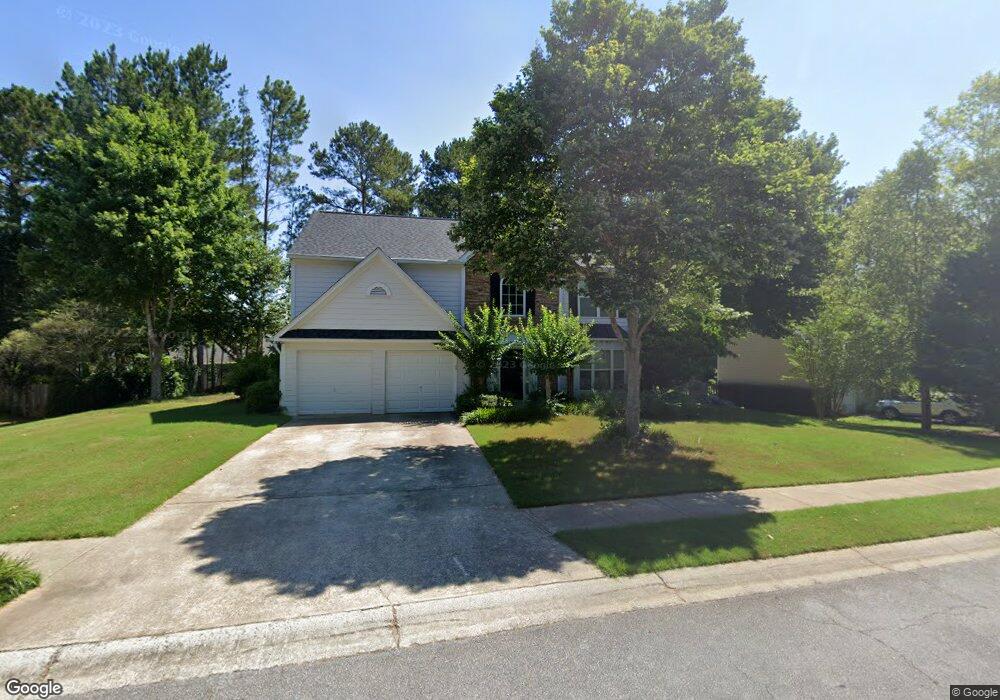
529 Huntgate Rd Woodstock, GA 30189
Oak Grove NeighborhoodEstimated Value: $461,000 - $470,053
4
Beds
3
Baths
2,174
Sq Ft
$214/Sq Ft
Est. Value
About This Home
This home is located at 529 Huntgate Rd, Woodstock, GA 30189 and is currently estimated at $465,527, approximately $214 per square foot. 529 Huntgate Rd is a home located in Cherokee County with nearby schools including Bascomb Elementary School, E. T. Booth Middle School, and Etowah High School.
Ownership History
Date
Name
Owned For
Owner Type
Purchase Details
Closed on
Dec 12, 2003
Sold by
Mcmahan Charles D and Mcmahan Peggy E
Bought by
Sullivan Kevin R and Sullivan Lisa
Current Estimated Value
Home Financials for this Owner
Home Financials are based on the most recent Mortgage that was taken out on this home.
Original Mortgage
$27,750
Interest Rate
5.3%
Mortgage Type
Unknown
Purchase Details
Closed on
Feb 24, 1998
Sold by
Torrey D R Horton Inc -
Bought by
Mcmahan Charles D and Mcmahan Peggy E
Home Financials for this Owner
Home Financials are based on the most recent Mortgage that was taken out on this home.
Original Mortgage
$112,750
Interest Rate
6.95%
Mortgage Type
New Conventional
Create a Home Valuation Report for This Property
The Home Valuation Report is an in-depth analysis detailing your home's value as well as a comparison with similar homes in the area
Home Values in the Area
Average Home Value in this Area
Purchase History
| Date | Buyer | Sale Price | Title Company |
|---|---|---|---|
| Sullivan Kevin R | $185,000 | -- | |
| Mcmahan Charles D | $141,000 | -- |
Source: Public Records
Mortgage History
| Date | Status | Borrower | Loan Amount |
|---|---|---|---|
| Closed | Sullivan Kevin R | $27,750 | |
| Open | Sullivan Kevin R | $148,000 | |
| Previous Owner | Mcmahan Charles D | $112,750 |
Source: Public Records
Tax History Compared to Growth
Tax History
| Year | Tax Paid | Tax Assessment Tax Assessment Total Assessment is a certain percentage of the fair market value that is determined by local assessors to be the total taxable value of land and additions on the property. | Land | Improvement |
|---|---|---|---|---|
| 2025 | $3,915 | $170,204 | $36,000 | $134,204 |
| 2024 | $3,810 | $165,884 | $33,600 | $132,284 |
| 2023 | $3,278 | $161,288 | $33,600 | $127,688 |
| 2022 | $3,146 | $132,572 | $29,200 | $103,372 |
| 2021 | $2,752 | $104,256 | $24,000 | $80,256 |
| 2020 | $2,574 | $96,496 | $22,000 | $74,496 |
| 2019 | $2,431 | $90,280 | $20,000 | $70,280 |
| 2018 | $2,396 | $88,280 | $18,400 | $69,880 |
| 2017 | $2,353 | $214,200 | $20,000 | $65,680 |
| 2016 | $2,147 | $190,500 | $19,200 | $57,000 |
| 2015 | $1,974 | $173,600 | $12,920 | $56,520 |
| 2014 | $1,875 | $164,900 | $12,920 | $53,040 |
Source: Public Records
Map
Nearby Homes
- 522 Huntgate Rd Unit 4
- 1028 Deer Hollow Dr
- 1029 Chatsworth Ln
- 507 Huntgate Rd
- 7119 Big Woods Dr
- 1001 Deer Hollow Dr
- 1020 Braelin Ct
- 104 Rose Cottage Ln Unit 65
- 146 Sunset Ln
- 2006 Hawthorne Way
- 235 Rose Cottage Dr Unit 28
- 442 Colonial Walk
- 313 Maltibe Dr
- 315 Pinewood Dr
- 234 Ascott Ln
- 0 Black Oak Trail Unit 7303191
- 0 Black Oak Trail Unit 10267626
- 4005 Watkins Glen Dr
- 1516 Shadow Ridge Cir
- 1704 Amberwood Pointe
- 531 Huntgate Rd Unit 4
- 527 Huntgate Rd Unit 4
- 1002 Elsberry Dr
- 1004 Elsberry Dr
- 1001 Brent Knoll Ct
- 1000 Brent Knoll Ct
- 1029 Deer Hollow Dr
- 532 Huntgate Rd Unit 4
- 1031 Deer Hollow Dr Unit B3
- 1006 Elsberry Dr
- 525 Huntgate Rd Unit 4
- 526 Huntgate Rd
- 1003 Brent Knoll Ct
- 1002 Brent Knoll Ct Unit 1
- 1005 Elsberry Dr Unit 4
- 1003 Elsberry Dr
- 1033 Deer Hollow Dr
- 1007 Elsberry Dr
- 524 Huntgate Rd
- 1008 Elsberry Dr