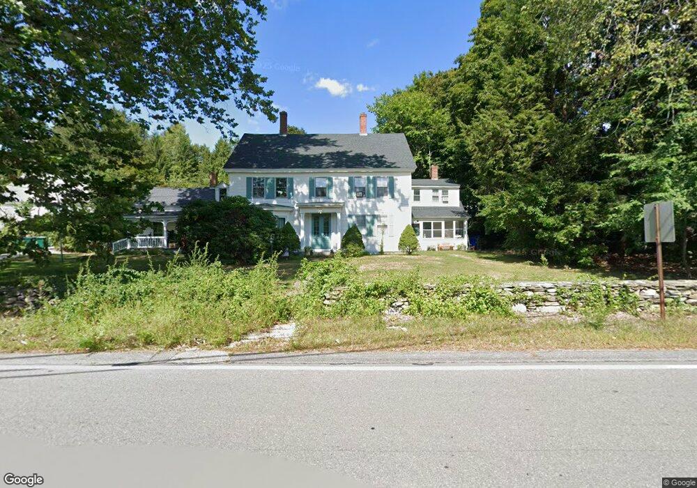
529 Main St Dunstable, MA 01827
Estimated Value: $765,878 - $808,000
2
Beds
3
Baths
3,096
Sq Ft
$254/Sq Ft
Est. Value
About This Home
This home is located at 529 Main St, Dunstable, MA 01827 and is currently estimated at $786,939, approximately $254 per square foot. 529 Main St is a home located in Middlesex County with nearby schools including Groton Dunstable Regional High School, World Academy, and Academy of Notre Dame - Upper School.
Ownership History
Date
Name
Owned For
Owner Type
Purchase Details
Closed on
Dec 12, 2019
Sold by
Wellington David W Est
Bought by
Wellington House Llc
Current Estimated Value
Purchase Details
Closed on
Apr 10, 2019
Sold by
Wellington David Est
Bought by
Stjean Daniel M and Stjean Barbara A
Create a Home Valuation Report for This Property
The Home Valuation Report is an in-depth analysis detailing your home's value as well as a comparison with similar homes in the area
Home Values in the Area
Average Home Value in this Area
Purchase History
| Date | Buyer | Sale Price | Title Company |
|---|---|---|---|
| Wellington House Llc | -- | None Available | |
| Stjean Daniel M | $22,500 | -- |
Source: Public Records
Tax History
| Year | Tax Paid | Tax Assessment Tax Assessment Total Assessment is a certain percentage of the fair market value that is determined by local assessors to be the total taxable value of land and additions on the property. | Land | Improvement |
|---|---|---|---|---|
| 2025 | $9,170 | $666,900 | $224,400 | $442,500 |
| 2024 | $8,429 | $603,800 | $205,400 | $398,400 |
| 2023 | $8,609 | $575,100 | $205,400 | $369,700 |
| 2022 | $7,976 | $523,000 | $205,400 | $317,600 |
| 2021 | $24,237 | $494,500 | $187,700 | $306,800 |
| 2020 | $7,937 | $471,300 | $187,700 | $283,600 |
| 2019 | $8,088 | $474,100 | $192,000 | $282,100 |
| 2018 | $7,932 | $452,200 | $189,900 | $262,300 |
| 2017 | $7,696 | $452,200 | $189,900 | $262,300 |
| 2016 | $7,294 | $440,700 | $181,700 | $259,000 |
| 2015 | $6,965 | $416,300 | $154,000 | $262,300 |
| 2014 | $6,565 | $416,300 | $154,000 | $262,300 |
Source: Public Records
Map
Nearby Homes
- 319 Pleasant St
- 62 Brook St
- 0 Lowell St
- 153 Off Pond St
- 6 Green Heron Ln Unit U22
- 11 Lojko Dr
- 38 Georgetown Dr
- 141 Ridge Rd
- 1 Doucet Ave
- 77 Wilderness Dr
- 58 Wilderness Dr
- 20 Georgetown Dr
- 65 Wilderness Dr
- 1 Wilderness Dr
- 2 Wilderness Dr
- 4 Wilderness Dr
- 79 Wilderness Dr
- 3 Wilderness Dr
- 7 Wilderness Dr
- 6 Wilderness Dr
Your Personal Tour Guide
Ask me questions while you tour the home.