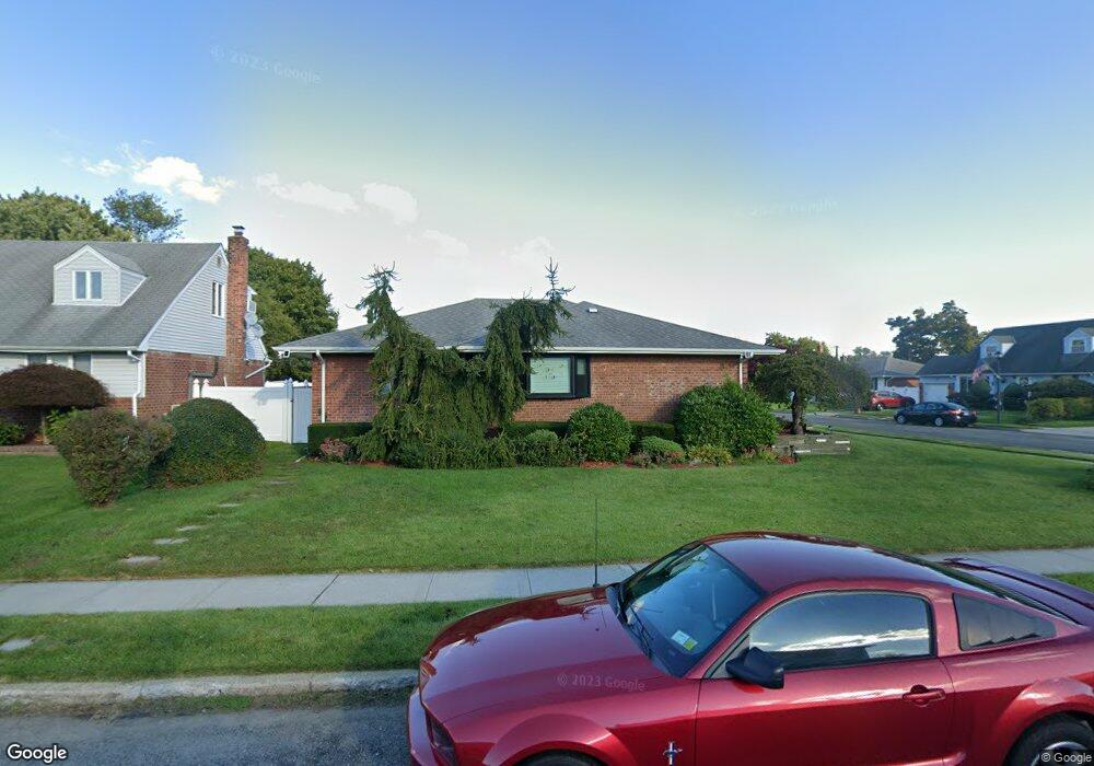
529 Mansfield Ave Levittown, NY 11756
Estimated Value: $733,000 - $767,994
3
Beds
2
Baths
1,516
Sq Ft
$495/Sq Ft
Est. Value
About This Home
This home is located at 529 Mansfield Ave, Levittown, NY 11756 and is currently estimated at $750,497, approximately $495 per square foot. 529 Mansfield Ave is a home located in Nassau County with nearby schools including Michael F. Stokes Elementary School, J Fred Sparke Elementary School, and Island Trees Middle School.
Ownership History
Date
Name
Owned For
Owner Type
Purchase Details
Closed on
Jun 2, 2014
Sold by
Jodice Linda and Crandall Leslie
Bought by
Lopez Michael and Ruggiero Angela
Current Estimated Value
Home Financials for this Owner
Home Financials are based on the most recent Mortgage that was taken out on this home.
Original Mortgage
$317,200
Outstanding Balance
$241,903
Interest Rate
4.27%
Mortgage Type
New Conventional
Estimated Equity
$508,594
Purchase Details
Closed on
Sep 13, 2001
Purchase Details
Closed on
Sep 28, 1999
Sold by
Jodice Louis A and Jodice Lucille
Bought by
Jodice Linda and Crandall Leslie
Create a Home Valuation Report for This Property
The Home Valuation Report is an in-depth analysis detailing your home's value as well as a comparison with similar homes in the area
Home Values in the Area
Average Home Value in this Area
Purchase History
| Date | Buyer | Sale Price | Title Company |
|---|---|---|---|
| Lopez Michael | $352,500 | Lands End Abstract | |
| -- | -- | -- | |
| Jodice Linda | -- | Commonwealth Land Title Ins |
Source: Public Records
Mortgage History
| Date | Status | Borrower | Loan Amount |
|---|---|---|---|
| Open | Lopez Michael | $317,200 |
Source: Public Records
Tax History Compared to Growth
Tax History
| Year | Tax Paid | Tax Assessment Tax Assessment Total Assessment is a certain percentage of the fair market value that is determined by local assessors to be the total taxable value of land and additions on the property. | Land | Improvement |
|---|---|---|---|---|
| 2025 | $11,036 | $475 | $216 | $259 |
| 2024 | $3,407 | $487 | $221 | $266 |
| 2023 | $11,437 | $568 | $258 | $310 |
| 2022 | $11,437 | $568 | $258 | $310 |
| 2021 | $15,103 | $541 | $246 | $295 |
| 2020 | $10,688 | $691 | $475 | $216 |
| 2019 | $9,875 | $691 | $475 | $216 |
| 2018 | $9,252 | $691 | $0 | $0 |
| 2017 | $4,597 | $625 | $475 | $150 |
| 2016 | $7,325 | $625 | $427 | $198 |
| 2015 | $2,223 | $660 | $402 | $258 |
| 2014 | $2,223 | $660 | $402 | $258 |
| 2013 | $2,203 | $695 | $424 | $271 |
Source: Public Records
Map
Nearby Homes
- 3842 Whitman St
- 243 Elm Dr S
- 17 Rural Ln
- 520 Ann Ln
- 6 Regal Ln
- 3945 Old Post Rd
- 28 Eve Ln
- 4092 Maywood Dr
- 3977 Wellwood Rd
- 3980 Kingsberry Rd
- 3667 Richard Ln
- 3676 Regent Ln
- 25 Red Maple Dr N
- 53 Elbow Ln
- 3621 Regent Ln
- 294 Swansdowne Dr
- 4195 Florence Rd
- 406 Red Maple Dr W
- 3901 Moore St
- 4203 Ludwig Ln
- 507 Mansfield Ave
- 539 Mansfield Ave
- 501 Mansfield Ave
- 534 Mansfield Ave
- 528 Mansfield Ave
- 545 Mansfield Ave
- 514 Mansfield Ave
- 508 Mansfield Ave
- 540 Mansfield Ave
- 518 Mansfield Ave
- 522 Mansfield Ave
- 495 Mansfield Ave
- 502 Mansfield Ave
- 546 Mansfield Ave
- 573 Parker Ave
- 579 Parker Ave
- 555 Mansfield Ave
- 494 Mansfield Ave
- 515 Parker Ave
- 521 Parker Ave