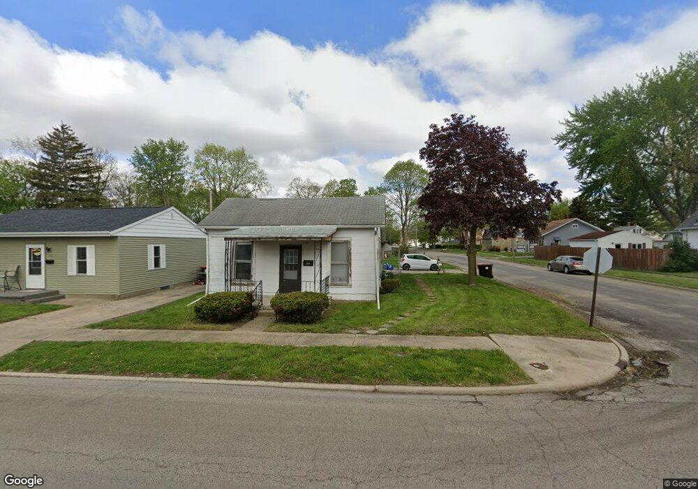
529 N Hamilton St Lincoln, IL 62656
Estimated Value: $62,222 - $119,000
--
Bed
--
Bath
1,206
Sq Ft
$76/Sq Ft
Est. Value
About This Home
This home is located at 529 N Hamilton St, Lincoln, IL 62656 and is currently estimated at $91,556, approximately $75 per square foot. 529 N Hamilton St is a home with nearby schools including Washington-Monroe Elementary School, Lincoln Junior High School, and Lincoln Community High School.
Ownership History
Date
Name
Owned For
Owner Type
Purchase Details
Closed on
Mar 26, 2021
Sold by
Ferguson Gary
Bought by
Cody Melissa R
Current Estimated Value
Purchase Details
Closed on
Mar 25, 2021
Sold by
Cronin John
Bought by
Cody Melissa R
Purchase Details
Closed on
Jan 7, 2016
Sold by
Ferguson Rose
Bought by
Cronin John
Purchase Details
Closed on
Aug 20, 1991
Sold by
Ferguson Rose E
Bought by
Ferguson Est Rose E
Create a Home Valuation Report for This Property
The Home Valuation Report is an in-depth analysis detailing your home's value as well as a comparison with similar homes in the area
Home Values in the Area
Average Home Value in this Area
Purchase History
| Date | Buyer | Sale Price | Title Company |
|---|---|---|---|
| Cody Melissa R | -- | None Available | |
| Cody Melissa R | -- | None Available | |
| Cronin John | $4,000 | -- | |
| Ferguson Est Rose E | $18,500 | -- |
Source: Public Records
Tax History Compared to Growth
Tax History
| Year | Tax Paid | Tax Assessment Tax Assessment Total Assessment is a certain percentage of the fair market value that is determined by local assessors to be the total taxable value of land and additions on the property. | Land | Improvement |
|---|---|---|---|---|
| 2024 | $758 | $8,270 | $3,920 | $4,350 |
| 2023 | $724 | $7,660 | $3,630 | $4,030 |
| 2022 | $707 | $7,160 | $3,390 | $3,770 |
| 2021 | $680 | $6,870 | $3,250 | $3,620 |
| 2020 | $672 | $6,770 | $3,200 | $3,570 |
| 2019 | $658 | $6,640 | $3,140 | $3,500 |
| 2018 | $653 | $6,510 | $3,080 | $3,430 |
| 2017 | $649 | $6,510 | $3,080 | $3,430 |
| 2016 | $633 | $6,510 | $3,080 | $3,430 |
| 2015 | -- | $12,380 | $3,090 | $9,290 |
| 2014 | -- | $12,380 | $3,090 | $9,290 |
| 2013 | -- | $11,750 | $2,930 | $8,820 |
Source: Public Records
Map
Nearby Homes
- 915 Peoria St
- 1225 Delavan St
- 1227 Delavan St
- 928 Broadway St
- 113 N Kickapoo St
- 311 Davenport St
- 1019 N Mclean St
- 620 Tremont St
- 1025 Broadway St
- 1121 Broadway St
- 1624 Delavan St
- 1311 Broadway St
- 410 S Chicago St
- 419 Decatur St
- 521 Decatur St
- 1107 N Kankakee St
- 617 Decatur St
- 418 Wyatt Ave
- 402 Wyatt Ave
- 330 Water St
- 525 N Hamilton St
- 1215 Lincoln Ave
- 601 N Hamilton St
- 519 N Hamilton St
- 1301 Lincoln Ave
- 603 N Hamilton St
- 515 N Hamilton St
- 604 N Hamilton St
- 524 N Hamilton St
- 617 N Hamilton St
- 1210 Lincoln Ave
- 528 N Mclean St
- 509 N Hamilton St
- 524 N Mclean St
- 518 N Hamilton St
- 619 N Hamilton St
- 507 N Hamilton St
- 522 N Mclean St
- 602 N Mclean St
- 1305 Lincoln Ave