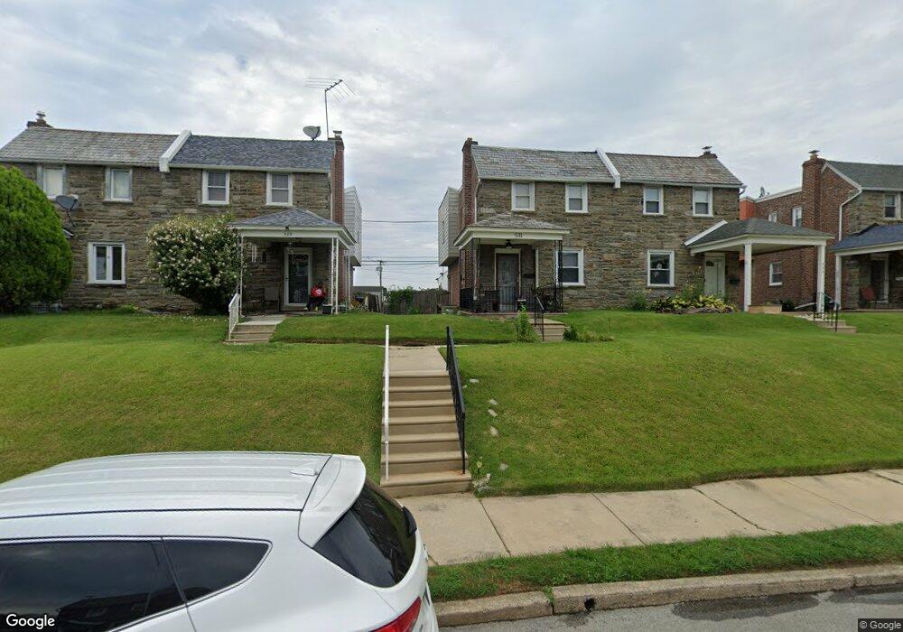
529 Rose St Lansdowne, PA 19050
Estimated Value: $196,430 - $248,000
3
Beds
2
Baths
1,328
Sq Ft
$170/Sq Ft
Est. Value
About This Home
This home is located at 529 Rose St, Lansdowne, PA 19050 and is currently estimated at $225,108, approximately $169 per square foot. 529 Rose St is a home located in Delaware County with nearby schools including Evans Elementary School, Penn Wood Middle School, and Penn Wood High School - Cypress Street Campus.
Ownership History
Date
Name
Owned For
Owner Type
Purchase Details
Closed on
May 23, 1996
Sold by
Connor Jane H
Bought by
Winder Mcclain Barbara A
Current Estimated Value
Home Financials for this Owner
Home Financials are based on the most recent Mortgage that was taken out on this home.
Original Mortgage
$64,900
Outstanding Balance
$3,668
Interest Rate
7.91%
Mortgage Type
FHA
Estimated Equity
$221,440
Create a Home Valuation Report for This Property
The Home Valuation Report is an in-depth analysis detailing your home's value as well as a comparison with similar homes in the area
Home Values in the Area
Average Home Value in this Area
Purchase History
| Date | Buyer | Sale Price | Title Company |
|---|---|---|---|
| Winder Mcclain Barbara A | $65,000 | T A Title Insurance Company |
Source: Public Records
Mortgage History
| Date | Status | Borrower | Loan Amount |
|---|---|---|---|
| Open | Winder Mcclain Barbara A | $64,900 |
Source: Public Records
Tax History Compared to Growth
Tax History
| Year | Tax Paid | Tax Assessment Tax Assessment Total Assessment is a certain percentage of the fair market value that is determined by local assessors to be the total taxable value of land and additions on the property. | Land | Improvement |
|---|---|---|---|---|
| 2025 | $3,739 | $87,570 | $33,150 | $54,420 |
| 2024 | $3,739 | $87,570 | $33,150 | $54,420 |
| 2023 | $3,396 | $87,570 | $33,150 | $54,420 |
| 2022 | $3,238 | $87,570 | $33,150 | $54,420 |
| 2021 | $4,897 | $87,570 | $33,150 | $54,420 |
| 2020 | $4,556 | $72,960 | $19,130 | $53,830 |
| 2019 | $4,476 | $72,960 | $19,130 | $53,830 |
| 2018 | $4,414 | $72,960 | $0 | $0 |
| 2017 | $4,321 | $72,960 | $0 | $0 |
| 2016 | $400 | $72,960 | $0 | $0 |
| 2015 | $409 | $72,960 | $0 | $0 |
| 2014 | $409 | $72,960 | $0 | $0 |
Source: Public Records
Map
Nearby Homes
- 536 Cypress St
- 1016 Whitby Ave
- 407 Church Ln
- 503 Bonsall Ave
- 435 Bonsall Ave
- 702 Cedar Ave
- 537 Orchard Ave
- 711 Yeadon Ave Unit 1
- 740 Church Ln
- 530 Orchard Ave
- 722 Yeadon Ave
- 813 Arbor Rd
- 6030 Cedarhurst St
- 1212 S Millick St
- 6013 Baltimore Ave
- 1214 S 60th St
- 6026 Baltimore Ave
- 603 Penn St
- 1201 S Millick St
- 800 Bullock Ave