Estimated Value: $65,000 - $93,000
3
Beds
1
Bath
1,658
Sq Ft
$45/Sq Ft
Est. Value
About This Home
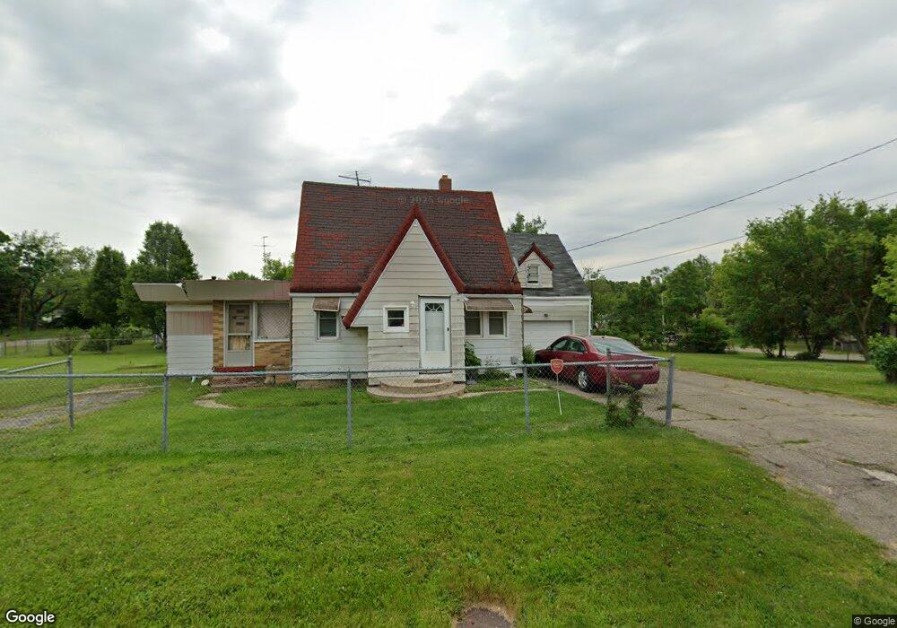
This home is located at 5290 Summit St, Flint, MI 48505 and is currently estimated at $74,286, approximately $44 per square foot. 5290 Summit St is a home located in Genesee County with nearby schools including Beecher High School, The New Standard Academy, and Flint Fairhaven Elementary School.
Ownership History
Date
Name
Owned For
Owner Type
Purchase Details
Closed on
Mar 24, 2015
Sold by
Panek David L
Bought by
Emerick Jeffrey A and Emerick Crystal L
Current Estimated Value
Purchase Details
Closed on
Sep 1, 2014
Sold by
Panek Michael
Bought by
Panek David
Purchase Details
Closed on
Jul 21, 2009
Sold by
Panek David L
Bought by
Panek Michael
Purchase Details
Closed on
Aug 1, 2008
Sold by
Susberry Michelle L
Bought by
Federal Home Loan Mortgage Corporation
Purchase Details
Closed on
Oct 19, 2004
Sold by
Estate Of Pearl Violet Olmstead
Bought by
Susberry Michelle L
Home Financials for this Owner
Home Financials are based on the most recent Mortgage that was taken out on this home.
Original Mortgage
$35,625
Interest Rate
5.93%
Mortgage Type
Unknown
Purchase Details
Closed on
Dec 13, 1999
Sold by
Olmstead Violet P and Olmstead Donald L
Bought by
Olmstead Violet P and Olmstead Violet C
Create a Home Valuation Report for This Property
The Home Valuation Report is an in-depth analysis detailing your home's value as well as a comparison with similar homes in the area
Home Values in the Area
Average Home Value in this Area
Purchase History
| Date | Buyer | Sale Price | Title Company |
|---|---|---|---|
| Emerick Jeffrey A | $1,000 | None Available | |
| Panek David | -- | None Available | |
| Panek Michael | -- | None Available | |
| Federal Home Loan Mortgage Corporation | $37,454 | None Available | |
| Susberry Michelle L | $37,500 | Cislo Title Company | |
| Olmstead Violet P | -- | -- |
Source: Public Records
Mortgage History
| Date | Status | Borrower | Loan Amount |
|---|---|---|---|
| Previous Owner | Susberry Michelle L | $35,625 |
Source: Public Records
Tax History
| Year | Tax Paid | Tax Assessment Tax Assessment Total Assessment is a certain percentage of the fair market value that is determined by local assessors to be the total taxable value of land and additions on the property. | Land | Improvement |
|---|---|---|---|---|
| 2025 | $971 | $23,200 | $0 | $0 |
| 2024 | $134 | $21,500 | $0 | $0 |
| 2023 | $128 | $18,300 | $0 | $0 |
| 2022 | $863 | $15,900 | $0 | $0 |
| 2021 | $859 | $13,100 | $0 | $0 |
| 2020 | $117 | $11,300 | $0 | $0 |
| 2019 | $115 | $10,600 | $0 | $0 |
| 2018 | $798 | $9,700 | $0 | $0 |
| 2017 | $986 | $12,700 | $0 | $0 |
| 2016 | $1,020 | $13,200 | $0 | $0 |
| 2015 | $455 | $10,000 | $0 | $0 |
| 2014 | $77 | $6,800 | $0 | $0 |
| 2012 | -- | $7,300 | $7,300 | $0 |
Source: Public Records
Map
Nearby Homes
- 5218 Summit St
- 5261 Harvard St
- 1061 W Harvard Ave
- 5159 Summit St
- 00 Detroit St
- 1080 E Cornell Ave
- 1065 W Kurtz Ave
- 1076 W Kurtz Ave
- 1062 Tremont Ave
- 1395 W Yale Ave
- 1151 E Cornell Ave
- 5485 Detroit St
- 1023 E Princeton Ave
- 0 Detroit St Unit 25061886
- 0 Detroit St Unit 25061882
- 0 Detroit St Unit 25061884
- 0 Detroit St Unit 25061881
- 0 Detroit St Unit 25061883
- 0 Detroit St Unit 25061887
- 0 Detroit St Unit 25061880
- 1119 N Cornell Ave
- 1113 N Cornell Ave
- 1108 S Cornell Ave
- 1104 S Cornell Ave
- 1118 N Cornell Ave
- 1142 N Cornell Ave
- 1123 S Cornell Ave
- 5268 Summit St
- 1101 N Cornell Ave
- 1115 S Cornell Ave
- 1177 N Cornell Ave
- 1145 S Cornell Ave
- 1096 S Cornell Ave
- 1108 N Cornell Ave
- 1107 S Cornell Ave
- 1129 W Yale Ave
- 1097 N Cornell Ave
- 1105 S Cornell Ave
- 1143 W Yale Ave
- 1151 S Cornell Ave
Your Personal Tour Guide
Ask me questions while you tour the home.