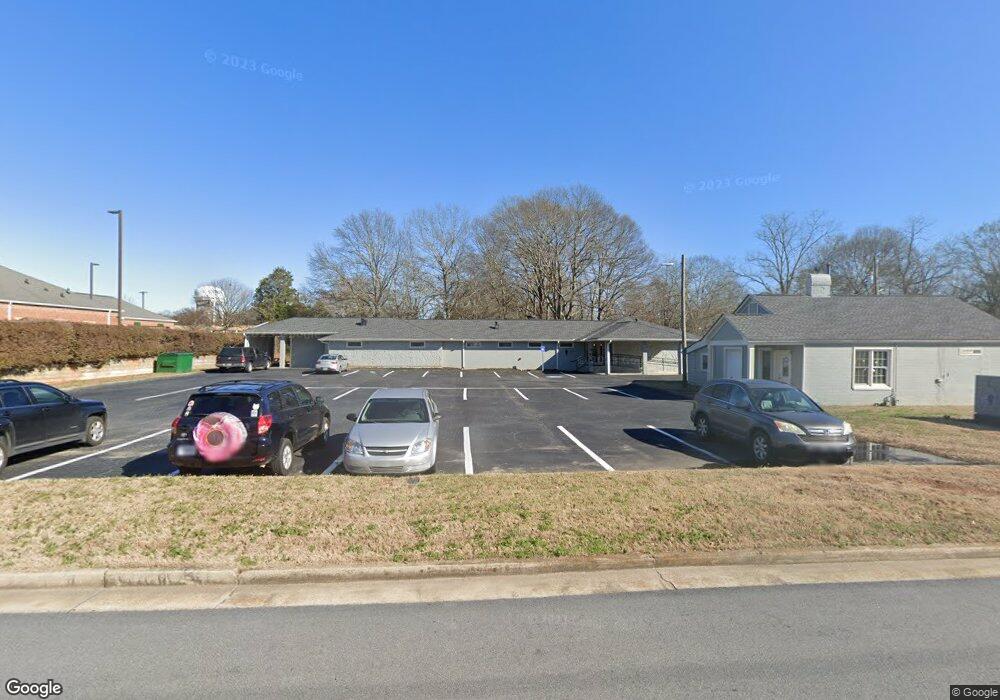
5294 Adams St Covington, GA 30014
Estimated Value: $647,782
--
Bed
6
Baths
4,053
Sq Ft
$160/Sq Ft
Est. Value
About This Home
This home is located at 5294 Adams St, Covington, GA 30014 and is currently estimated at $647,782, approximately $159 per square foot. 5294 Adams St is a home located in Newton County with nearby schools including East Newton Elementary School, Cousins Middle School, and Eastside High School.
Ownership History
Date
Name
Owned For
Owner Type
Purchase Details
Closed on
Mar 5, 2021
Sold by
Massey Gary K
Bought by
Sr Covington Llc
Current Estimated Value
Home Financials for this Owner
Home Financials are based on the most recent Mortgage that was taken out on this home.
Original Mortgage
$1,197,690
Interest Rate
2.7%
Mortgage Type
Commercial
Purchase Details
Closed on
Jul 24, 2019
Sold by
Dalmeida Anthony A
Bought by
Massey Gary K
Home Financials for this Owner
Home Financials are based on the most recent Mortgage that was taken out on this home.
Original Mortgage
$181,280
Interest Rate
3.73%
Mortgage Type
Commercial
Create a Home Valuation Report for This Property
The Home Valuation Report is an in-depth analysis detailing your home's value as well as a comparison with similar homes in the area
Home Values in the Area
Average Home Value in this Area
Purchase History
| Date | Buyer | Sale Price | Title Company |
|---|---|---|---|
| Sr Covington Llc | $460,000 | -- | |
| Massey Gary K | $226,600 | -- |
Source: Public Records
Mortgage History
| Date | Status | Borrower | Loan Amount |
|---|---|---|---|
| Closed | Sr Covington Llc | $1,197,690 | |
| Previous Owner | Massey Gary K | $181,280 |
Source: Public Records
Tax History Compared to Growth
Tax History
| Year | Tax Paid | Tax Assessment Tax Assessment Total Assessment is a certain percentage of the fair market value that is determined by local assessors to be the total taxable value of land and additions on the property. | Land | Improvement |
|---|---|---|---|---|
| 2024 | $6,058 | $200,640 | $58,800 | $141,840 |
| 2023 | $6,302 | $193,920 | $58,800 | $135,120 |
| 2022 | $5,961 | $183,440 | $58,800 | $124,640 |
| 2021 | $6,462 | $177,920 | $65,320 | $112,600 |
| 2020 | $7,097 | $177,920 | $65,320 | $112,600 |
| 2019 | $7,065 | $173,880 | $65,320 | $108,560 |
| 2018 | $7,146 | $173,880 | $65,320 | $108,560 |
| 2017 | $7,229 | $175,920 | $65,320 | $110,600 |
| 2016 | $6,945 | $169,000 | $65,320 | $103,680 |
| 2015 | $6,980 | $169,640 | $65,360 | $104,280 |
| 2014 | $6,978 | $169,640 | $0 | $0 |
Source: Public Records
Map
Nearby Homes
- 6127 Floyd St NE
- 5130 N Dearing St NE
- 6104 Floyd St NE
- 0 Highway 278 NE Unit 10595588
- 5139 West Dr NE
- 6192 Collins St NE
- 5150 Wheat St NE
- 6193 Collins St NE
- 4105 Rose Ln NE
- 4217 Elizabeth St NE
- 4181 A&B Floyd St NE
- 4128 Elizabeth St NE
- 5118 Floyd St NE
- 10630 Highway 278 NE
- 3127 Mill St SE
- 3149 Thompson Ave SE
- 3112 Floyd St NE
- 9202 Settlers Grove Rd NE
- 3183 Conyers St SE
- 7128 Honeysuckle Ct SE
- 6151 Gordy St NE
- 6149 Gordy St NE
- 5278 Adams St NE
- 0 Gordy St NE Unit 8774225
- 0 Gordy St NE Unit 7283698
- 6139 Gordy St NE
- 5303 Adams St Unit 6
- 5303 Adams St
- 6129 Gordy St NE
- 5264 Adams St NE
- 5277 Adams St NE
- 6136 Gordy St NE
- 5220 Highway 278 NW
- 5269 Adams St NE
- 5154 Cook St NE
- 6128 Gordy St NE
- 5156 Cook St NE Unit 5164
- 5144 Cook St NE
- 6149 Hannah St NE
- 6122 Gordy St NE