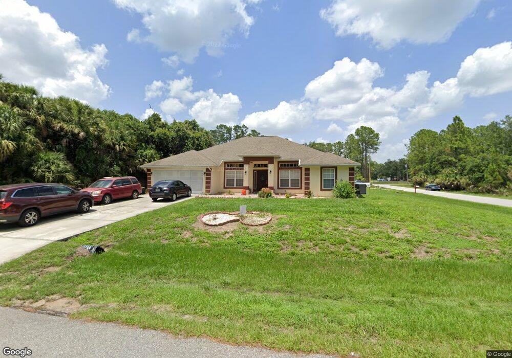
5296 Deckard Ave North Port, FL 34288
Estimated Value: $323,000 - $393,000
4
Beds
2
Baths
2,169
Sq Ft
$161/Sq Ft
Est. Value
About This Home
This home is located at 5296 Deckard Ave, North Port, FL 34288 and is currently estimated at $349,832, approximately $161 per square foot. 5296 Deckard Ave is a home located in Sarasota County with nearby schools including Atwater Elementary School, North Port High School, and Woodland Middle School.
Ownership History
Date
Name
Owned For
Owner Type
Purchase Details
Closed on
Jul 21, 2006
Sold by
Daniel Mark J
Bought by
Auguste Yves and Baptiste Ruth
Current Estimated Value
Home Financials for this Owner
Home Financials are based on the most recent Mortgage that was taken out on this home.
Original Mortgage
$180,800
Outstanding Balance
$109,124
Interest Rate
7.05%
Mortgage Type
Balloon
Estimated Equity
$240,708
Purchase Details
Closed on
Dec 14, 2005
Sold by
Adams Homes Of Northwest Florida Inc
Bought by
Daniel Mark J
Home Financials for this Owner
Home Financials are based on the most recent Mortgage that was taken out on this home.
Original Mortgage
$138,385
Interest Rate
6.37%
Mortgage Type
Fannie Mae Freddie Mac
Purchase Details
Closed on
Nov 7, 2003
Sold by
Hendrick Frank D and Hendrick Otelia C
Bought by
Natl Recreational Prop Port Charlotte L
Create a Home Valuation Report for This Property
The Home Valuation Report is an in-depth analysis detailing your home's value as well as a comparison with similar homes in the area
Home Values in the Area
Average Home Value in this Area
Purchase History
| Date | Buyer | Sale Price | Title Company |
|---|---|---|---|
| Auguste Yves | $226,000 | Dba Premier Title Of Florida | |
| Daniel Mark J | $212,900 | None Available | |
| Natl Recreational Prop Port Charlotte L | $5,000 | -- | |
| Natl Recreational Prop Port Charlotte L | $5,000 | -- |
Source: Public Records
Mortgage History
| Date | Status | Borrower | Loan Amount |
|---|---|---|---|
| Open | Auguste Yves | $180,800 | |
| Previous Owner | Daniel Mark J | $138,385 |
Source: Public Records
Tax History Compared to Growth
Tax History
| Year | Tax Paid | Tax Assessment Tax Assessment Total Assessment is a certain percentage of the fair market value that is determined by local assessors to be the total taxable value of land and additions on the property. | Land | Improvement |
|---|---|---|---|---|
| 2024 | $1,966 | $131,795 | -- | -- |
| 2023 | $1,966 | $116,256 | $0 | $0 |
| 2022 | $2,101 | $124,570 | $0 | $0 |
| 2021 | $2,056 | $120,942 | $0 | $0 |
| 2020 | $2,041 | $119,272 | $0 | $0 |
| 2019 | $1,959 | $116,590 | $0 | $0 |
| 2018 | $1,812 | $114,416 | $0 | $0 |
| 2017 | $1,767 | $112,063 | $0 | $0 |
| 2016 | $1,763 | $172,200 | $4,300 | $167,900 |
| 2015 | $1,779 | $147,900 | $4,000 | $143,900 |
| 2014 | $1,744 | $106,532 | $0 | $0 |
Source: Public Records
Map
Nearby Homes
- Lot 44 Jericho Ave
- 2121 Firebrand Rd
- LOT 3 Bonnet Ave
- 0 Blueberry Rd Unit MFRNS1085904
- 0 Blueberry Rd Unit MFROM702283
- 0 Lakeport St Unit MFRA4656813
- 2264 Ananas Rd
- 2350 Firebrand Rd
- 2363 Blueberry Rd
- 5547 Jonesboro Ave
- Lot 32 Ananas Rd
- 18 Jonesboro Ave
- 1829 Russellville St
- Lot 10 Minerva Rd
- 5540 Allamanda Ave
- 0 Myrt Rd Unit MFRN6139714
- 2261 Barrister St
- 2325 Hanford Ln
- 5661 Jonesboro Ave
- 5599 Centro Ave