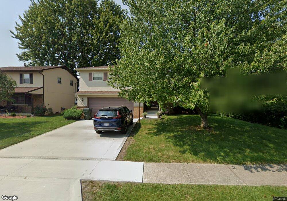
5297 Sandalwood Ct Columbus, OH 43229
Forest Park East NeighborhoodEstimated Value: $284,770 - $314,000
3
Beds
3
Baths
1,427
Sq Ft
$209/Sq Ft
Est. Value
About This Home
This home is located at 5297 Sandalwood Ct, Columbus, OH 43229 and is currently estimated at $298,693, approximately $209 per square foot. 5297 Sandalwood Ct is a home located in Franklin County with nearby schools including Parkmoor Elementary School, Woodward Park Middle School, and Northland High School.
Ownership History
Date
Name
Owned For
Owner Type
Purchase Details
Closed on
Sep 19, 1986
Bought by
Dison Rick S and Dison Mary E
Current Estimated Value
Purchase Details
Closed on
Aug 1, 1984
Create a Home Valuation Report for This Property
The Home Valuation Report is an in-depth analysis detailing your home's value as well as a comparison with similar homes in the area
Home Values in the Area
Average Home Value in this Area
Purchase History
| Date | Buyer | Sale Price | Title Company |
|---|---|---|---|
| Dison Rick S | $67,500 | -- | |
| -- | $63,500 | -- |
Source: Public Records
Tax History Compared to Growth
Tax History
| Year | Tax Paid | Tax Assessment Tax Assessment Total Assessment is a certain percentage of the fair market value that is determined by local assessors to be the total taxable value of land and additions on the property. | Land | Improvement |
|---|---|---|---|---|
| 2024 | $3,734 | $83,200 | $21,700 | $61,500 |
| 2023 | $3,686 | $83,195 | $21,700 | $61,495 |
| 2022 | $2,999 | $57,820 | $13,160 | $44,660 |
| 2021 | $3,004 | $57,820 | $13,160 | $44,660 |
| 2020 | $3,008 | $57,820 | $13,160 | $44,660 |
| 2019 | $2,529 | $41,690 | $9,730 | $31,960 |
| 2018 | $2,482 | $41,690 | $9,730 | $31,960 |
| 2017 | $2,607 | $41,690 | $9,730 | $31,960 |
| 2016 | $2,687 | $40,570 | $9,140 | $31,430 |
| 2015 | $2,440 | $40,570 | $9,140 | $31,430 |
| 2014 | $2,446 | $40,570 | $9,140 | $31,430 |
| 2013 | $1,325 | $44,555 | $9,625 | $34,930 |
Source: Public Records
Map
Nearby Homes
- 5124 Northcliff Loop W
- 1704 Riverbirch Dr
- 5231 Arrowood Ct
- 5485 Tamarack Blvd
- 1722 Blue Ash Place
- 5204 Honeytree Loop W
- 1914 Walden Dr
- 2058 Northcliff Dr
- 1493 Boxwood Dr
- 5022 Sienna Ln
- 5056 Northtowne Blvd Unit 5054
- 1687 Brookfield Square S
- 1881 Brimfield Rd
- 2158 Kilbourne Ave
- 1492 Cottonwood Dr
- 2033 Brittany Rd
- 1752 Pine Tree St S Unit H
- 5727 Tamarack Blvd Unit A
- 1743 Pine Tree St N Unit A
- 2166 Waldorf Rd
- 5289 Sandalwood Ct
- 1801 Sandalwood Place
- 1793 Sandalwood Place
- 5288 Butternut Ct E
- 5280 Butternut Ct E
- 5281 Sandalwood Ct
- 1781 Sandalwood Place
- 1819 Sandalwood Place
- 5272 Butternut Ct E
- 5296 Sandalwood Ct
- 1775 Sandalwood Place
- 5275 Sandalwood Ct
- 5296 Butternut Ct E
- 5278 Sandalwood Ct
- 5264 Butternut Ct E
- 1827 Sandalwood Place
- 5284 Sandalwood Ct
- 1792 Sandalwood Place
- 1802 Sandalwood Place