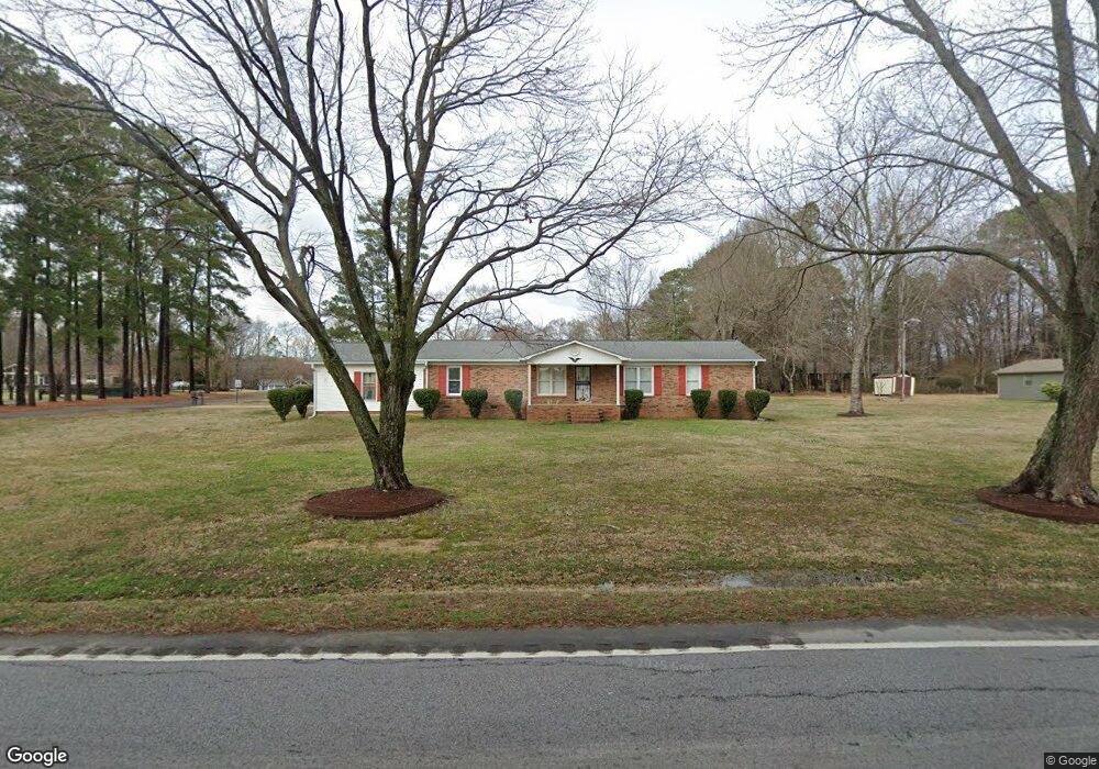
5298 Mount Gallant Rd Rock Hill, SC 29732
Estimated Value: $303,246 - $405,000
--
Bed
--
Bath
1,638
Sq Ft
$208/Sq Ft
Est. Value
About This Home
This home is located at 5298 Mount Gallant Rd, Rock Hill, SC 29732 and is currently estimated at $341,312, approximately $208 per square foot. 5298 Mount Gallant Rd is a home located in York County with nearby schools including Mount Gallant Elementary School, Dutchman Creek Middle School, and Northwestern High School.
Ownership History
Date
Name
Owned For
Owner Type
Purchase Details
Closed on
Feb 12, 2013
Sold by
Estate Of Everardus M Van Der Els
Bought by
Vander Els G M and Vander Van Der
Current Estimated Value
Purchase Details
Closed on
Jun 4, 2008
Sold by
Daves Vergie M
Bought by
Vanderels Everardus M and Vanderels Geertruida
Home Financials for this Owner
Home Financials are based on the most recent Mortgage that was taken out on this home.
Original Mortgage
$123,200
Interest Rate
6.04%
Mortgage Type
New Conventional
Create a Home Valuation Report for This Property
The Home Valuation Report is an in-depth analysis detailing your home's value as well as a comparison with similar homes in the area
Home Values in the Area
Average Home Value in this Area
Purchase History
| Date | Buyer | Sale Price | Title Company |
|---|---|---|---|
| Vander Els G M | -- | -- | |
| Vanderels Everardus M | $154,000 | -- |
Source: Public Records
Mortgage History
| Date | Status | Borrower | Loan Amount |
|---|---|---|---|
| Previous Owner | Vanderels Everardus M | $123,200 |
Source: Public Records
Tax History Compared to Growth
Tax History
| Year | Tax Paid | Tax Assessment Tax Assessment Total Assessment is a certain percentage of the fair market value that is determined by local assessors to be the total taxable value of land and additions on the property. | Land | Improvement |
|---|---|---|---|---|
| 2024 | $705 | $6,532 | $1,367 | $5,165 |
| 2023 | $723 | $6,532 | $1,367 | $5,165 |
| 2022 | $726 | $6,532 | $1,367 | $5,165 |
| 2021 | -- | $6,532 | $1,367 | $5,165 |
| 2020 | $724 | $6,532 | $0 | $0 |
| 2019 | $630 | $5,680 | $0 | $0 |
| 2018 | $626 | $5,680 | $0 | $0 |
| 2017 | $590 | $5,680 | $0 | $0 |
| 2016 | $787 | $5,680 | $0 | $0 |
| 2014 | $741 | $5,680 | $1,600 | $4,080 |
| 2013 | $741 | $5,580 | $1,600 | $3,980 |
Source: Public Records
Map
Nearby Homes
- 933 Kingswood Dr
- 5381 Woodside Dr
- 5380 Woodside Dr
- 1210 Aragon Beach Rd
- 1592 Covenant Place
- 1367 Aragon Beach Rd
- 1388 Aragon Beach Rd
- 1230 Bowater Rd
- 423 Shallowford Dr
- 440 Shallowford Dr
- 479 Shallowford Dr
- 1538 Aragon Beach Rd
- 3059 Oxtail Ct
- 239 Heatherland Dr
- 314 Challis Ct
- 3029 Oxtail Ct
- 1590 Springpoint Rd Unit E
- 1015 Hands Mill Hwy
- 1641 Bowater Rd
- 1657 Bowater Rd
- 5286 Mount Gallant Rd
- 5286 Mount Gallant Rd
- 918 Kingswood Dr
- 5283 Woodside Dr
- 909 Kingswood Dr
- 5303 Woodside Dr
- 5271 Woodside Dr
- 5296 Woodside Dr
- 5284 Woodside Dr
- 5316 Mount Gallant Rd
- 5240 Woodside Dr
- 5321 Woodside Dr
- 5302 Woodside Dr
- 915 River Pines Rd
- 5272 Woodside Dr
- 5263 Woodside Dr
- 5264 Woodside Dr
- 5328 Mount Gallant Rd
- 5333 Woodside Dr
- 936 Kingswood Dr