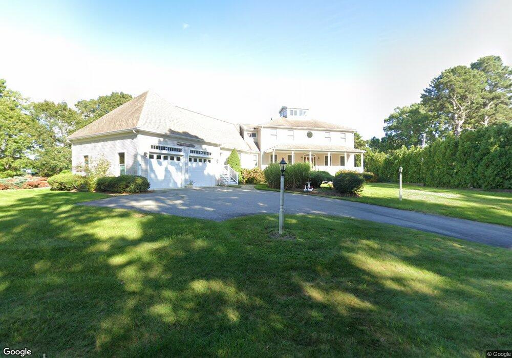
53 Aunt Debbys Rd Dennis Port, MA 02639
Dennis Port NeighborhoodEstimated Value: $1,484,000 - $1,906,456
4
Beds
5
Baths
3,897
Sq Ft
$441/Sq Ft
Est. Value
About This Home
This home is located at 53 Aunt Debbys Rd, Dennis Port, MA 02639 and is currently estimated at $1,716,819, approximately $440 per square foot. 53 Aunt Debbys Rd is a home located in Barnstable County with nearby schools including Dennis-Yarmouth Regional High School and St. Pius X. School.
Ownership History
Date
Name
Owned For
Owner Type
Purchase Details
Closed on
Jun 7, 2004
Sold by
Lucas Jennifer N
Bought by
Surrette Joan F and Surrette Robert J
Current Estimated Value
Home Financials for this Owner
Home Financials are based on the most recent Mortgage that was taken out on this home.
Original Mortgage
$619,900
Outstanding Balance
$288,394
Interest Rate
5.39%
Mortgage Type
Purchase Money Mortgage
Estimated Equity
$1,428,425
Purchase Details
Closed on
May 10, 2004
Sold by
Lucas Jennifer N and Nelson William
Bought by
Surrette Joan F and Surrette Robert A
Home Financials for this Owner
Home Financials are based on the most recent Mortgage that was taken out on this home.
Original Mortgage
$619,900
Outstanding Balance
$288,394
Interest Rate
5.39%
Mortgage Type
Purchase Money Mortgage
Estimated Equity
$1,428,425
Create a Home Valuation Report for This Property
The Home Valuation Report is an in-depth analysis detailing your home's value as well as a comparison with similar homes in the area
Home Values in the Area
Average Home Value in this Area
Purchase History
| Date | Buyer | Sale Price | Title Company |
|---|---|---|---|
| Surrette Joan F | -- | -- | |
| Surrette Joan F | $220,000 | -- |
Source: Public Records
Mortgage History
| Date | Status | Borrower | Loan Amount |
|---|---|---|---|
| Open | Surrette Joan F | $619,900 |
Source: Public Records
Tax History Compared to Growth
Tax History
| Year | Tax Paid | Tax Assessment Tax Assessment Total Assessment is a certain percentage of the fair market value that is determined by local assessors to be the total taxable value of land and additions on the property. | Land | Improvement |
|---|---|---|---|---|
| 2025 | $7,215 | $1,666,300 | $356,300 | $1,310,000 |
| 2024 | $7,170 | $1,633,200 | $342,700 | $1,290,500 |
| 2023 | $6,815 | $1,459,400 | $311,500 | $1,147,900 |
| 2022 | $6,048 | $1,080,000 | $280,600 | $799,400 |
| 2021 | $5,838 | $968,200 | $275,100 | $693,100 |
| 2020 | $5,230 | $857,300 | $275,100 | $582,200 |
| 2019 | $5,191 | $841,400 | $292,800 | $548,600 |
| 2018 | $4,988 | $786,800 | $232,300 | $554,500 |
| 2017 | $5,223 | $849,300 | $232,300 | $617,000 |
| 2016 | $5,075 | $777,200 | $252,300 | $524,900 |
| 2015 | $4,974 | $777,200 | $252,300 | $524,900 |
| 2014 | $5,048 | $794,900 | $252,300 | $542,600 |
Source: Public Records
Map
Nearby Homes
- 20 Aunt Debbys Rd
- 24 Indian Trail
- 171 Searsville Rd
- 78 Upper County Rd Unit A&B
- 78 Upper County Rd
- 116 Searsville Rd
- 360 Center St
- 95 Center St
- 11 Lane Rd
- 125 Main St Unit 3
- 268 Main St
- 29 Highland St
- 71 Main St
- 4 Coffey Ln
- 9 Country Ln
- 12 Candlewood Ln Unit 2-9
- 10 Candlewood Ln Unit 2-1
- 72 Bassett Ln
- 26 Center St
- 537 Depot St
- 62 Aunt Debbys Rd
- 58 Aunt Debbys Rd
- 58 Aunt Debbys Rd
- 54 Aunt Debbys Rd
- 275 Center St
- 273 Center St
- 265 Center St
- 45 Aunt Debbys Rd
- 50 Aunt Debbys Rd
- 7 Rowena Way
- 289 Center St
- 12 Rowena Way
- 41 Aunt Debbys Rd
- 11 Rowena Way
- 46 Aunt Debbys Rd
- 11 Rowena
- 7 Rowena
- 282 Center St
- 261 Center St
- 15 Rowena Way