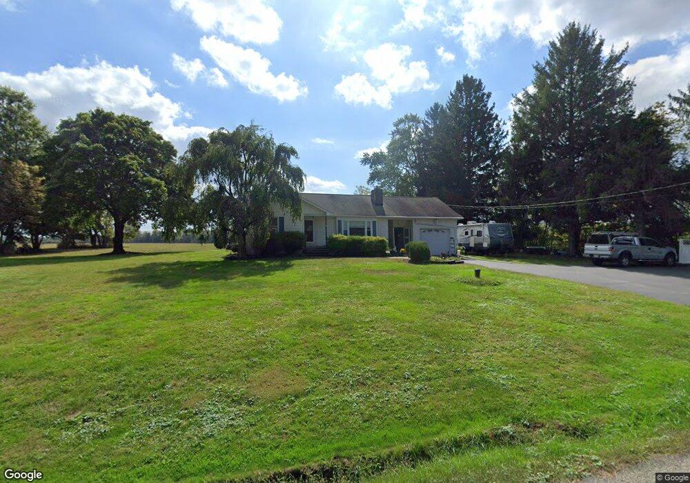
53 Baker Rd Pittstown, NJ 08867
Franklin NeighborhoodEstimated Value: $272,000 - $516,000
Studio
--
Bath
1,358
Sq Ft
$307/Sq Ft
Est. Value
About This Home
This home is located at 53 Baker Rd, Pittstown, NJ 08867 and is currently estimated at $416,598, approximately $306 per square foot. 53 Baker Rd is a home located in Hunterdon County with nearby schools including Franklin Township School and North Hunterdon High School.
Ownership History
Date
Name
Owned For
Owner Type
Purchase Details
Closed on
Feb 13, 2004
Sold by
Leon Diane S
Bought by
Wadle Rudy K and Wadle Jamie A
Current Estimated Value
Home Financials for this Owner
Home Financials are based on the most recent Mortgage that was taken out on this home.
Original Mortgage
$180,000
Outstanding Balance
$83,186
Interest Rate
5.62%
Mortgage Type
Credit Line Revolving
Estimated Equity
$333,412
Purchase Details
Closed on
Feb 9, 2004
Sold by
Berger Wayne
Bought by
Leon Berger Diane
Home Financials for this Owner
Home Financials are based on the most recent Mortgage that was taken out on this home.
Original Mortgage
$180,000
Outstanding Balance
$83,186
Interest Rate
5.62%
Mortgage Type
Credit Line Revolving
Estimated Equity
$333,412
Purchase Details
Closed on
Mar 22, 1991
Sold by
Miller Mildred
Bought by
Berger Wane and Berger Diane L
Create a Home Valuation Report for This Property
The Home Valuation Report is an in-depth analysis detailing your home's value as well as a comparison with similar homes in the area
Home Values in the Area
Average Home Value in this Area
Purchase History
| Date | Buyer | Sale Price | Title Company |
|---|---|---|---|
| Wadle Rudy K | $160,000 | -- | |
| Leon Berger Diane | -- | -- | |
| Berger Wane | $100,000 | -- | |
| Burger Wayne | $100,000 | -- |
Source: Public Records
Mortgage History
| Date | Status | Borrower | Loan Amount |
|---|---|---|---|
| Open | Wadle Rudy K | $180,000 | |
| Closed | Leon Berger Diane | $180,000 |
Source: Public Records
Tax History
| Year | Tax Paid | Tax Assessment Tax Assessment Total Assessment is a certain percentage of the fair market value that is determined by local assessors to be the total taxable value of land and additions on the property. | Land | Improvement |
|---|---|---|---|---|
| 2025 | $8,381 | $278,800 | $162,300 | $116,500 |
| 2024 | $7,924 | $278,800 | $162,300 | $116,500 |
Source: Public Records
Map
Nearby Homes
- 39 Sky Manor Rd
- 14 Woodland Rd
- 24 Locust Grove Rd
- 1491&1493 Cty Rd 519
- 271 County Road 513
- 240 Oak Grove Rd
- 152 White Bridge Rd
- 20 Northwood Dr
- 1068 County Road519
- 7 Maple Springs Rd
- 56 Old Route12
- 1663 County Road 519
- 990 County Road 519
- 1491&1493 County Road 519
- 39 Upper Kingtown Rd
- 124 Fitzer Rd
- 130 Fitzer Rd
- 863 County Road 519
- 550 Barbertown Point Breeze Rd
- 60 Perryville Rd
- 52 Baker Rd
- 56 Baker Rd
- 6 Samuel Wilson Ln
- 3 Samuel Wilson Ln
- 8 Samuel Wilson Ln
- 5 Samuel Wilson Ln
- 7 Samuel Wilson Ln
- 10 Samuel Wilson Ln
- 9 Samuel Wilson Ln
- 12 Samuel Wilson Ln
- 24 Baker Rd
- 11 Samuel Wilson Ln
- 91 Sky Manor Rd
- 14 Samuel Wilson Ln
- 87 Sky Manor Rd
- 79 Sky Manor Rd
- 89 Sky Manor Rd
- 77 Sky Manor Rd
- 73 Sky Manor Rd
- 93 Sky Manor Rd
Your Personal Tour Guide
Ask me questions while you tour the home.