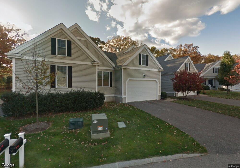
53 Balancing Rock Dr Unit 3 Holliston, MA 01746
Estimated Value: $665,000 - $679,040
2
Beds
3
Baths
2,282
Sq Ft
$294/Sq Ft
Est. Value
About This Home
This home is located at 53 Balancing Rock Dr Unit 3, Holliston, MA 01746 and is currently estimated at $671,760, approximately $294 per square foot. 53 Balancing Rock Dr Unit 3 is a home located in Middlesex County with nearby schools including Miller Elementary School, Robert H. Adams Middle School, and Holliston High School.
Ownership History
Date
Name
Owned For
Owner Type
Purchase Details
Closed on
May 29, 2025
Sold by
Evanoff Kevin J and Bingham Robin K
Bought by
Chapin Rt and Chapin
Current Estimated Value
Purchase Details
Closed on
Dec 17, 2008
Sold by
Evanoff Norma G
Bought by
Evanoff Kevin John and Wood Pamela Lee
Purchase Details
Closed on
Mar 19, 2007
Sold by
Balancing Rock Llc
Bought by
Evanoff John A and Evanoff Norma G
Create a Home Valuation Report for This Property
The Home Valuation Report is an in-depth analysis detailing your home's value as well as a comparison with similar homes in the area
Home Values in the Area
Average Home Value in this Area
Purchase History
| Date | Buyer | Sale Price | Title Company |
|---|---|---|---|
| Chapin Rt | $665,000 | None Available | |
| Chapin Rt | $665,000 | None Available | |
| Evanoff Kevin John | -- | -- | |
| Evanoff Kevin John | -- | -- | |
| Evanoff Kevin John | -- | -- | |
| Evanoff John A | $447,850 | -- | |
| Evanoff John A | $447,850 | -- | |
| Evanoff John A | $447,850 | -- |
Source: Public Records
Tax History Compared to Growth
Tax History
| Year | Tax Paid | Tax Assessment Tax Assessment Total Assessment is a certain percentage of the fair market value that is determined by local assessors to be the total taxable value of land and additions on the property. | Land | Improvement |
|---|---|---|---|---|
| 2025 | $9,184 | $626,900 | $0 | $626,900 |
| 2024 | $9,095 | $603,900 | $0 | $603,900 |
| 2023 | $9,141 | $593,600 | $0 | $593,600 |
| 2022 | $8,188 | $471,100 | $0 | $471,100 |
| 2021 | $8,245 | $461,900 | $0 | $461,900 |
| 2020 | $8,652 | $459,000 | $0 | $459,000 |
| 2019 | $8,067 | $428,400 | $0 | $428,400 |
| 2018 | $7,998 | $428,400 | $0 | $428,400 |
| 2017 | $7,934 | $428,400 | $0 | $428,400 |
| 2016 | $7,666 | $408,000 | $0 | $408,000 |
| 2015 | $7,709 | $397,800 | $0 | $397,800 |
Source: Public Records
Map
Nearby Homes
- 56 Paul Rd
- 85 Fisher St
- 78 Fisher St
- 15 Broad Acres Farm Rd
- 4 Deerfield Rd
- Lot 2 Hanlon Rd
- 6 Rainbow Dr
- 75 Ridge Rd
- 4 E Charles St
- 12 Longmeadow Ln
- Lot 1 Florence St
- 15 Free St
- 22 Granite St
- 17 Middleton St
- 35 Woodland Ave Unit 35A
- 11 Shadowbrook Ln Unit 9
- 3 Shadowbrook Ln Unit 3
- 18 Shadowbrook Ln Unit 17
- 14 Shadowbrook Ln Unit 30
- 9 Tulip Way
- 61 Balancing Rock Dr
- 57 Balancing Rock Dr
- 53 Balancing Rock Dr
- 61 Balancing Rock Dr Unit 1
- 65 Balancing Rock Dr
- 49 Balancing Rock Dr
- 45 Balancing Rock Dr
- 50 Balancing Rock Dr
- 2249 Washington St
- 41 Balancing Rock Dr
- 41 Balancing Rock Dr Unit 41
- 54 Balancing Rock Dr
- 58 Balancing Rock Dr
- 54 Balancing Rock Dr Unit 54
- 54 Balancing Rock Dr Unit 11
- 58 Balancing Rock Dr Unit 12
- 40 Balancing Rock Dr
- 2217 Washington St
- 2220 Washington St
- 25 Balancing Rock Dr