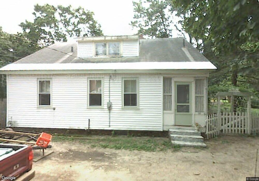
53 Bennett Ln Lancaster, MA 01523
Estimated Value: $355,463 - $379,000
2
Beds
1
Bath
1,263
Sq Ft
$291/Sq Ft
Est. Value
About This Home
This home is located at 53 Bennett Ln, Lancaster, MA 01523 and is currently estimated at $367,616, approximately $291 per square foot. 53 Bennett Ln is a home with nearby schools including Mary Rowlandson Elementary School, Luther Burbank Middle School, and Nashoba Regional High School.
Ownership History
Date
Name
Owned For
Owner Type
Purchase Details
Closed on
Jun 15, 2001
Sold by
Wilder Barbara A
Bought by
Howe Timothy J
Current Estimated Value
Home Financials for this Owner
Home Financials are based on the most recent Mortgage that was taken out on this home.
Original Mortgage
$74,256
Interest Rate
7.15%
Mortgage Type
Purchase Money Mortgage
Create a Home Valuation Report for This Property
The Home Valuation Report is an in-depth analysis detailing your home's value as well as a comparison with similar homes in the area
Home Values in the Area
Average Home Value in this Area
Purchase History
| Date | Buyer | Sale Price | Title Company |
|---|---|---|---|
| Howe Timothy J | $72,800 | -- |
Source: Public Records
Mortgage History
| Date | Status | Borrower | Loan Amount |
|---|---|---|---|
| Open | Howe Timothy J | $116,000 | |
| Closed | Howe Timothy J | $30,000 | |
| Closed | Howe Timothy J | $74,256 |
Source: Public Records
Tax History
| Year | Tax Paid | Tax Assessment Tax Assessment Total Assessment is a certain percentage of the fair market value that is determined by local assessors to be the total taxable value of land and additions on the property. | Land | Improvement |
|---|---|---|---|---|
| 2025 | $3,588 | $222,000 | $98,300 | $123,700 |
| 2024 | $3,838 | $219,800 | $91,500 | $128,300 |
| 2023 | $3,414 | $198,600 | $83,200 | $115,400 |
| 2022 | $3,540 | $182,000 | $86,500 | $95,500 |
| 2021 | $3,441 | $172,200 | $86,500 | $85,700 |
| 2020 | $3,289 | $165,700 | $86,500 | $79,200 |
| 2019 | $3,182 | $161,100 | $86,500 | $74,600 |
| 2018 | $3,121 | $156,200 | $86,500 | $69,700 |
| 2016 | $2,944 | $150,600 | $85,800 | $64,800 |
| 2015 | $2,822 | $150,400 | $85,800 | $64,600 |
| 2014 | $2,767 | $146,300 | $85,800 | $60,500 |
Source: Public Records
Map
Nearby Homes
- 76 Mill St Unit 3
- 132 Kilbourn Rd
- 73 Prescott St
- 0 Parker Rd
- 12 Woodruff Rd
- 508 High St
- 46 Woodruff Rd
- 93 Forest St
- 18 Highfield Dr
- 920 Ridgefield Cir Unit C
- 101 Woodruff Rd
- 5 Catherine St
- 54 S Meadow Rd
- 719 Main St
- 57 Clark St
- 308 Ridgefield Cir Unit C
- 229 Sterling St
- 37 Sterling St
- 610 Ridgefield Cir Unit B
- 20 Willow St
- 56 Bennett Ln
- 45 Bennett Ln
- 43 Kilbourn Rd
- 43 Kilbourn Rd
- 29 Bennett Ln
- 33 Kilbourn Rd
- 41 Kilbourn Rd
- 27 Bennett Ln
- 65 Kilbourn Rd
- 88 Mill St
- 42 Kilbourn Rd
- 25 Bennett Ln
- 62 Kilbourn Rd
- 62 Kilbourn Rd Unit 62 kilbourn unit 2
- 62 Kilbourn Rd Unit 2
- 56 Kilbourn Rd
- 77 Kilbourn Rd
- 32 Kilbourn Rd
- 112 Mill St
- 76 Mill St Unit 6
Your Personal Tour Guide
Ask me questions while you tour the home.