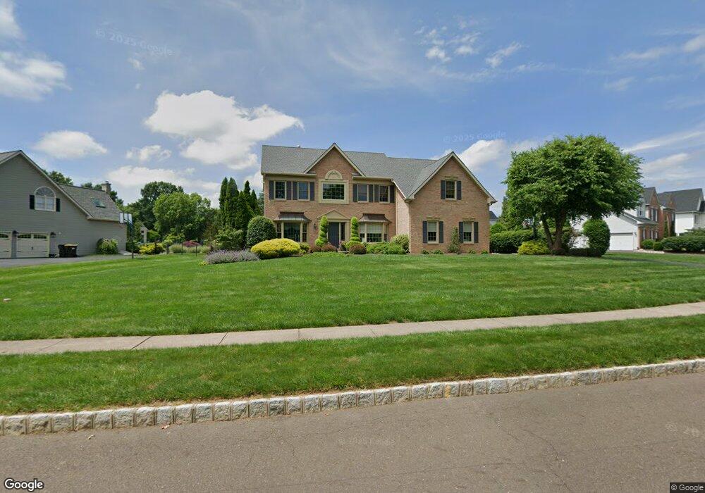
53 Bittersweet Dr Doylestown, PA 18901
Estimated Value: $1,045,000 - $1,073,000
4
Beds
3
Baths
3,298
Sq Ft
$321/Sq Ft
Est. Value
About This Home
This home is located at 53 Bittersweet Dr, Doylestown, PA 18901 and is currently estimated at $1,057,307, approximately $320 per square foot. 53 Bittersweet Dr is a home located in Bucks County with nearby schools including Kutz Elementary School, Lenape Middle School, and Central Bucks High School-West.
Ownership History
Date
Name
Owned For
Owner Type
Purchase Details
Closed on
Mar 25, 1998
Sold by
The Cutler Group Inc
Bought by
Keeley Kevin J and Keeley Dawn E
Current Estimated Value
Home Financials for this Owner
Home Financials are based on the most recent Mortgage that was taken out on this home.
Original Mortgage
$210,000
Outstanding Balance
$38,281
Interest Rate
6.98%
Estimated Equity
$1,019,026
Create a Home Valuation Report for This Property
The Home Valuation Report is an in-depth analysis detailing your home's value as well as a comparison with similar homes in the area
Home Values in the Area
Average Home Value in this Area
Purchase History
| Date | Buyer | Sale Price | Title Company |
|---|---|---|---|
| Keeley Kevin J | $318,640 | -- |
Source: Public Records
Mortgage History
| Date | Status | Borrower | Loan Amount |
|---|---|---|---|
| Open | Keeley Kevin J | $210,000 |
Source: Public Records
Tax History Compared to Growth
Tax History
| Year | Tax Paid | Tax Assessment Tax Assessment Total Assessment is a certain percentage of the fair market value that is determined by local assessors to be the total taxable value of land and additions on the property. | Land | Improvement |
|---|---|---|---|---|
| 2025 | $11,389 | $64,360 | $7,480 | $56,880 |
| 2024 | $11,389 | $64,360 | $7,480 | $56,880 |
| 2023 | $10,860 | $64,360 | $7,480 | $56,880 |
| 2022 | $10,739 | $64,360 | $7,480 | $56,880 |
| 2021 | $10,518 | $64,360 | $7,480 | $56,880 |
| 2020 | $10,470 | $64,360 | $7,480 | $56,880 |
| 2019 | $10,357 | $64,360 | $7,480 | $56,880 |
| 2018 | $10,325 | $64,360 | $7,480 | $56,880 |
| 2017 | $10,245 | $64,360 | $7,480 | $56,880 |
| 2016 | $10,180 | $64,360 | $7,480 | $56,880 |
| 2015 | -- | $64,360 | $7,480 | $56,880 |
| 2014 | -- | $64,360 | $7,480 | $56,880 |
Source: Public Records
Map
Nearby Homes
- 222 Windsor Way
- 137 Wells Rd
- 1101 Deerfield Ln
- 20 Woodstone Dr
- 82 Avalon Ct Unit 2005
- 60 Quarry Rd
- 125 Edison Furlong Rd
- 612 Bethel Ln Unit THE ROOSEVELT PLAN
- 47 Mill Creek Dr Unit 32
- 47 Mill Creek Dr
- 52 Tradesville Dr Unit 83
- Vetri Plan at Doylestown Walk
- 52 Tradesville Dr
- 2 Mill Creek Dr
- 2 Mill Creek Dr Unit 137
- 6 Mill Creek Dr
- 73 Tradesville Dr
- 73 Tradesville Dr Unit 80
- 1 Mill Creek Dr
- 21 Mill Creek Dr Unit 11
- 57 Bittersweet Dr
- 49 Bittersweet Dr
- 54 Bittersweet Dr
- 52 Bittersweet Dr
- 4 Windrose Cir
- 3 Hudson Ct
- 56 Bittersweet Dr
- 59 Bittersweet Dr
- 2 Windrose Cir
- 50 Bittersweet Dr
- 5 Hudson Ct
- 58 Bittersweet Dr
- 48 Bittersweet Dr
- 8 Windrose Cir
- 46 Bittersweet Dr
- 61 Bittersweet Dr
- 3 Windrose Cir
- 60 Bittersweet Dr
- 39 Bittersweet Dr
- 6 Hudson Ct