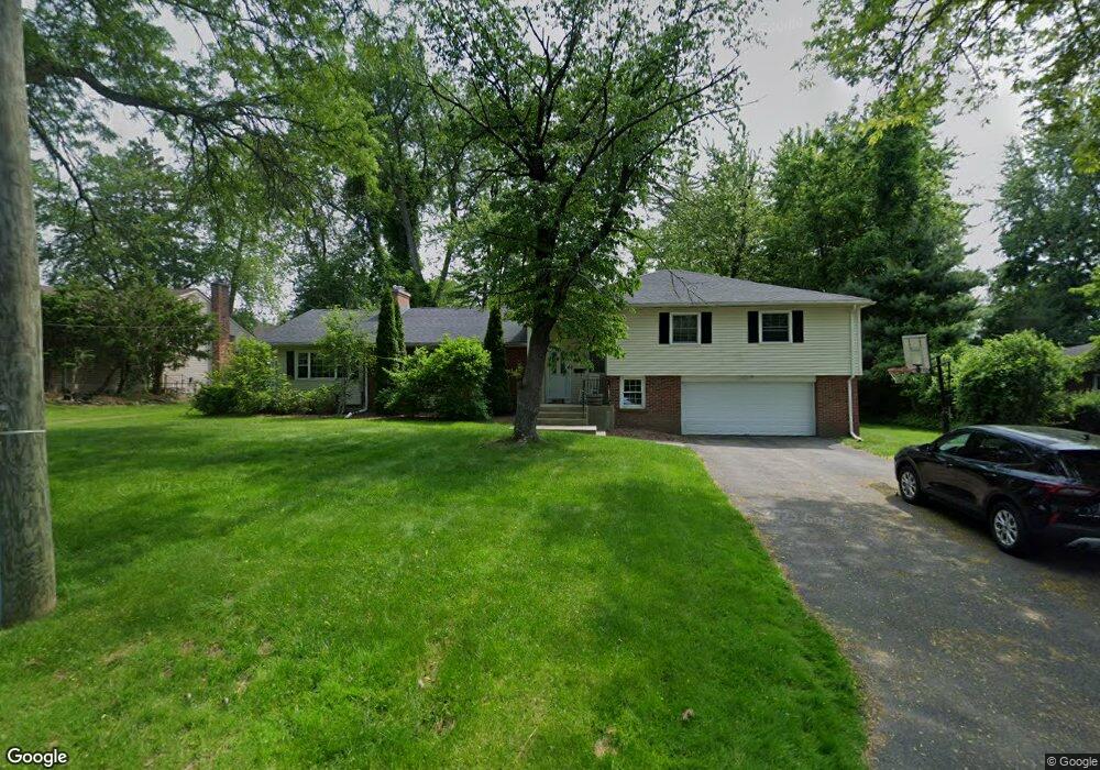
53 Briarcliff Rd Longmeadow, MA 01106
Estimated Value: $610,000 - $662,000
4
Beds
4
Baths
2,677
Sq Ft
$238/Sq Ft
Est. Value
About This Home
This home is located at 53 Briarcliff Rd, Longmeadow, MA 01106 and is currently estimated at $637,517, approximately $238 per square foot. 53 Briarcliff Rd is a home located in Hampden County with nearby schools including Center Elementary School, Williams Middle School, and Longmeadow High School.
Ownership History
Date
Name
Owned For
Owner Type
Purchase Details
Closed on
Jan 18, 2008
Sold by
Kobrosky Gary and Kobrosky Krystyna
Bought by
Rice Timothy B
Current Estimated Value
Home Financials for this Owner
Home Financials are based on the most recent Mortgage that was taken out on this home.
Original Mortgage
$272,000
Outstanding Balance
$170,435
Interest Rate
6.02%
Mortgage Type
Purchase Money Mortgage
Estimated Equity
$467,082
Purchase Details
Closed on
Sep 22, 2004
Sold by
Kobrosky Neil
Bought by
Kobrosky Gary and Kobrosky Krystyna
Create a Home Valuation Report for This Property
The Home Valuation Report is an in-depth analysis detailing your home's value as well as a comparison with similar homes in the area
Home Values in the Area
Average Home Value in this Area
Purchase History
| Date | Buyer | Sale Price | Title Company |
|---|---|---|---|
| Rice Timothy B | $342,000 | -- | |
| Kobrosky Gary | $60,000 | -- |
Source: Public Records
Mortgage History
| Date | Status | Borrower | Loan Amount |
|---|---|---|---|
| Open | Rice Timothy B | $272,000 |
Source: Public Records
Tax History Compared to Growth
Tax History
| Year | Tax Paid | Tax Assessment Tax Assessment Total Assessment is a certain percentage of the fair market value that is determined by local assessors to be the total taxable value of land and additions on the property. | Land | Improvement |
|---|---|---|---|---|
| 2025 | $11,434 | $541,400 | $168,400 | $373,000 |
| 2024 | $11,196 | $541,400 | $168,400 | $373,000 |
| 2023 | $11,002 | $480,000 | $153,600 | $326,400 |
| 2022 | $10,024 | $406,800 | $153,600 | $253,200 |
| 2021 | $9,624 | $389,000 | $146,300 | $242,700 |
| 2020 | $9,038 | $373,300 | $146,300 | $227,000 |
| 2019 | $8,868 | $368,100 | $146,300 | $221,800 |
| 2018 | $8,463 | $347,700 | $170,200 | $177,500 |
| 2017 | $8,038 | $340,900 | $170,200 | $170,700 |
| 2016 | $7,752 | $318,600 | $154,700 | $163,900 |
| 2015 | $7,488 | $317,000 | $153,100 | $163,900 |
Source: Public Records
Map
Nearby Homes
- 50 Elmwood Ave
- 260 Longmeadow St
- 32 Edgewood Ave
- 118 Field Rd
- 33 Severn St
- 44 Wendover Rd
- 51 Merrell Dr
- 114 Park Dr
- 124 Tecumseh Dr
- 60 Alhambra Cir S
- 1168 River Rd
- 0 Dennis Rd
- 132 Coventry Ln
- 23 Peros Dr
- 72 Plantation Dr
- 283 Longhill St
- 29 Plantation Dr Unit 29
- 52 Peros Dr
- 106 Magnolia Terrace
- 68 Peros Dr
- 43 Briarcliff Rd
- 63 Briarcliff Rd
- 64 Elmwood Ave
- 44 Elmwood Ave
- 44 Elmwood Ave Unit 44
- 40 Elmwood Ave
- 52 Briarcliff Rd
- 60 Briarcliff Rd
- 68 Elmwood Ave
- 31 Briarcliff Rd
- 32 Elmwood Ave
- 77 Briarcliff Rd
- 40 Briarcliff Rd
- 51 Elmwood Ave
- 26 Elmwood Ave
- 47 Elmwood Ave
- 61 Elmwood Ave
- 80 Elmwood Ave
- 78 Briarcliff Rd
- 67 Elmwood Ave