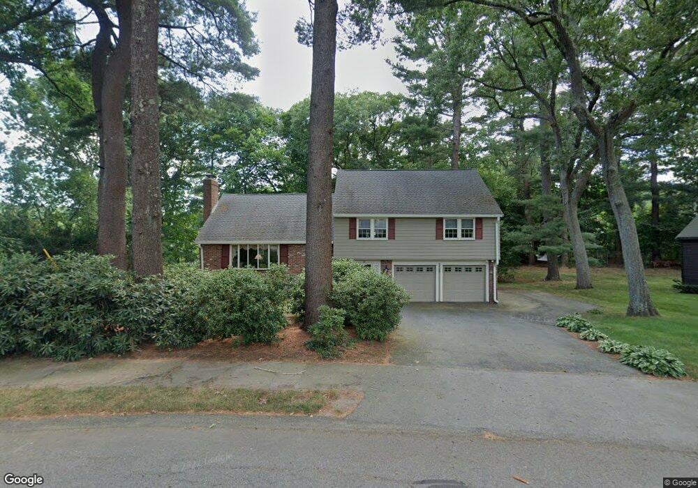
53 Clarke Rd Needham, MA 02492
Estimated Value: $1,238,000 - $1,396,094
4
Beds
3
Baths
1,516
Sq Ft
$878/Sq Ft
Est. Value
About This Home
This home is located at 53 Clarke Rd, Needham, MA 02492 and is currently estimated at $1,330,524, approximately $877 per square foot. 53 Clarke Rd is a home located in Norfolk County with nearby schools including Sunita L. Williams Elementary School, High Rock Middle School, and Pollard Middle School.
Create a Home Valuation Report for This Property
The Home Valuation Report is an in-depth analysis detailing your home's value as well as a comparison with similar homes in the area
Home Values in the Area
Average Home Value in this Area
Tax History
| Year | Tax Paid | Tax Assessment Tax Assessment Total Assessment is a certain percentage of the fair market value that is determined by local assessors to be the total taxable value of land and additions on the property. | Land | Improvement |
|---|---|---|---|---|
| 2025 | $14,745 | $1,391,000 | $1,108,700 | $282,300 |
| 2024 | $10,861 | $867,500 | $621,300 | $246,200 |
| 2023 | $11,036 | $846,300 | $621,300 | $225,000 |
| 2022 | $10,622 | $794,500 | $576,300 | $218,200 |
| 2021 | $10,352 | $794,500 | $576,300 | $218,200 |
| 2020 | $10,047 | $804,400 | $576,300 | $228,100 |
| 2019 | $9,312 | $751,600 | $525,200 | $226,400 |
| 2018 | $8,929 | $751,600 | $525,200 | $226,400 |
| 2017 | $8,579 | $721,500 | $525,200 | $196,300 |
| 2016 | $8,326 | $721,500 | $525,200 | $196,300 |
| 2015 | $8,146 | $721,500 | $525,200 | $196,300 |
| 2014 | $7,784 | $668,700 | $478,700 | $190,000 |
Source: Public Records
Map
Nearby Homes
- 70 Briarwood Cir
- 102 Jarvis Cir Unit 102
- 15 Mackintosh Ave
- 36 Eliot Rd
- 81 Parish Rd
- 19 Mason Rd
- 34 Pershing Rd
- 12 Hill St
- 3 Hancock Rd
- 151 Oakland St
- 37 Standish Rd
- 48 Taylor St
- 21 Brewster Dr
- 52 Hancock Rd
- 15 Alden Rd
- 3 Crescent Rd
- 379 Hunnewell St Unit 379
- 100 Rosemary Way Unit 129
- 385 Hillside Ave
- 385 Hillside Ave Unit 385
Your Personal Tour Guide
Ask me questions while you tour the home.