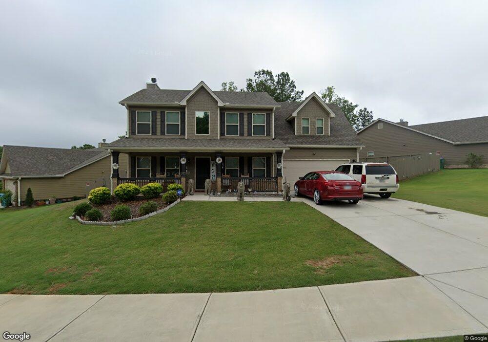
53 Dockside Dr Unit 55 Statham, GA 30666
Estimated Value: $340,684 - $385,000
4
Beds
3
Baths
2,200
Sq Ft
$164/Sq Ft
Est. Value
About This Home
This home is located at 53 Dockside Dr Unit 55, Statham, GA 30666 and is currently estimated at $361,171, approximately $164 per square foot. 53 Dockside Dr Unit 55 is a home located in Barrow County with nearby schools including Statham Elementary School, Bear Creek Middle School, and Winder-Barrow High School.
Ownership History
Date
Name
Owned For
Owner Type
Purchase Details
Closed on
Nov 8, 2020
Sold by
Southfork Homes Llc
Bought by
Bolton Antonio and Bolton Antonia Benn
Current Estimated Value
Purchase Details
Closed on
Mar 23, 2020
Sold by
Embassy Development Llc
Bought by
Southfork Homes Llc
Purchase Details
Closed on
Jun 26, 2018
Sold by
Ala Providence Estates Llc
Bought by
Embassy Development Llc
Create a Home Valuation Report for This Property
The Home Valuation Report is an in-depth analysis detailing your home's value as well as a comparison with similar homes in the area
Home Values in the Area
Average Home Value in this Area
Purchase History
| Date | Buyer | Sale Price | Title Company |
|---|---|---|---|
| Bolton Antonio | $234,900 | -- | |
| Southfork Homes Llc | $246,500 | -- | |
| Embassy Development Llc | $756,000 | -- |
Source: Public Records
Tax History
| Year | Tax Paid | Tax Assessment Tax Assessment Total Assessment is a certain percentage of the fair market value that is determined by local assessors to be the total taxable value of land and additions on the property. | Land | Improvement |
|---|---|---|---|---|
| 2025 | $3,784 | $118,498 | $20,800 | $97,698 |
| 2024 | $3,443 | $115,637 | $20,800 | $94,837 |
| 2023 | $2,970 | $115,637 | $20,800 | $94,837 |
| 2022 | $2,915 | $98,568 | $20,800 | $77,768 |
| 2021 | $2,751 | $86,864 | $18,000 | $68,864 |
| 2020 | $229 | $7,200 | $7,200 | $0 |
| 2019 | $233 | $7,200 | $7,200 | $0 |
| 2018 | $348 | $10,800 | $10,800 | $0 |
| 2017 | $377 | $10,800 | $10,800 | $0 |
Source: Public Records
Map
Nearby Homes
- 139 Goldshore Way
- 38 Goldshore Way
- 210 Charlotte Cir
- 174 Charlotte Cir
- 406 Ellerbe Dr Unit 3
- 133 Charlotte Dr
- 115 Charlotte Dr
- 190 Charlotte Cir
- 95 Charlotte Dr
- 1975 Broad St
- 304 Seminole Cir
- 235 1st St
- 16 Georgia Highway 211
- 0 1st St Unit 10689434
- 0 1st St Unit 7713343
- 1907 Broad St
- 619 Graham Campbell Ln
- 2124 Broad St
- 350 Graham Campbell Ln
- 32 Graham Campbell Ln
- 25 Dockside Dr
- 25 Dockside Dr Unit 56
- 75 Dockside Dr Unit 54
- 17 Dockside Dr
- 87 Dockside Dr Unit 53
- 68 Dockside Dr
- 48 Dockside Dr Unit 38
- 80 Dockside Dr Unit 41
- 120 Goldshore Way Unit 36
- 120 Goldshore Way
- 97 Dockside Dr Unit 52
- 6 Goldshore Way
- 110 Goldshore Way Unit 35
- 110 Goldshore Way
- 92 Dockside Dr Unit 42
- 149 Goldshore Way
- 104 Dockside Dr Unit 43
- 139 Goldshore Way Unit 12
- 171 Goldshore Way
- 98 Goldshore Way Unit 34
Your Personal Tour Guide
Ask me questions while you tour the home.