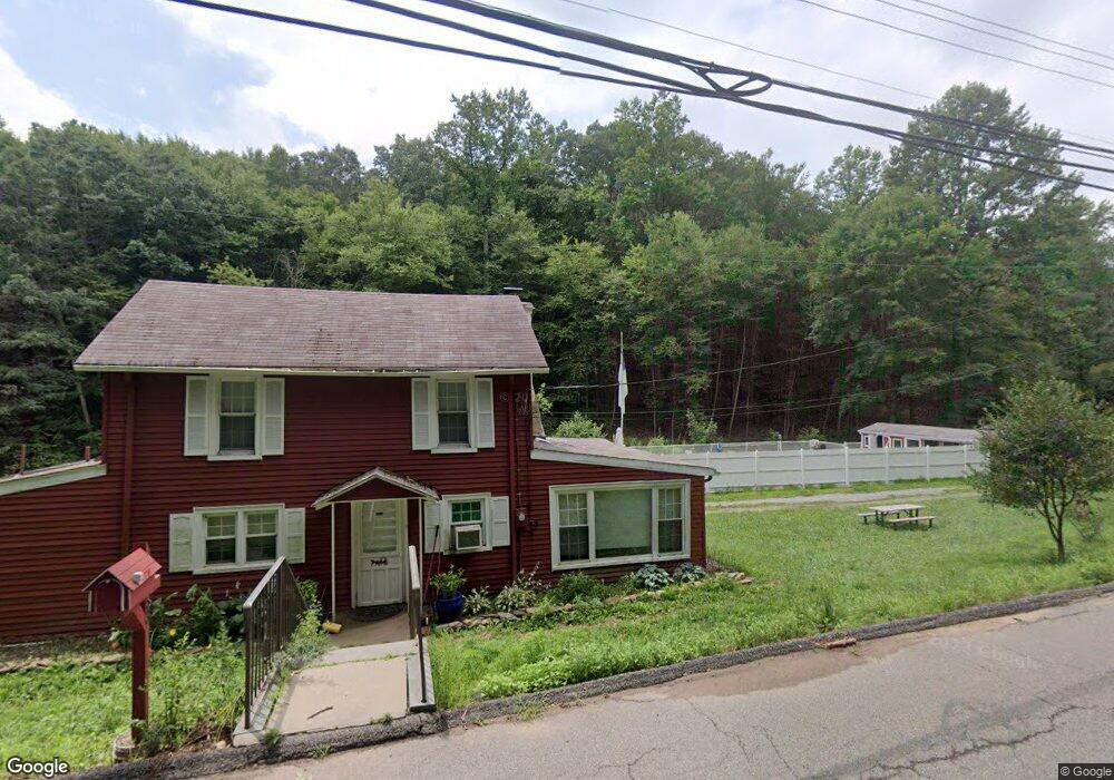
53 Fords Rd Randolph, NJ 07869
Estimated Value: $661,000 - $733,000
Studio
--
Bath
1,874
Sq Ft
$367/Sq Ft
Est. Value
About This Home
This home is located at 53 Fords Rd, Randolph, NJ 07869 and is currently estimated at $688,479, approximately $367 per square foot. 53 Fords Rd is a home located in Morris County with nearby schools including Randolph High School, Randolph Middle School, and Apple Montessori Schools and Camps - Randolph.
Ownership History
Date
Name
Owned For
Owner Type
Purchase Details
Closed on
Jun 4, 2015
Sold by
Bruno John and Bruno Patricia A
Bought by
Sewell Glen Laan and Yeung Nancy
Current Estimated Value
Home Financials for this Owner
Home Financials are based on the most recent Mortgage that was taken out on this home.
Original Mortgage
$320,000
Outstanding Balance
$246,961
Interest Rate
3.65%
Mortgage Type
New Conventional
Estimated Equity
$441,518
Create a Home Valuation Report for This Property
The Home Valuation Report is an in-depth analysis detailing your home's value as well as a comparison with similar homes in the area
Home Values in the Area
Average Home Value in this Area
Purchase History
| Date | Buyer | Sale Price | Title Company |
|---|---|---|---|
| Sewell Glen Laan | $400,000 | Chicago Title Insurance Co |
Source: Public Records
Mortgage History
| Date | Status | Borrower | Loan Amount |
|---|---|---|---|
| Open | Sewell Glen Laan | $320,000 |
Source: Public Records
Tax History
| Year | Tax Paid | Tax Assessment Tax Assessment Total Assessment is a certain percentage of the fair market value that is determined by local assessors to be the total taxable value of land and additions on the property. | Land | Improvement |
|---|---|---|---|---|
| 2025 | $10,243 | $361,800 | $163,600 | $198,200 |
| 2024 | $9,986 | $361,800 | $163,600 | $198,200 |
Source: Public Records
Map
Nearby Homes
- 31 Edinburgh Dr
- 384 Millbrook Ave
- 12 Birch St
- 107 High St
- 33 Shongum Rd
- 3 Marble Ln
- 49 Kearney St
- 121 W Munson Ave
- 58 Conrad Place
- 51 Linwood Ave
- 77B Highland Way
- 67 Victory Ct Unit 67B
- 71 Washington Ave Unit 73
- 44 Shongum Rd
- 170 Park Heights Ave
- 3 Springhill Rd
- 142 W Blackwell St
- 46 W Hanover Ave
- 86 Route 10
- 15 Skytop Dr
Your Personal Tour Guide
Ask me questions while you tour the home.