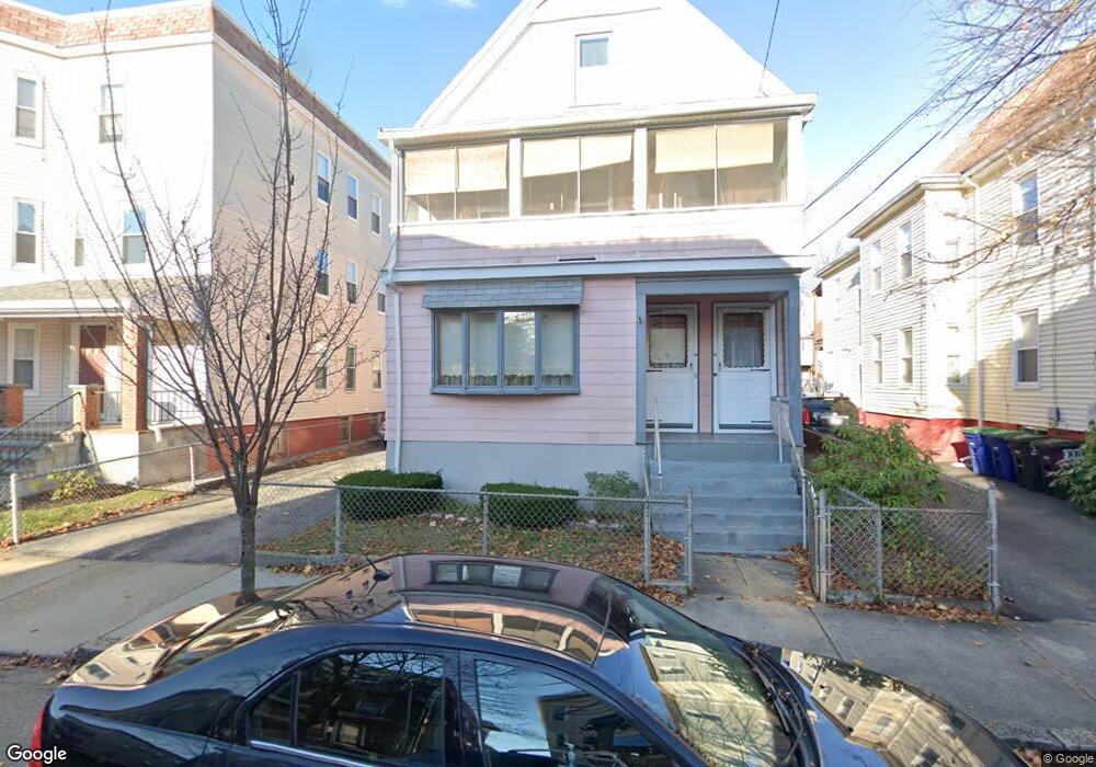
53 Gorham St Somerville, MA 02144
Davis Square NeighborhoodEstimated Value: $1,076,000 - $1,642,000
4
Beds
2
Baths
3,361
Sq Ft
$430/Sq Ft
Est. Value
About This Home
This home is located at 53 Gorham St, Somerville, MA 02144 and is currently estimated at $1,446,874, approximately $430 per square foot. 53 Gorham St is a home located in Middlesex County with nearby schools including Somerville High School, Benjamin Banneker Charter Public School, and St. Clement Elementary School.
Ownership History
Date
Name
Owned For
Owner Type
Purchase Details
Closed on
Jul 9, 2018
Sold by
Straticos Josephine S
Bought by
Josephine Straticos Ft
Current Estimated Value
Purchase Details
Closed on
Mar 13, 2008
Sold by
Straticos Josephine S
Bought by
Straticos Josephine S and Straticos Stratis C
Purchase Details
Closed on
Jul 14, 2004
Sold by
Dicampo Francis C and Dicampo Frank
Bought by
Dicampo Francis C and Dicampo Frank
Create a Home Valuation Report for This Property
The Home Valuation Report is an in-depth analysis detailing your home's value as well as a comparison with similar homes in the area
Home Values in the Area
Average Home Value in this Area
Purchase History
| Date | Buyer | Sale Price | Title Company |
|---|---|---|---|
| Josephine Straticos Ft | -- | -- | |
| Straticos Josephine S | -- | -- | |
| Dicampo Francis C | -- | -- |
Source: Public Records
Tax History
| Year | Tax Paid | Tax Assessment Tax Assessment Total Assessment is a certain percentage of the fair market value that is determined by local assessors to be the total taxable value of land and additions on the property. | Land | Improvement |
|---|---|---|---|---|
| 2025 | $14,524 | $1,331,300 | $738,900 | $592,400 |
| 2024 | $13,895 | $1,320,800 | $738,900 | $581,900 |
| 2023 | $13,247 | $1,281,100 | $738,900 | $542,200 |
| 2022 | $12,466 | $1,224,600 | $703,600 | $521,000 |
| 2021 | $11,973 | $1,175,000 | $683,100 | $491,900 |
| 2020 | $11,093 | $1,099,400 | $636,500 | $462,900 |
| 2019 | $10,357 | $962,500 | $565,800 | $396,700 |
| 2018 | $10,087 | $891,900 | $563,800 | $328,100 |
| 2017 | $9,887 | $847,200 | $531,900 | $315,300 |
| 2016 | $9,894 | $789,600 | $502,500 | $287,100 |
| 2015 | $9,389 | $744,600 | $460,100 | $284,500 |
Source: Public Records
Map
Nearby Homes
- 34 Elmwood St Unit 2
- 5 Glendale Ave Unit 5
- 17 Holland St Unit 301
- 97 Elmwood St Unit 313
- 97 Elmwood St Unit 110
- 97 Elmwood St Unit 310
- 1004 Broadway Unit 3
- 30 Clarendon Ave
- 9-11 Edmunds St
- 69 Harvey St Unit 1
- 38 Brookford St Unit 2
- 69 Electric Ave Unit 3
- 69 Electric Ave Unit 1
- 42 Packard Ave Unit 42
- 127 Harvey St
- 55 Packard Ave Unit 1
- 68 Winslow Ave
- 14 Farragut Ave Unit 1
- 7 Russell St Unit 1
- 124 Jackson St
- 47 Gorham St Unit 2
- 55 Gorham St
- 55 Gorham St Unit 3
- 55 Gorham St
- 55 Gorham St Unit 1
- 49 Gorham St
- 14 Harrison Rd
- 59 Gorham St
- 45 Gorham St
- 43 Gorham St Unit 3
- 43 Gorham St
- 13 Elmwood Terrace
- 12 Harrison Rd
- 56 Gorham St Unit 3
- 56 Gorham St Unit 2
- 58 Gorham St Unit 1
- 58 Gorham St Unit 2
- 56 Gorham St Unit 1
- 41 Gorham St
- 52 Gorham St Unit 3
Your Personal Tour Guide
Ask me questions while you tour the home.