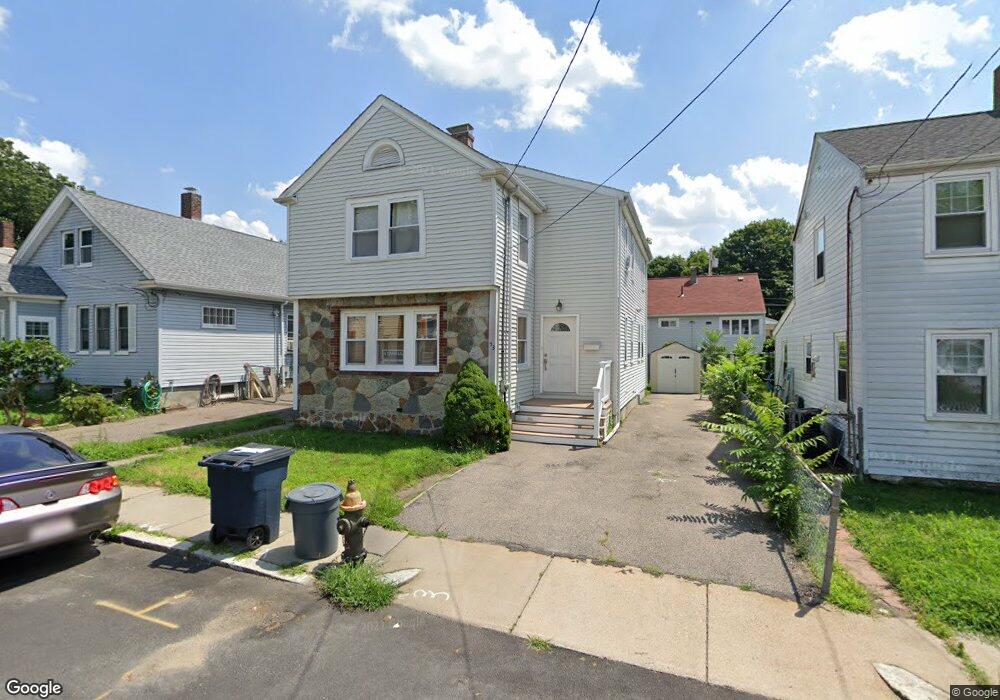
53 Halliday St Unit 1 Roslindale, MA 02131
Jamaica Plain NeighborhoodEstimated Value: $777,000 - $849,498
3
Beds
2
Baths
1,600
Sq Ft
$513/Sq Ft
Est. Value
About This Home
This home is located at 53 Halliday St Unit 1, Roslindale, MA 02131 and is currently estimated at $820,875, approximately $513 per square foot. 53 Halliday St Unit 1 is a home located in Suffolk County with nearby schools including Brooke Charter School Roslindale, The Croft School - Jamaica Plain, and St. Clare High School.
Ownership History
Date
Name
Owned For
Owner Type
Purchase Details
Closed on
Dec 7, 1993
Sold by
Picknally Patricia M
Bought by
Medrano Herbert G
Current Estimated Value
Create a Home Valuation Report for This Property
The Home Valuation Report is an in-depth analysis detailing your home's value as well as a comparison with similar homes in the area
Home Values in the Area
Average Home Value in this Area
Purchase History
| Date | Buyer | Sale Price | Title Company |
|---|---|---|---|
| Medrano Herbert G | $70,000 | -- |
Source: Public Records
Mortgage History
| Date | Status | Borrower | Loan Amount |
|---|---|---|---|
| Open | Medrano Herbert G | $30,573 | |
| Open | Medrano Herbert G | $199,000 | |
| Closed | Medrano Herbert G | $32,400 |
Source: Public Records
Tax History Compared to Growth
Tax History
| Year | Tax Paid | Tax Assessment Tax Assessment Total Assessment is a certain percentage of the fair market value that is determined by local assessors to be the total taxable value of land and additions on the property. | Land | Improvement |
|---|---|---|---|---|
| 2025 | $8,746 | $755,300 | $148,600 | $606,700 |
| 2024 | $8,647 | $793,300 | $151,600 | $641,700 |
| 2023 | $7,959 | $741,100 | $141,600 | $599,500 |
| 2022 | $7,396 | $679,800 | $129,900 | $549,900 |
| 2021 | $7,041 | $659,900 | $126,100 | $533,800 |
| 2020 | $5,924 | $561,000 | $126,800 | $434,200 |
| 2019 | $5,633 | $534,400 | $103,700 | $430,700 |
| 2018 | $5,000 | $477,100 | $103,700 | $373,400 |
| 2017 | $4,955 | $467,900 | $103,700 | $364,200 |
| 2016 | $5,047 | $458,800 | $103,700 | $355,100 |
| 2015 | $5,219 | $431,000 | $119,200 | $311,800 |
| 2014 | $4,748 | $377,400 | $119,200 | $258,200 |
Source: Public Records
Map
Nearby Homes
- 24 Waterman Rd
- 105 Neponset Ave Unit 105
- 103 Neponset Ave Unit 103A
- 103-105 Neponset Ave
- 602 Canterbury St Unit 14
- 602 Canterbury St Unit 4
- 602 Canterbury St Unit 5
- 602 Canterbury St Unit 2
- 602 Canterbury St Unit 9
- 579 American Legion Hwy
- 50 Southbourne Rd
- 36 Neponset Ave Unit 1
- 577-579 American Legion Hwy
- 348-350 Hyde Park Ave Unit 2
- 32 Jewett St
- 18-20 Northbourne Rd Unit 18
- 31 Rodman St Unit 2
- 31 Rodman St Unit 1
- 29 Paine St
- 187 Florence St Unit 2L
- 53 Halliday St
- 57 Halliday St
- 49 Halliday St
- 44 Waterman Rd
- 61 Halliday St
- 48 Waterman Rd
- 54 Halliday St
- 40 Waterman Rd
- 58 Halliday St
- 58 Halliday St Unit 1
- 58 Halliday St Unit SF
- 54 Waterman Rd
- 50 Halliday St
- 65 Halliday St
- 62 Halliday St
- 46 Halliday St
- 36 Waterman Rd
- 66 Halliday St
- 69 Halliday St
- 42 Halliday St