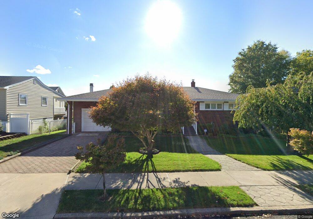
53 Harned Ave Perth Amboy, NJ 08861
Estimated Value: $359,852 - $565,000
Studio
--
Bath
1,235
Sq Ft
$371/Sq Ft
Est. Value
About This Home
This home is located at 53 Harned Ave, Perth Amboy, NJ 08861 and is currently estimated at $458,213, approximately $371 per square foot. 53 Harned Ave is a home located in Middlesex County with nearby schools including Port Reading Elementary School, Fords Middle School, and John F. Kennedy Memorial High School.
Create a Home Valuation Report for This Property
The Home Valuation Report is an in-depth analysis detailing your home's value as well as a comparison with similar homes in the area
Home Values in the Area
Average Home Value in this Area
Tax History
| Year | Tax Paid | Tax Assessment Tax Assessment Total Assessment is a certain percentage of the fair market value that is determined by local assessors to be the total taxable value of land and additions on the property. | Land | Improvement |
|---|---|---|---|---|
| 2025 | $10,798 | $85,100 | $22,000 | $63,100 |
| 2024 | $10,528 | $85,100 | $22,000 | $63,100 |
| 2023 | $10,528 | $85,100 | $22,000 | $63,100 |
| 2022 | $10,225 | $85,100 | $22,000 | $63,100 |
| 2021 | $10,221 | $85,100 | $22,000 | $63,100 |
| 2020 | $9,867 | $85,100 | $22,000 | $63,100 |
| 2019 | $9,629 | $85,100 | $22,000 | $63,100 |
| 2018 | $9,413 | $85,100 | $22,000 | $63,100 |
| 2017 | $9,238 | $85,100 | $22,000 | $63,100 |
| 2016 | $9,145 | $85,100 | $22,000 | $63,100 |
| 2015 | $8,981 | $85,100 | $22,000 | $63,100 |
| 2014 | $8,745 | $85,100 | $22,000 | $63,100 |
Source: Public Records
Map
Nearby Homes
Your Personal Tour Guide
Ask me questions while you tour the home.