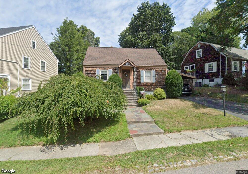
53 Lone Pine Path Weymouth, MA 02188
Weymouth Landing NeighborhoodEstimated Value: $555,000 - $604,000
3
Beds
2
Baths
1,192
Sq Ft
$488/Sq Ft
Est. Value
About This Home
This home is located at 53 Lone Pine Path, Weymouth, MA 02188 and is currently estimated at $581,574, approximately $487 per square foot. 53 Lone Pine Path is a home located in Norfolk County with nearby schools including Frederick C Murphy, Abigail Adams Middle School, and Weymouth Middle School Chapman.
Ownership History
Date
Name
Owned For
Owner Type
Purchase Details
Closed on
Oct 14, 2020
Sold by
Doyle Gerald P and Doyle Christine
Bought by
Doyle Gerald P and Doyle Christine
Current Estimated Value
Create a Home Valuation Report for This Property
The Home Valuation Report is an in-depth analysis detailing your home's value as well as a comparison with similar homes in the area
Home Values in the Area
Average Home Value in this Area
Purchase History
| Date | Buyer | Sale Price | Title Company |
|---|---|---|---|
| Doyle Gerald P | -- | None Available |
Source: Public Records
Tax History
| Year | Tax Paid | Tax Assessment Tax Assessment Total Assessment is a certain percentage of the fair market value that is determined by local assessors to be the total taxable value of land and additions on the property. | Land | Improvement |
|---|---|---|---|---|
| 2025 | $4,822 | $477,400 | $213,100 | $264,300 |
| 2024 | $4,671 | $454,800 | $203,000 | $251,800 |
| 2023 | $4,404 | $421,400 | $188,000 | $233,400 |
| 2022 | $4,304 | $375,600 | $174,100 | $201,500 |
| 2021 | $4,000 | $340,700 | $174,100 | $166,600 |
| 2020 | $3,782 | $317,300 | $174,100 | $143,200 |
| 2019 | $3,721 | $307,000 | $167,400 | $139,600 |
| 2018 | $3,640 | $291,200 | $159,400 | $131,800 |
| 2017 | $3,539 | $276,300 | $151,800 | $124,500 |
| 2016 | $3,455 | $269,900 | $146,000 | $123,900 |
| 2015 | $3,253 | $252,200 | $139,300 | $112,900 |
| 2014 | $3,108 | $233,700 | $129,700 | $104,000 |
Source: Public Records
Map
Nearby Homes
- 82 Lester Ln
- 107 Summer St
- 33 Congress St
- 15 Summer St
- 11 Richmond St
- 19 Vine St Unit 3
- 19 Vine St Unit 2
- 122 Washington St Unit Twenty-two
- 25 Richmond St
- 501 Commerce Dr Unit 2310
- 501 Commerce Dr Unit 4308
- 31 Doris Rd
- 37 Lantern Ln
- 41 Lantern Ln
- 46 Roosevelt Rd
- 116 Greenvale Ave
- 300 Commercial St Unit 23
- 73 Ryder Rd
- 747 Middle St
- 8 Tara Dr Unit 4
- 59 Lone Pine Path
- 47 Lone Pine Path
- 23 Briarwood Trail
- 41 Lone Pine Path
- 65 Lone Pine Path
- 26 Briarwood Trail
- 50 Lone Pine Path
- 56 Lone Pine Path
- 35 Lone Pine Path
- 69 Lone Pine Path
- 21 Briarwood Trail
- 46 Lone Pine Path
- 60 Lone Pine Path
- 29 Lone Pine Path
- 40 Lone Pine Path
- 66 Lone Pine Path
- 17 Briarwood Trail
- 73 Lone Pine Path
- 25 Lone Pine Path
- 20 Briarwood Trail
Your Personal Tour Guide
Ask me questions while you tour the home.