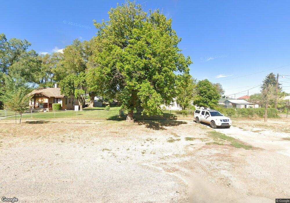
53 N 100 E Paragonah, UT 84760
Estimated Value: $285,474 - $358,000
1
Bed
1
Bath
1,184
Sq Ft
$281/Sq Ft
Est. Value
About This Home
This home is located at 53 N 100 E, Paragonah, UT 84760 and is currently estimated at $332,158, approximately $280 per square foot. 53 N 100 E is a home located in Iron County with nearby schools including Parowan School, Parowan High School, and Cedar City High School.
Ownership History
Date
Name
Owned For
Owner Type
Purchase Details
Closed on
Jun 30, 2025
Sold by
Barker Marlene Susan
Bought by
Marlene Barker Family Trust and Barker
Current Estimated Value
Purchase Details
Closed on
Nov 10, 2021
Sold by
Put Investments Llc
Bought by
Barker Marlene Susan
Home Financials for this Owner
Home Financials are based on the most recent Mortgage that was taken out on this home.
Original Mortgage
$206,925
Interest Rate
3.01%
Mortgage Type
New Conventional
Purchase Details
Closed on
Oct 15, 2020
Sold by
Federal Home Loan Corporation
Bought by
Put Investments Llc
Purchase Details
Closed on
Aug 11, 2020
Sold by
Rendahl Dale A and First Colony Mortgage Corporation
Bought by
Federal Home Loan Corporation and Credit Risk Transfer Trust
Purchase Details
Closed on
Jan 10, 2020
Sold by
Wigley Kenneth J
Bought by
Specialized Loan Servicing Llc
Create a Home Valuation Report for This Property
The Home Valuation Report is an in-depth analysis detailing your home's value as well as a comparison with similar homes in the area
Home Values in the Area
Average Home Value in this Area
Purchase History
| Date | Buyer | Sale Price | Title Company |
|---|---|---|---|
| Marlene Barker Family Trust | -- | None Listed On Document | |
| Marlene Barker Family Trust | -- | None Listed On Document | |
| Barker Marlene Susan | $275,210 | Legal Title | |
| Put Investments Llc | -- | Security Ttl Ins Agcy Salt L | |
| Federal Home Loan Corporation | $95,468 | None Available | |
| Specialized Loan Servicing Llc | -- | None Available |
Source: Public Records
Mortgage History
| Date | Status | Borrower | Loan Amount |
|---|---|---|---|
| Previous Owner | Barker Marlene Susan | $206,925 |
Source: Public Records
Tax History
| Year | Tax Paid | Tax Assessment Tax Assessment Total Assessment is a certain percentage of the fair market value that is determined by local assessors to be the total taxable value of land and additions on the property. | Land | Improvement |
|---|---|---|---|---|
| 2025 | $955 | $118,470 | $44,004 | $74,466 |
| 2023 | $876 | $94,985 | $39,290 | $55,695 |
| 2022 | $752 | $78,560 | $35,715 | $42,845 |
| 2021 | $624 | $65,185 | $22,325 | $42,860 |
| 2020 | $655 | $60,420 | $17,515 | $42,905 |
| 2019 | $659 | $57,990 | $17,515 | $40,475 |
| 2018 | $647 | $55,725 | $15,230 | $40,495 |
| 2017 | $601 | $50,485 | $15,230 | $35,255 |
| 2016 | $591 | $47,070 | $15,230 | $31,840 |
| 2015 | $582 | $43,740 | $0 | $0 |
| 2014 | $628 | $45,025 | $0 | $0 |
Source: Public Records
Map
Nearby Homes
- 10 ACFT Water Right: 75-2258 Unit 1917 Priority
- 1 ACFT Water Right: 75-251 Unit 1915 Priority
- 25 S 200 E
- 267 N 300 W
- 161 E 200 South St
- 140 W 300 S
- 150 W 300 S
- 220 N 300 E
- 180 S 300 E Unit E2
- 290 E 200 S
- 24 S 500 W
- 56 S 500 W
- 1 Parowan Foothills
- 495 125 S
- 755 W 130 N
- 30 N 100 W
- 0 Parowan Foothills
- 114 N 850 W
- 1.73 AF Water Right ~ #75-1
- 0 Lot 2 Blk 8 Plat C Unit 108795
- 53 W 100 N
- 57 W 100 N
- 37 W 100 N
- 77 N 100 E
- 72 W Pioneer Ave
- lot 31-34 W Pioneer Ave Unit 771 W 60 N; Approxim
- lot 31-34 W Pioneer Ave
- Lot 33-34 W Pioneer Ave
- Lot 31-32 W Pioneer Ave
- 90 W Pioneer Ave
- Area 75
- 67 W Pioneer Ave
- 71 N Main St
- 71 N Main St
- 83 Pioneer Ave
- 52 N 100 W
- 83 Pioneer Ln
- 0 4 2 Af of Water Right #75-327 Unit 107088
- 1916 Priority Water Right #75-2171 Unit (2 AF)
- 1916 Priority Water Right #75-2171