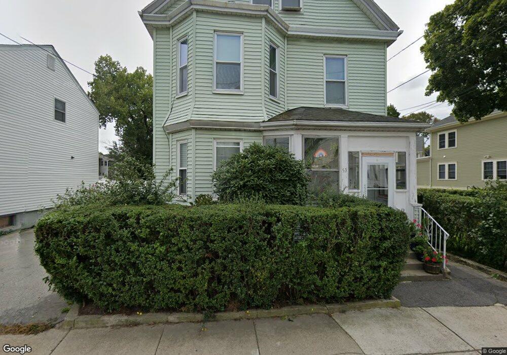
53 Neponset Ave Roslindale, MA 02131
Roslindale NeighborhoodEstimated Value: $772,748 - $1,045,000
5
Beds
6
Baths
2,568
Sq Ft
$353/Sq Ft
Est. Value
About This Home
This home is located at 53 Neponset Ave, Roslindale, MA 02131 and is currently estimated at $905,437, approximately $352 per square foot. 53 Neponset Ave is a home located in Suffolk County with nearby schools including Brooke Charter School Roslindale, Sacred Heart STEM School, and St. Clare High School.
Ownership History
Date
Name
Owned For
Owner Type
Purchase Details
Closed on
May 1, 1990
Sold by
Ruggeri Carolina
Bought by
Gonzalez Ismaelina
Current Estimated Value
Create a Home Valuation Report for This Property
The Home Valuation Report is an in-depth analysis detailing your home's value as well as a comparison with similar homes in the area
Home Values in the Area
Average Home Value in this Area
Purchase History
| Date | Buyer | Sale Price | Title Company |
|---|---|---|---|
| Gonzalez Ismaelina | $185,000 | -- |
Source: Public Records
Mortgage History
| Date | Status | Borrower | Loan Amount |
|---|---|---|---|
| Open | Gonzalez Ismaelina | $89,824 | |
| Closed | Gonzalez Ismaelina | $120,000 | |
| Closed | Gonzalez Ismaelina | $20,000 | |
| Closed | Gonzalez Ismaelina | $159,150 |
Source: Public Records
Tax History
| Year | Tax Paid | Tax Assessment Tax Assessment Total Assessment is a certain percentage of the fair market value that is determined by local assessors to be the total taxable value of land and additions on the property. | Land | Improvement |
|---|---|---|---|---|
| 2025 | $9,237 | $797,700 | $265,000 | $532,700 |
| 2024 | $8,220 | $754,100 | $213,900 | $540,200 |
| 2023 | $7,864 | $732,200 | $207,700 | $524,500 |
| 2022 | $7,583 | $697,000 | $197,700 | $499,300 |
| 2021 | $7,083 | $663,800 | $188,300 | $475,500 |
| 2020 | $6,756 | $639,800 | $189,600 | $450,200 |
| 2019 | $6,127 | $581,300 | $146,100 | $435,200 |
| 2018 | $5,539 | $528,500 | $146,100 | $382,400 |
| 2017 | $5,436 | $513,300 | $146,100 | $367,200 |
| 2016 | $5,228 | $475,300 | $146,100 | $329,200 |
| 2015 | $4,760 | $393,100 | $132,700 | $260,400 |
| 2014 | $4,579 | $364,000 | $132,700 | $231,300 |
Source: Public Records
Map
Nearby Homes
- 40 Catherine St Unit B
- 40 Catherine St Unit 2
- 375 Hyde Park Ave Unit 3
- 472 Hyde Park Ave Unit 472
- 348-350 Hyde Park Ave Unit 2
- 23 Rowe St Unit 23 Rowe
- 543 Hyde Park Ave Unit 1
- 61 Fawndale Rd
- 68 Rowe St Unit 3
- 68 Rowe St Unit 2
- 60 Stella Rd
- 602 Canterbury St Unit 14
- 602 Canterbury St Unit 10
- 602 Canterbury St Unit 13
- 602 Canterbury St Unit 5
- 602 Canterbury St Unit 9
- 8 Mount Calvary Rd Unit 4
- 134 Sycamore St
- 586 Canterbury St
- 35 Eldridge Rd Unit 209
- 55 Neponset Ave
- 43-45 Neponset Ave Unit 35
- 43-45 Neponset Ave Unit 35-37
- 43-45 Neponset Ave Unit 2 Duplex
- 43-45 Neponset Ave Unit 1 Duplex
- 43 Neponset Ave Unit 45
- 43-45 Neponset Ave Unit 45
- 43-45 Neponset Ave
- 43 Neponset Ave Unit 2
- 43-45 Neponset Ave Unit 1
- 43-45 Neponset Ave Unit 2
- 12 Sammett Ave
- 12 Sammett Ave Unit 12
- 57 Neponset Ave Unit 59
- 56 Neponset Ave
- 56 Neponset Ave Unit 2
- 56 Neponset Ave Unit 1
- 14 Sammett Ave
- 58 Neponset Ave
- 58 Neponset Ave Unit 2
Your Personal Tour Guide
Ask me questions while you tour the home.