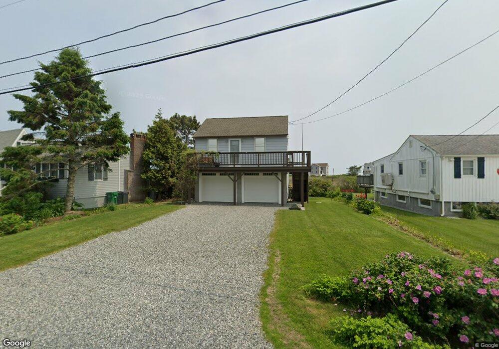
53 Ocean Ave Wakefield, RI 02879
Estimated Value: $843,000 - $1,386,000
2
Beds
1
Bath
480
Sq Ft
$2,182/Sq Ft
Est. Value
About This Home
This home is located at 53 Ocean Ave, Wakefield, RI 02879 and is currently estimated at $1,047,280, approximately $2,181 per square foot. 53 Ocean Ave is a home located in Washington County with nearby schools including South Kingstown High School.
Ownership History
Date
Name
Owned For
Owner Type
Purchase Details
Closed on
Dec 3, 2019
Sold by
Imrich Joann
Bought by
Bse Lt
Current Estimated Value
Purchase Details
Closed on
Mar 20, 1998
Sold by
Patton Margaret T
Bought by
Imrich Joann
Home Financials for this Owner
Home Financials are based on the most recent Mortgage that was taken out on this home.
Original Mortgage
$120,000
Interest Rate
6.92%
Create a Home Valuation Report for This Property
The Home Valuation Report is an in-depth analysis detailing your home's value as well as a comparison with similar homes in the area
Home Values in the Area
Average Home Value in this Area
Purchase History
| Date | Buyer | Sale Price | Title Company |
|---|---|---|---|
| Bse Lt | -- | None Available | |
| Imrich Joann | $150,000 | -- |
Source: Public Records
Mortgage History
| Date | Status | Borrower | Loan Amount |
|---|---|---|---|
| Previous Owner | Imrich Joann | $150,000 | |
| Previous Owner | Imrich Joann | $120,000 |
Source: Public Records
Tax History
| Year | Tax Paid | Tax Assessment Tax Assessment Total Assessment is a certain percentage of the fair market value that is determined by local assessors to be the total taxable value of land and additions on the property. | Land | Improvement |
|---|---|---|---|---|
| 2025 | $8,066 | $902,200 | $785,200 | $117,000 |
| 2024 | $8,364 | $756,900 | $658,800 | $98,100 |
| 2023 | $8,364 | $756,900 | $658,800 | $98,100 |
| 2022 | $8,288 | $756,900 | $658,800 | $98,100 |
| 2021 | $8,846 | $612,200 | $537,100 | $75,100 |
| 2020 | $8,846 | $612,200 | $537,100 | $75,100 |
| 2019 | $8,846 | $612,200 | $537,100 | $75,100 |
| 2018 | $7,619 | $485,900 | $429,700 | $56,200 |
| 2017 | $7,439 | $485,900 | $429,700 | $56,200 |
| 2016 | $7,332 | $485,900 | $429,700 | $56,200 |
| 2015 | $8,035 | $517,700 | $458,100 | $59,600 |
| 2014 | $8,014 | $517,700 | $458,100 | $59,600 |
Source: Public Records
Map
Nearby Homes
- 975 Matunuck Beach Rd
- 210 Washington St
- 14 E Pointe Ct Unit 14
- 6 MacAlder St
- 1138 Succotash Rd
- 1140 Succotash Rd
- 1185 Succotash Rd
- 550 Cards Pond Rd
- 7 Conch Rd
- 17 Goose Island Rd
- 2321 Post Rd
- 120 Chestnut Ave
- 0 Hemlock Ave
- 0 Point Judith Rd
- 22 Shore Rd
- 1499 Ocean Rd Unit 9
- 11 Wendy Ln
- 2 Green Hill Ave
- 37 Coast Guard Ave
- 209 Carpenter Dr
- 47 Ocean Ave
- 47 Ocean Ave
- 47 Ocean Ave Unit 47
- 61 Ocean Ave
- 41 Ocean Ave
- 69 Ocean Ave
- 0 Ocean Ave Unit 657961
- 0 Ocean Ave Unit 806677
- 0 Ocean Ave Unit 1025749
- 0 Ocean Ave Unit 1037338
- 0 Ocean Ave Unit 1123179
- 0 Ocean Ave Unit 1139026
- 0 Ocean Ave Unit 1142268
- 0 Ocean Ave Unit 1200209
- 19 Peninsula Rd
- 27 Ocean Ave
- 77 Ocean Ave
- 64 Ocean Ave
- 2 Peninsula Rd
- 83 Ocean Ave
Your Personal Tour Guide
Ask me questions while you tour the home.