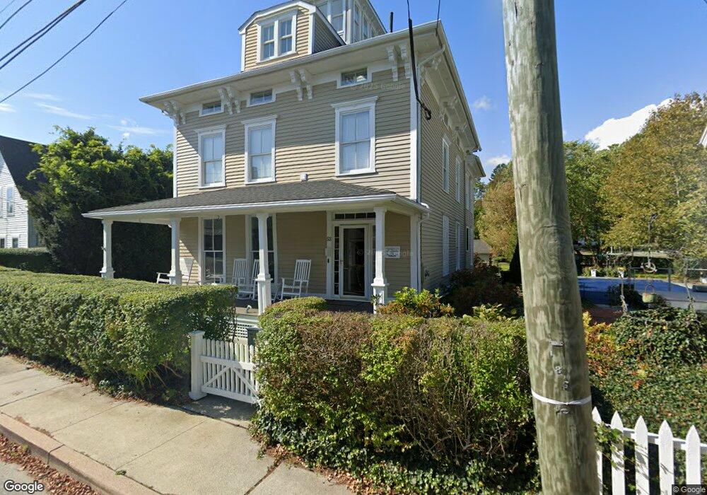
53 Pearl St Mystic, CT 06355
Mystic Historic District NeighborhoodEstimated Value: $1,522,000 - $1,885,343
3
Beds
3
Baths
3,181
Sq Ft
$540/Sq Ft
Est. Value
About This Home
This home is located at 53 Pearl St, Mystic, CT 06355 and is currently estimated at $1,717,448, approximately $539 per square foot. 53 Pearl St is a home with nearby schools including Northeast Academy Arts Magnet School, Groton Middle School, and Robert E. Fitch High School.
Ownership History
Date
Name
Owned For
Owner Type
Purchase Details
Closed on
Mar 22, 2012
Sold by
Chamberlai Richard and Crum Martha
Bought by
Bronk Karen S and Finnegan Pal J
Current Estimated Value
Home Financials for this Owner
Home Financials are based on the most recent Mortgage that was taken out on this home.
Original Mortgage
$646,000
Outstanding Balance
$443,545
Interest Rate
3.86%
Mortgage Type
Purchase Money Mortgage
Estimated Equity
$1,273,903
Purchase Details
Closed on
Dec 21, 2001
Sold by
Wolman Mark and Wolman Julie
Bought by
Crum Martha and Chamberlain Richard
Create a Home Valuation Report for This Property
The Home Valuation Report is an in-depth analysis detailing your home's value as well as a comparison with similar homes in the area
Home Values in the Area
Average Home Value in this Area
Purchase History
| Date | Buyer | Sale Price | Title Company |
|---|---|---|---|
| Bronk Karen S | $807,500 | -- | |
| Crum Martha | $845,000 | -- |
Source: Public Records
Mortgage History
| Date | Status | Borrower | Loan Amount |
|---|---|---|---|
| Open | Crum Martha | $646,000 |
Source: Public Records
Tax History Compared to Growth
Tax History
| Year | Tax Paid | Tax Assessment Tax Assessment Total Assessment is a certain percentage of the fair market value that is determined by local assessors to be the total taxable value of land and additions on the property. | Land | Improvement |
|---|---|---|---|---|
| 2025 | $22,933 | $842,520 | $485,898 | $356,622 |
| 2024 | $21,304 | $842,520 | $485,898 | $356,622 |
| 2023 | $20,478 | $842,520 | $333,060 | $509,460 |
| 2022 | $20,030 | $842,520 | $333,060 | $509,460 |
| 2021 | $19,729 | $700,350 | $333,060 | $367,290 |
| 2020 | $19,568 | $700,350 | $333,060 | $367,290 |
| 2019 | $18,720 | $700,350 | $333,060 | $367,290 |
| 2018 | $18,496 | $700,350 | $333,060 | $367,290 |
| 2017 | $18,153 | $700,350 | $333,060 | $367,290 |
Source: Public Records
Map
Nearby Homes
- 5 Park Place
- 7 Gravel St Unit 1
- 435 High St Unit 31
- 435 High St Unit 30
- 435 High St Unit 58
- 435 High St Unit 26
- 3 Water St Unit 301
- 3 Water St Unit 305
- 147 Pequot Ave
- 3 Stanton Place
- 32 E Main St
- 28 Rossie St
- 10 Pleasant St
- 17 Water St Unit A-10
- 60 Willow St Unit 305
- 60 Willow St Unit 205
- 19 Ashby St
- 38 Rossie St
- 40 Allyn St
- 190 Library St