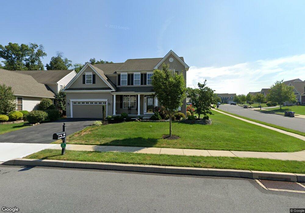
53 Putter Ln Pottstown, PA 19464
Limerick Township NeighborhoodEstimated Value: $629,630 - $735,000
4
Beds
3
Baths
2,862
Sq Ft
$244/Sq Ft
Est. Value
About This Home
This home is located at 53 Putter Ln, Pottstown, PA 19464 and is currently estimated at $697,658, approximately $243 per square foot. 53 Putter Ln is a home located in Montgomery County with nearby schools including Evans Elementary School, Spring-Ford Middle School 8th Grade Center, and Spring-Ford Middle School 5/6/7 Grade Center.
Ownership History
Date
Name
Owned For
Owner Type
Purchase Details
Closed on
Jan 20, 2009
Sold by
Dewey John M
Bought by
Bingham Lori Z and Bingham David W
Current Estimated Value
Home Financials for this Owner
Home Financials are based on the most recent Mortgage that was taken out on this home.
Original Mortgage
$310,451
Outstanding Balance
$196,440
Interest Rate
5.2%
Estimated Equity
$501,218
Create a Home Valuation Report for This Property
The Home Valuation Report is an in-depth analysis detailing your home's value as well as a comparison with similar homes in the area
Home Values in the Area
Average Home Value in this Area
Purchase History
| Date | Buyer | Sale Price | Title Company |
|---|---|---|---|
| Bingham Lori Z | $388,064 | None Available |
Source: Public Records
Mortgage History
| Date | Status | Borrower | Loan Amount |
|---|---|---|---|
| Open | Bingham Lori Z | $310,451 |
Source: Public Records
Tax History Compared to Growth
Tax History
| Year | Tax Paid | Tax Assessment Tax Assessment Total Assessment is a certain percentage of the fair market value that is determined by local assessors to be the total taxable value of land and additions on the property. | Land | Improvement |
|---|---|---|---|---|
| 2025 | $7,745 | $200,300 | -- | -- |
| 2024 | $7,745 | $200,300 | -- | -- |
| 2023 | $7,389 | $200,300 | $0 | $0 |
| 2022 | $7,389 | $200,300 | $0 | $0 |
| 2021 | $6,971 | $200,300 | $0 | $0 |
| 2020 | $6,794 | $200,300 | $0 | $0 |
| 2019 | $6,670 | $200,300 | $0 | $0 |
| 2018 | $5,179 | $200,300 | $0 | $0 |
| 2017 | $6,547 | $200,300 | $0 | $0 |
| 2016 | $6,469 | $200,300 | $0 | $0 |
| 2015 | $6,189 | $200,300 | $0 | $0 |
| 2014 | $6,189 | $200,300 | $0 | $0 |
Source: Public Records
Map
Nearby Homes
- 20 Bunker Way
- 1687 Rupert Rd
- 1629 Rupert Rd
- 1180 Rupert Rd
- 1060 Oakdale Dr
- 0 Industrial Pkwy Unit PAMC2142810
- 847 Rivendell Ln
- 90 Kurtz Rd
- 2933 E High St
- 2672 Crownview Rd
- 3000 E High St Unit 1
- 0 Steinmetz Rd
- 217 S Park Rd
- 2576 Swamp Pike
- 172 Oak Creek Dr
- 59 Houck Rd
- 2580 Allison Dr Unit 3
- 2419 Sanatoga Rd
- 2126 Deer Ridge Dr
- 17 Lightcap Rd