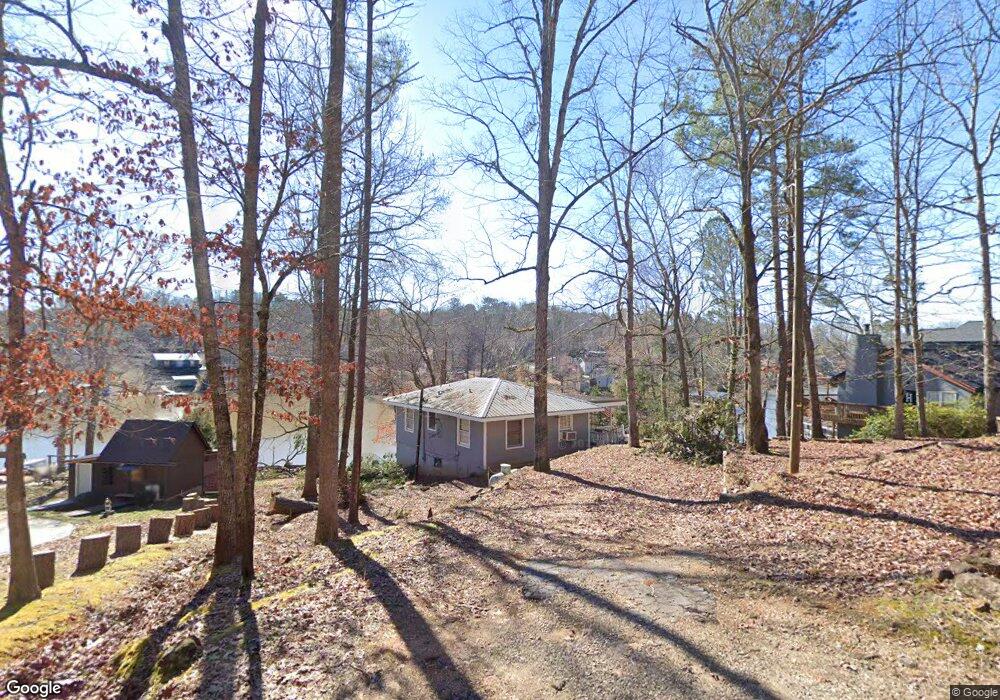
53 Ray Rd Covington, GA 30014
Estimated Value: $287,000 - $325,814
2
Beds
2
Baths
1,464
Sq Ft
$208/Sq Ft
Est. Value
About This Home
This home is located at 53 Ray Rd, Covington, GA 30014 and is currently estimated at $304,954, approximately $208 per square foot. 53 Ray Rd is a home located in Newton County with nearby schools including Rocky Plains Elementary School, Indian Creek Middle School, and Alcovy High School.
Ownership History
Date
Name
Owned For
Owner Type
Purchase Details
Closed on
Mar 29, 2017
Sold by
Verran Felicite Smith
Bought by
Hall Eddie M
Current Estimated Value
Home Financials for this Owner
Home Financials are based on the most recent Mortgage that was taken out on this home.
Original Mortgage
$117,769
Outstanding Balance
$97,705
Interest Rate
4.1%
Mortgage Type
New Conventional
Estimated Equity
$207,249
Purchase Details
Closed on
Jan 10, 2007
Sold by
Smith H M
Bought by
Verren Felicity S
Create a Home Valuation Report for This Property
The Home Valuation Report is an in-depth analysis detailing your home's value as well as a comparison with similar homes in the area
Home Values in the Area
Average Home Value in this Area
Purchase History
| Date | Buyer | Sale Price | Title Company |
|---|---|---|---|
| Hall Eddie M | $131,000 | -- | |
| Verren Felicity S | -- | -- |
Source: Public Records
Mortgage History
| Date | Status | Borrower | Loan Amount |
|---|---|---|---|
| Open | Hall Eddie M | $117,769 |
Source: Public Records
Tax History Compared to Growth
Tax History
| Year | Tax Paid | Tax Assessment Tax Assessment Total Assessment is a certain percentage of the fair market value that is determined by local assessors to be the total taxable value of land and additions on the property. | Land | Improvement |
|---|---|---|---|---|
| 2024 | $2,829 | $111,680 | $48,000 | $63,680 |
| 2023 | $2,761 | $101,760 | $48,000 | $53,760 |
| 2022 | $2,232 | $82,240 | $28,800 | $53,440 |
| 2021 | $2,159 | $71,200 | $28,800 | $42,400 |
| 2020 | $2,126 | $63,280 | $24,000 | $39,280 |
| 2019 | $2,172 | $63,680 | $24,000 | $39,680 |
| 2018 | $900 | $56,496 | $24,000 | $32,496 |
| 2017 | $1,845 | $53,728 | $24,000 | $29,728 |
| 2016 | $1,674 | $48,760 | $24,000 | $24,760 |
| 2015 | $1,555 | $45,280 | $24,000 | $21,280 |
| 2014 | $1,593 | $47,480 | $0 | $0 |
Source: Public Records
Map
Nearby Homes
- 230 Friar Tuck Cir
- 0 Malcom Rd Unit 10594529
- 650 Malcom Rd
- 35 Yellow Brick Way Unit 6
- 550 Malcom Rd
- 45 Emerald Ln Unit 13
- 35 Emerald Ln Unit 14
- 480 Friar Tuck Cir
- 0000 Rocky Point Rd
- 115 Hunters Ridge Ct
- 470 Haley Rd
- 531 S River Dr
- 35 Lake Pines Ct
- 473 Haley Rd
- 0 S River Dr Unit 10598613
- 0 S River Dr Unit 7644682
- 243 Malcom Rd
- 800 Rocky Point Rd
- 0 Rocky Point Rd Unit 10488289
- 185 Stewart Glen Dr
- 79 Ray Rd
- 55 Ray Rd
- 0 Ray Rd Unit 7622029
- 0 Ray Rd Unit 8730553
- 0 Ray Rd Unit 7131749
- 0 Ray Rd Unit 3230249
- 0 Ray Rd
- 49 Ray Rd
- 75 Ray Rd
- 15 Ray Rd
- 900 Malcom Rd
- 95 Ray Rd
- 45 Ray Rd
- 0 Malcom Rd Unit 8653328
- 0 Malcom Rd Unit 8601313
- 0 Malcom Rd Unit 8273596
- 0 Malcom Rd Unit 8028495
- 0 Malcom Rd Unit 7179041
- 0 Malcom Rd Unit 3274441
- 0 Malcom Rd Unit 3256800