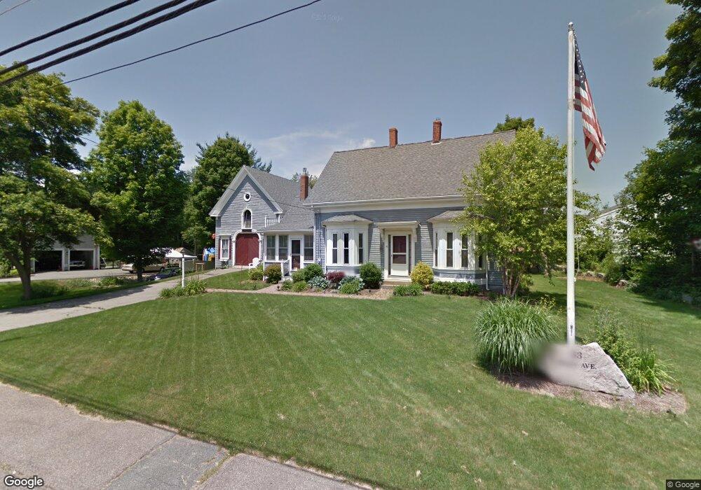
53 Shaw Ave Abington, MA 02351
Estimated Value: $603,000 - $658,000
3
Beds
1
Bath
1,694
Sq Ft
$370/Sq Ft
Est. Value
About This Home
This home is located at 53 Shaw Ave, Abington, MA 02351 and is currently estimated at $627,142, approximately $370 per square foot. 53 Shaw Ave is a home located in Plymouth County with nearby schools including Beaver Brook Elementary School, Abington Middle School, and Woodsdale School.
Ownership History
Date
Name
Owned For
Owner Type
Purchase Details
Closed on
Dec 23, 2021
Sold by
Doughty Kris J
Bought by
Doughty Kris J and Rivera Marisol
Current Estimated Value
Purchase Details
Closed on
Jan 26, 2000
Sold by
Clark Hazel G Est
Bought by
Doughty Kris J
Create a Home Valuation Report for This Property
The Home Valuation Report is an in-depth analysis detailing your home's value as well as a comparison with similar homes in the area
Home Values in the Area
Average Home Value in this Area
Purchase History
| Date | Buyer | Sale Price | Title Company |
|---|---|---|---|
| Doughty Kris J | -- | None Available | |
| Doughty Kris J | $180,000 | -- |
Source: Public Records
Mortgage History
| Date | Status | Borrower | Loan Amount |
|---|---|---|---|
| Previous Owner | Doughty Kris J | $200,000 | |
| Previous Owner | Doughty Kris J | $200,000 | |
| Previous Owner | Doughty Kris J | $250,000 | |
| Previous Owner | Doughty Kris J | $102,000 |
Source: Public Records
Tax History Compared to Growth
Tax History
| Year | Tax Paid | Tax Assessment Tax Assessment Total Assessment is a certain percentage of the fair market value that is determined by local assessors to be the total taxable value of land and additions on the property. | Land | Improvement |
|---|---|---|---|---|
| 2025 | $6,842 | $523,900 | $274,000 | $249,900 |
| 2024 | $6,746 | $504,200 | $250,100 | $254,100 |
| 2023 | $6,814 | $479,500 | $228,400 | $251,100 |
| 2022 | $6,449 | $423,700 | $192,100 | $231,600 |
| 2021 | $4,919 | $367,100 | $176,000 | $191,100 |
| 2020 | $6,261 | $368,300 | $177,200 | $191,100 |
| 2019 | $6,430 | $342,900 | $170,300 | $172,600 |
| 2018 | $6,127 | $330,800 | $170,300 | $160,500 |
| 2017 | $5,901 | $309,000 | $170,300 | $138,700 |
| 2016 | $5,286 | $294,800 | $156,100 | $138,700 |
| 2015 | $5,008 | $294,600 | $156,100 | $138,500 |
Source: Public Records
Map
Nearby Homes
- 676 Bedford St
- 0 Bedford St
- 38 Lantern Ln
- 90 Warren St
- 1042 Washington St
- 1353 Washington St
- 32 Warren St
- 40 Wales St
- 96 Plymouth St
- 925 Washington St
- 10 Mccue Cir
- 1077 Bedford St
- 715 Thayer St Unit 715
- 57 Battery St
- 197 Bedford St
- 74 Checkerberry Rd
- 209 Hancock St
- 257 Rockland St Unit 257
- 451 Lincoln St
- 10 Bank St
- 700 Bedford St Unit 4
- 700 Bedford St Unit 1-3
- 700 Bedford St
- 57 Shaw Ave
- 84 Shaw Ave
- 676 Bedford St Unit 2
- 94 Shaw Ave
- 714 Bedford St
- 104 Shaw Ave
- 728 Bedford St
- 27 Shaw Ave
- 27 Shaw Ave Unit 1
- 707 Bedford St Unit 4
- 707 Bedford St Unit 9
- 707 Bedford St Unit 16
- 707 Bedford St Unit 6
- 707 Bedford St Unit 3
- 707 Bedford St Unit 13
- 707 Bedford St Unit 2
- 707 Bedford St Unit 1