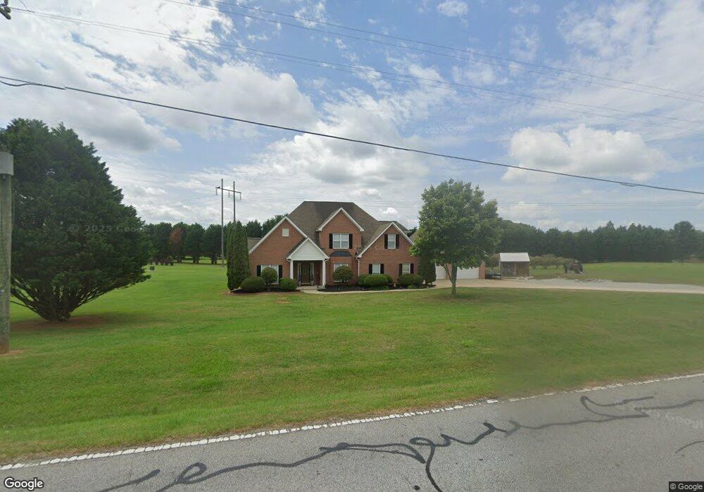
53 Stewart Rd Sharpsburg, GA 30277
Estimated Value: $436,572 - $506,000
4
Beds
3
Baths
2,399
Sq Ft
$197/Sq Ft
Est. Value
About This Home
This home is located at 53 Stewart Rd, Sharpsburg, GA 30277 and is currently estimated at $472,143, approximately $196 per square foot. 53 Stewart Rd is a home located in Coweta County with nearby schools including Willis Road Elementary School, Lee Middle School, and East Coweta High School.
Ownership History
Date
Name
Owned For
Owner Type
Purchase Details
Closed on
Aug 30, 2006
Sold by
Binion Abbey S
Bought by
Binion Abbey S and Binion Andrew Binion
Current Estimated Value
Purchase Details
Closed on
May 13, 2004
Sold by
Stonemill Homes Llc
Bought by
Binion Abbey
Home Financials for this Owner
Home Financials are based on the most recent Mortgage that was taken out on this home.
Original Mortgage
$188,245
Interest Rate
5.49%
Mortgage Type
New Conventional
Purchase Details
Closed on
Dec 7, 2001
Sold by
Brookside Communitie
Bought by
Stonemill Homes Llc
Purchase Details
Closed on
Sep 20, 1999
Bought by
Brookside Communitie
Create a Home Valuation Report for This Property
The Home Valuation Report is an in-depth analysis detailing your home's value as well as a comparison with similar homes in the area
Home Values in the Area
Average Home Value in this Area
Purchase History
| Date | Buyer | Sale Price | Title Company |
|---|---|---|---|
| Binion Abbey S | -- | -- | |
| Binion Abbey | $191,200 | -- | |
| Stonemill Homes Llc | -- | -- | |
| Brookside Communitie | $494,300 | -- |
Source: Public Records
Mortgage History
| Date | Status | Borrower | Loan Amount |
|---|---|---|---|
| Previous Owner | Binion Abbey | $188,245 |
Source: Public Records
Tax History Compared to Growth
Tax History
| Year | Tax Paid | Tax Assessment Tax Assessment Total Assessment is a certain percentage of the fair market value that is determined by local assessors to be the total taxable value of land and additions on the property. | Land | Improvement |
|---|---|---|---|---|
| 2024 | $3,608 | $159,999 | $24,000 | $135,999 |
| 2023 | $3,608 | $132,754 | $18,000 | $114,754 |
| 2022 | $2,948 | $124,389 | $18,000 | $106,389 |
| 2021 | $2,924 | $115,759 | $18,000 | $97,759 |
| 2020 | $2,943 | $115,759 | $18,000 | $97,759 |
| 2019 | $2,426 | $87,702 | $12,000 | $75,702 |
| 2018 | $2,431 | $87,702 | $12,000 | $75,702 |
| 2017 | $2,193 | $79,591 | $12,000 | $67,591 |
| 2016 | $2,169 | $79,591 | $12,000 | $67,591 |
| 2015 | $2,135 | $79,591 | $12,000 | $67,591 |
| 2014 | $2,120 | $79,591 | $12,000 | $67,591 |
Source: Public Records
Map
Nearby Homes
- 8 Chiefs Trail
- 51 Pinegate Way
- 180 Saint James Place
- 50 Kay Ct
- 250 Bob Smith Rd
- 248 Wynnward Way
- 30 Shelley Ln
- 90 Halo Trace
- 5 Bob Smith Rd
- 0 Bob Smith Rd Unit 10562838
- 193 Doe Run Ct
- 97 Twelve Parks Trail
- 60 Doe Run Dr
- 73 Oakhurst Trail
- Denton Plan at Twelve Parks - Ranch
- Denton with Basement Plan at Twelve Parks - Ranch
- Grayson with Basement Plan at Twelve Parks - Ranch
- Sullivan Plan at Twelve Parks - Ranch
- Grayson Plan at Twelve Parks - Ranch
- 12 Unicoi Trail
- 107 Stewart Rd
- 76 Melrose Dr
- 64 Melrose Dr
- 48 Melrose Dr
- 115 Stewart Rd
- 0 Melrose Dr Unit 8546467
- 0 Melrose Dr Unit 8449609
- 0 Melrose Dr Unit 8438246
- 0 Melrose Dr Unit 8283995
- 0 Melrose Dr Unit 7148996
- 0 Melrose Dr
- 88 Melrose Dr Unit B-20
- 88 Melrose Dr
- 71 Melrose Dr
- 112 Stewart Rd
- 465 Bob Smith Rd
- 72 Stewart Rd Unit 17
- 85 Melrose Dr
- 8 Melrose Dr
- 94 Melrose Dr