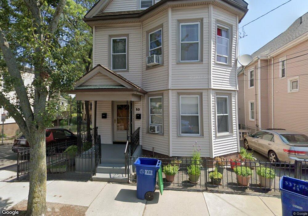
53 Tufts St Somerville, MA 02145
East Somerville NeighborhoodEstimated Value: $1,026,000 - $1,188,000
6
Beds
2
Baths
2,751
Sq Ft
$404/Sq Ft
Est. Value
About This Home
This home is located at 53 Tufts St, Somerville, MA 02145 and is currently estimated at $1,112,301, approximately $404 per square foot. 53 Tufts St is a home located in Middlesex County with nearby schools including Somerville High School, Prospect Hill Academy Upper Elementary Campus, and Community Charter School of Cambridge.
Ownership History
Date
Name
Owned For
Owner Type
Purchase Details
Closed on
Nov 30, 1995
Sold by
Alanalmary T and Romano Alexander C
Bought by
Greenidge Elise O and Catwell Gloria G
Current Estimated Value
Home Financials for this Owner
Home Financials are based on the most recent Mortgage that was taken out on this home.
Original Mortgage
$144,900
Outstanding Balance
$2,964
Interest Rate
7.37%
Mortgage Type
Purchase Money Mortgage
Estimated Equity
$1,109,337
Create a Home Valuation Report for This Property
The Home Valuation Report is an in-depth analysis detailing your home's value as well as a comparison with similar homes in the area
Home Values in the Area
Average Home Value in this Area
Purchase History
| Date | Buyer | Sale Price | Title Company |
|---|---|---|---|
| Greenidge Elise O | $144,900 | -- |
Source: Public Records
Mortgage History
| Date | Status | Borrower | Loan Amount |
|---|---|---|---|
| Open | Greenidge Elise O | $144,900 |
Source: Public Records
Tax History Compared to Growth
Tax History
| Year | Tax Paid | Tax Assessment Tax Assessment Total Assessment is a certain percentage of the fair market value that is determined by local assessors to be the total taxable value of land and additions on the property. | Land | Improvement |
|---|---|---|---|---|
| 2025 | $10,094 | $925,200 | $371,000 | $554,200 |
| 2024 | $9,630 | $915,400 | $371,000 | $544,400 |
| 2023 | $9,084 | $878,500 | $371,000 | $507,500 |
| 2022 | $8,562 | $841,100 | $353,300 | $487,800 |
| 2021 | $8,246 | $809,200 | $348,500 | $460,700 |
| 2020 | $7,756 | $768,700 | $335,100 | $433,600 |
| 2019 | $6,995 | $650,100 | $278,000 | $372,100 |
| 2018 | $6,076 | $537,200 | $222,300 | $314,900 |
| 2017 | $5,980 | $512,400 | $209,700 | $302,700 |
| 2016 | $5,298 | $422,800 | $147,300 | $275,500 |
| 2015 | $5,072 | $402,200 | $146,500 | $255,700 |
Source: Public Records
Map
Nearby Homes
- 36 Fountain Ave
- 142 Cross St
- 34 Knowlton St Unit 2
- 20 Alston St
- 25 Alston St
- 25 Auburn Ave Unit 2
- 84 Cross St
- 76 Franklin St
- 39 Gilman St
- 38 Franklin Ave
- 2 Hillside Ave
- 147 - 149 Pearl
- 74 Gilman St Unit 1
- 57 Myrtle St
- 19 Everett Ave
- 43 Cross St
- 36 Everett Ave
- 18 Otis St
- 85 A Munroe St Unit 1
- 14 Bonair St Unit 14
- 53 Tufts St Unit 1
- 51 Tufts St
- 51 Tufts St Unit 2
- 51 Tufts St Unit 1
- 22 Dell St
- 57 Tufts St
- 20 Dell St
- 20 Dell St Unit 2
- 49 Tufts St
- 23 Dell St
- 23 Dell St Unit 1
- 23 Dell St Unit 3
- 23 Dell St Unit A
- 23 Dell St Unit C
- 23 Dell St Unit B
- 23 Dell St Unit 2
- 21 Dell St
- 21 Dell St Unit B
- 21 Dell St Unit 1
- 21 Dell St Unit 2