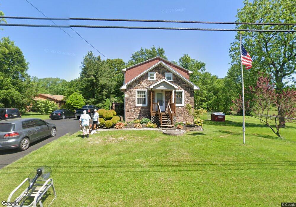
53 Unionville Rd Douglassville, PA 19518
Union NeighborhoodEstimated Value: $327,800 - $408,000
3
Beds
1
Bath
1,792
Sq Ft
$204/Sq Ft
Est. Value
About This Home
This home is located at 53 Unionville Rd, Douglassville, PA 19518 and is currently estimated at $364,700, approximately $203 per square foot. 53 Unionville Rd is a home located in Berks County with nearby schools including Daniel Boone Area Primary Center, Daniel Boone Area Middle School, and Daniel Boone Area High School.
Ownership History
Date
Name
Owned For
Owner Type
Purchase Details
Closed on
Jan 21, 2025
Sold by
Hoffman Matthew D and Hoffman Dawn R
Bought by
Hoffman Dawn R
Current Estimated Value
Home Financials for this Owner
Home Financials are based on the most recent Mortgage that was taken out on this home.
Original Mortgage
$178,000
Interest Rate
6.76%
Mortgage Type
New Conventional
Purchase Details
Closed on
Mar 24, 2010
Sold by
Hoffman Dawn R
Bought by
Hoffman Matthew D and Hoffman Dawn R
Home Financials for this Owner
Home Financials are based on the most recent Mortgage that was taken out on this home.
Original Mortgage
$130,400
Interest Rate
5.02%
Mortgage Type
New Conventional
Purchase Details
Closed on
Apr 22, 2008
Sold by
Hampton Dawn R and Hoffman Dawn R
Bought by
Hoffman Dawn R
Create a Home Valuation Report for This Property
The Home Valuation Report is an in-depth analysis detailing your home's value as well as a comparison with similar homes in the area
Home Values in the Area
Average Home Value in this Area
Purchase History
| Date | Buyer | Sale Price | Title Company |
|---|---|---|---|
| Hoffman Dawn R | -- | Titlemax | |
| Hoffman Matthew D | -- | None Available | |
| Hoffman Dawn R | -- | None Available |
Source: Public Records
Mortgage History
| Date | Status | Borrower | Loan Amount |
|---|---|---|---|
| Previous Owner | Hoffman Dawn R | $178,000 | |
| Previous Owner | Hoffman Matthew D | $130,400 |
Source: Public Records
Tax History Compared to Growth
Tax History
| Year | Tax Paid | Tax Assessment Tax Assessment Total Assessment is a certain percentage of the fair market value that is determined by local assessors to be the total taxable value of land and additions on the property. | Land | Improvement |
|---|---|---|---|---|
| 2025 | $1,204 | $95,100 | $38,000 | $57,100 |
| 2024 | $4,236 | $95,100 | $38,000 | $57,100 |
| 2023 | $3,639 | $95,100 | $38,000 | $57,100 |
| 2022 | $4,155 | $95,100 | $38,000 | $57,100 |
| 2021 | $4,079 | $95,100 | $38,000 | $57,100 |
| 2020 | $4,079 | $95,100 | $38,000 | $57,100 |
| 2019 | $4,008 | $95,100 | $38,000 | $57,100 |
| 2018 | $3,947 | $95,100 | $38,000 | $57,100 |
| 2017 | $3,873 | $95,100 | $38,000 | $57,100 |
| 2016 | $1,027 | $95,100 | $38,000 | $57,100 |
| 2015 | $1,027 | $95,100 | $38,000 | $57,100 |
| 2014 | $1,027 | $95,100 | $38,000 | $57,100 |
Source: Public Records
Map
Nearby Homes
- 1748 Honeysuckle Ln
- 1461 Benjamin Franklin Hwy
- 39 Westin Rd
- 0 Squirrel Hollow Rd
- 150 Random Rd
- 145 Random Rd
- 86 Westin Rd
- 1538 Temple Rd
- 25 Random Rd
- 94 Random Rd
- 131 Squirrel Hollow Rd
- Lot 3 Benjamin Franklin Hwy
- Lot 4 Benjamin Franklin Hwy
- Lot 1 N Monocacy Cre Benjamin Franklin Hwy
- 536 & 538 W Vine St
- 0 Ash St Unit PAMC2144590
- 1845 Evans Rd
- 703 Holly Dr
- 334 Lemon St
- 601 W High St
- 59 Unionville Rd
- 45 Unionville Rd
- 6 Unionville Rd
- 0 Furlong Rd Unit 1000858237
- 0 Furlong Rd Unit 1000858207
- 0 Furlong Rd Unit 1000858199
- 0 Furlong Rd
- 0 Furlong Rd Unit PABK373140
- 0 Furlong Rd Unit PABK373136
- 0 Furlong Rd Unit PABK351968
- 0 Furlong Rd Unit PABK351964
- 0 Furlong Rd Unit PABK351966
- 0 Furlong Rd Unit PABK351962
- 0 Furlong Rd Unit PABK102434
- 0 Furlong Rd Unit PABK102432
- 0 Furlong Rd Unit PABK102334
- 0 Furlong Rd Unit 1009744546
- 0 Furlong Rd Unit 1009744426
- 0 Furlong Rd Unit 1009744438
- 0 Furlong Rd Unit 1009744392