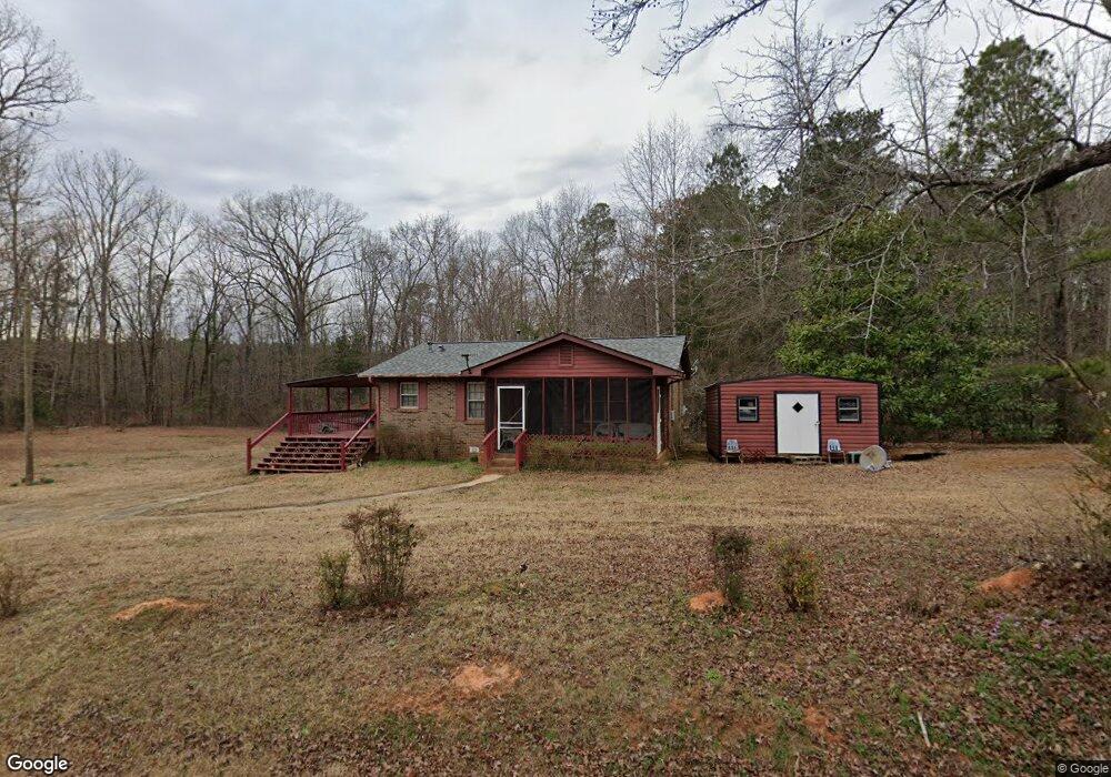
53 Westbrooks Rd Forsyth, GA 31029
Estimated Value: $97,003 - $367,000
--
Bed
1
Bath
936
Sq Ft
$227/Sq Ft
Est. Value
About This Home
This home is located at 53 Westbrooks Rd, Forsyth, GA 31029 and is currently estimated at $212,501, approximately $227 per square foot. 53 Westbrooks Rd is a home located in Monroe County with nearby schools including Katherine B. Sutton Elementary School and Mary Persons High School.
Ownership History
Date
Name
Owned For
Owner Type
Purchase Details
Closed on
Sep 17, 2021
Sold by
Mcdowell Christene
Bought by
Mcdowell Christene and Rawls Mildred
Current Estimated Value
Purchase Details
Closed on
Dec 7, 2018
Sold by
Barkley Mildred H
Bought by
Mcdowell Christene
Purchase Details
Closed on
May 8, 2015
Sold by
Rawls Mildred Juanita
Bought by
Barkley Mildred H
Purchase Details
Closed on
Oct 1, 2014
Sold by
Barkley Mildred H
Bought by
Rawls Mildred Juanita
Purchase Details
Closed on
Feb 2, 1982
Sold by
Bramlett Joe
Bought by
Barkley Earnest and Barkley Mildred H
Purchase Details
Closed on
Oct 22, 1981
Sold by
Mann Maudie H
Bought by
Bramlett Joe
Create a Home Valuation Report for This Property
The Home Valuation Report is an in-depth analysis detailing your home's value as well as a comparison with similar homes in the area
Home Values in the Area
Average Home Value in this Area
Purchase History
| Date | Buyer | Sale Price | Title Company |
|---|---|---|---|
| Mcdowell Christene | -- | -- | |
| Mcdowell Christene | -- | -- | |
| Barkley Mildred H | -- | -- | |
| Rawls Mildred Juanita | -- | -- | |
| Barkley Earnest | $32,200 | -- | |
| Bramlett Joe | -- | -- |
Source: Public Records
Tax History Compared to Growth
Tax History
| Year | Tax Paid | Tax Assessment Tax Assessment Total Assessment is a certain percentage of the fair market value that is determined by local assessors to be the total taxable value of land and additions on the property. | Land | Improvement |
|---|---|---|---|---|
| 2024 | $593 | $21,960 | $4,080 | $17,880 |
| 2023 | $537 | $19,040 | $4,080 | $14,960 |
| 2022 | $515 | $19,040 | $4,080 | $14,960 |
| 2021 | $534 | $19,040 | $4,080 | $14,960 |
| 2020 | $523 | $18,200 | $3,240 | $14,960 |
| 2019 | $527 | $18,200 | $3,240 | $14,960 |
| 2018 | $0 | $18,200 | $3,240 | $14,960 |
| 2017 | $529 | $18,200 | $3,240 | $14,960 |
| 2016 | -- | $18,200 | $3,240 | $14,960 |
| 2015 | $499 | $19,040 | $4,080 | $14,960 |
| 2014 | -- | $19,040 | $4,080 | $14,960 |
Source: Public Records
Map
Nearby Homes
- 40 Timber Dr
- 0 Garr Rd Unit 10439858
- 739 Westbrooks Rd
- 120 Homestead Cir
- 381 Homestead Cir
- 49 Homestead Cir Unit LOT 49A
- 6418 Georgia 42
- 353 Weldon Rd
- 837 Weldon Rd
- 788 Teagle Rd
- 0 Duncan Cir Unit 24915548
- 40 Towaliga Rd
- 412 Towaliga Trail
- 160 Aaron Ct
- 122 Towaliga Rd S
- 674 Stokes Store Rd
- 1538 Freeman Rd
- 401 Towaliga Trail
- 56 Ivey Cir
- 104 Old Oak Dr
- 31 Westbrooks Rd
- 31 Westbrooks Rd
- 0 Westbrooks Rd
- 0 Westbrooks Rd Unit 116175
- 0 Westbrooks Rd Unit 8730269
- 0 Westbrooks Rd Unit 8327644
- 0 Westbrooks Rd Unit 8047190
- 0 Westbrooks Rd Unit 2919855
- 127 Blount Rd
- 0 Blount Road Shortcut
- 288 Blount Rd
- 265 Blount Rd
- 63 Blount Road Shortcut
- 261 Blount Rd
- 61 Blount Road Shortcut
- 43 Blount Rd
- 61 Blount Road Shortcut
- 61 Blount Road Shortcut
- 61 Blount Road Shortcut
- 61 Blount Road Shortcut