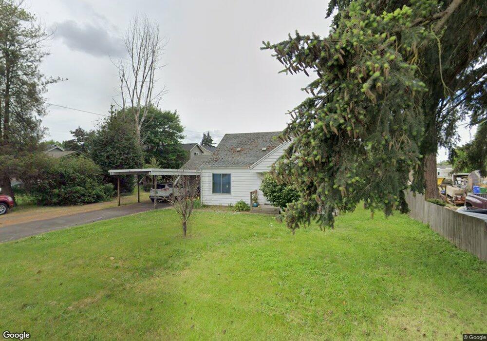
530 Bushnell Ln Eugene, OR 97404
River Road NeighborhoodEstimated Value: $309,000 - $391,000
2
Beds
1
Bath
884
Sq Ft
$403/Sq Ft
Est. Value
About This Home
This home is located at 530 Bushnell Ln, Eugene, OR 97404 and is currently estimated at $355,832, approximately $402 per square foot. 530 Bushnell Ln is a home located in Lane County with nearby schools including Irving Elementary School, Shasta Middle School, and Willamette High School.
Ownership History
Date
Name
Owned For
Owner Type
Purchase Details
Closed on
Apr 3, 2013
Sold by
Grey Colette C and Grey James L
Bought by
Adams Frances H
Current Estimated Value
Home Financials for this Owner
Home Financials are based on the most recent Mortgage that was taken out on this home.
Original Mortgage
$80,000
Outstanding Balance
$56,079
Interest Rate
3.47%
Mortgage Type
New Conventional
Estimated Equity
$299,753
Purchase Details
Closed on
Feb 22, 1999
Sold by
Redgrove Leslie C
Bought by
Grey James L and Grey Colette C
Home Financials for this Owner
Home Financials are based on the most recent Mortgage that was taken out on this home.
Original Mortgage
$56,000
Interest Rate
6.76%
Purchase Details
Closed on
Feb 18, 1999
Sold by
Connell Diane and Cote Eileen
Bought by
Redgrove Leslie C
Home Financials for this Owner
Home Financials are based on the most recent Mortgage that was taken out on this home.
Original Mortgage
$56,000
Interest Rate
6.76%
Create a Home Valuation Report for This Property
The Home Valuation Report is an in-depth analysis detailing your home's value as well as a comparison with similar homes in the area
Home Values in the Area
Average Home Value in this Area
Purchase History
We collect this data history from publicly available records. To have your information removed, we recommend requesting removal directly through your county’s website.
| Date | Buyer | Sale Price | Title Company |
|---|---|---|---|
| Adams Frances H | -- | Nextitle | |
| Grey James L | $70,000 | Evergreen Land Title Co | |
| Redgrove Leslie C | -- | Evergreen Land Title Co |
Source: Public Records
Mortgage History
We collect this data history from publicly available records. To have your information removed, we recommend requesting removal directly through your county’s website.
| Date | Status | Borrower | Loan Amount |
|---|---|---|---|
| Open | Adams Frances H | $80,000 | |
| Previous Owner | Grey James L | $56,000 |
Source: Public Records
Tax History
| Year | Tax Paid | Tax Assessment Tax Assessment Total Assessment is a certain percentage of the fair market value that is determined by local assessors to be the total taxable value of land and additions on the property. | Land | Improvement |
|---|---|---|---|---|
| 2025 | $2,350 | $159,742 | -- | -- |
| 2024 | $2,289 | $155,090 | -- | -- |
| 2023 | $2,289 | $150,573 | $0 | $0 |
| 2022 | $2,138 | $146,188 | $0 | $0 |
| 2021 | $2,085 | $141,931 | $0 | $0 |
| 2020 | $2,020 | $137,798 | $0 | $0 |
| 2019 | $1,913 | $133,785 | $0 | $0 |
| 2018 | $1,851 | $126,106 | $0 | $0 |
| 2017 | $1,786 | $126,106 | $0 | $0 |
| 2016 | $1,735 | $122,433 | $0 | $0 |
| 2015 | $1,712 | $118,867 | $0 | $0 |
| 2014 | $1,728 | $115,405 | $0 | $0 |
Source: Public Records
Map
Nearby Homes
- 1161 Molly Ln
- 325 Bushnell Ln
- 1764 Allea Dr
- 725 Heywood Ave
- 2488 Northampton
- 831 Greenwich Ave
- 1755 Brentwood Ave
- 1682 Hemlock St
- 903 Howard Ave
- 2690 Carbona St
- 0 Pacific Hwy W
- 1215 Irving Rd
- 2610 Crowther Dr
- 1565 Linwood St
- 2721 La Darrah St
- 2562 Dover Dr
- 445 Sterling Dr
- 2412 Dalton Dr
- 2565 Dover Dr
- 3717 Riviera
- 528 Bushnell Ln
- 1958 Debra Sue Ct
- 1975 Debra Sue Ct
- 0 Debra Sue Ct
- 1983 Debra Sue Ct
- 1961 Debra Sue Ct
- 1950 Debra Sue Ct
- 1955 Debra Sue Ct
- 520 Bushnell Ln
- 550 Bushnell Ln
- 1930 Debra Sue Ct
- 1943 Debra Sue Ct
- 2060 Delta St
- 510 Bushnell Ln
- 524 Bushnell Ln
- 1924 Debra Sue Ct
- 570 Bushnell Ln
- 527 Bushnell Ln
- 1925 Debra Sue Ct
- 2055 Delta St
Your Personal Tour Guide
Ask me questions while you tour the home.