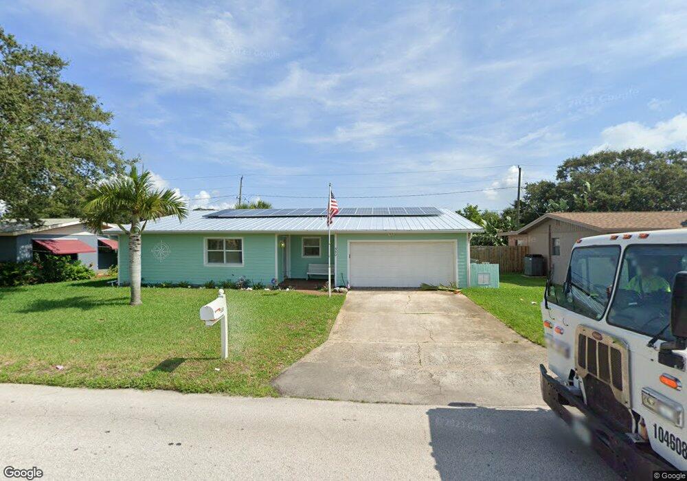
530 Cassia Blvd Satellite Beach, FL 32937
Estimated Value: $516,000 - $553,000
3
Beds
2
Baths
2,078
Sq Ft
$260/Sq Ft
Est. Value
About This Home
This home is located at 530 Cassia Blvd, Satellite Beach, FL 32937 and is currently estimated at $540,240, approximately $259 per square foot. 530 Cassia Blvd is a home located in Brevard County with nearby schools including Surfside Elementary School, Satellite Senior High School, and DeLaura Middle School.
Ownership History
Date
Name
Owned For
Owner Type
Purchase Details
Closed on
Nov 3, 2004
Sold by
Devary E Ann
Bought by
Boleware Alan R and Boleware Julie L
Current Estimated Value
Home Financials for this Owner
Home Financials are based on the most recent Mortgage that was taken out on this home.
Original Mortgage
$52,000
Outstanding Balance
$25,725
Interest Rate
5.65%
Estimated Equity
$514,515
Purchase Details
Closed on
Oct 10, 1997
Sold by
Devary Charles R and Devary Ann E
Bought by
Devary E Ann
Create a Home Valuation Report for This Property
The Home Valuation Report is an in-depth analysis detailing your home's value as well as a comparison with similar homes in the area
Home Values in the Area
Average Home Value in this Area
Purchase History
| Date | Buyer | Sale Price | Title Company |
|---|---|---|---|
| Boleware Alan R | $65,000 | Aurora Title | |
| Devary E Ann | $28,500 | -- |
Source: Public Records
Mortgage History
| Date | Status | Borrower | Loan Amount |
|---|---|---|---|
| Open | Boleware Alan R | $52,000 |
Source: Public Records
Tax History Compared to Growth
Tax History
| Year | Tax Paid | Tax Assessment Tax Assessment Total Assessment is a certain percentage of the fair market value that is determined by local assessors to be the total taxable value of land and additions on the property. | Land | Improvement |
|---|---|---|---|---|
| 2025 | $2,474 | $172,350 | -- | -- |
| 2024 | $2,427 | $167,500 | -- | -- |
| 2023 | $2,427 | $162,630 | $0 | $0 |
| 2022 | $2,265 | $157,900 | $0 | $0 |
| 2021 | $2,322 | $153,310 | $0 | $0 |
| 2020 | $2,311 | $151,200 | $0 | $0 |
| 2019 | $2,288 | $147,810 | $0 | $0 |
| 2018 | $2,284 | $145,060 | $0 | $0 |
| 2017 | $2,121 | $142,080 | $0 | $0 |
| 2016 | $2,122 | $139,160 | $60,000 | $79,160 |
| 2015 | $2,171 | $138,200 | $60,000 | $78,200 |
| 2014 | $2,282 | $137,110 | $47,000 | $90,110 |
Source: Public Records
Map
Nearby Homes
- 1341 S Patrick Dr
- 445 Saint Johns Dr
- 545 Teakwood Ave
- 502 Bay Cir
- 368 Ocean Spray Ave
- 366 Ocean Spray Ave
- 370 Cinnamon Dr
- 302 Markley Ct
- 445 Park Ave
- 595 Park Ave Unit 1
- 408 Hawthorne Ct
- 320 Glenwood Ave
- 426 Hawthorne Ct Unit G2
- 310 Glenwood Ave
- 225 Hedgecock Ct
- 325 Park Ave
- 295 Cinnamon Dr
- 240 Lansing Island Dr
- 348 Sherwood Ave
- 298 Harwood Ave
- 540 Cassia Blvd
- 520 Cassia Blvd
- 535 Cinnamon Dr
- 545 Cinnamon Dr
- 550 Cassia Blvd
- 510 Cassia Blvd
- 525 Cinnamon Dr
- 555 Cinnamon Dr
- 560 Cassia Blvd
- 508 Cassia Blvd
- 515 Cinnamon Dr
- 540 Cinnamon Dr
- 565 Cinnamon Dr
- 568 Cassia Blvd
- 550 Cinnamon Dr
- 510 Cinnamon Dr
- 555 Norwood Ct
- 565 Norwood Ct
- 570 Cassia Blvd
- 560 Cinnamon Dr